Updated July 8, 2025 02:11PM
Jump Into an Alpine Tarn at Emerald Lake, California
Wander through a remote paradise of high-altitude lakes in the lightly visited Trinity Alps on this 27.2-mile, long-weekend trip in Klamath National Forest.
For remote meadows, jagged peaks and an alpine lake nestled in a scoop of granite, spend four days on this out-and-back to a high-alpine lake in California’s Trinity Alps. Start at the Stuart Fork Trailhead and follow an old road to the Trinity Alps Wilderness Boundary, then climb beside the Stuart Fork of the Trinity River until you reach the turnoff for the Alpine Lake Trail (mile 5). Continue straight.
Leave the forest for the first time at Morris Meadows (mile 9), your campsite for the first night. (There are lots of black bears in the area, so make sure to bring a bear canister for food storage—trees at the upper lake campsites are scattered and not always good for food hanging.) Views up the valley give you a preview of the next day’s peaks; watch alpenglow over the granite while you finish dinner. Make sure to get plenty of rest before 2,000 feet of elevation gain in 4.4 miles on day 2. Emerald Lake is a popular backpacking spot, so get an early start to beat the crowds and snag a good site.
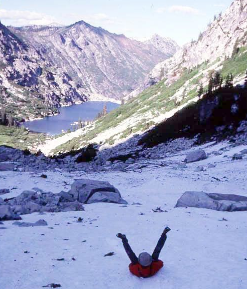
The forest ends for good just before Emerald Lake (mile 13), a deep blue tarn created by miners over a century ago. (Tip: Pack your camera. The ragged granite spines of the mountains to either side make for a hard-to-beat backdrop.) There are some flat spots near the shore that make for good camping, but steep scree runs straight to the water around much of the lake.
ADVERTISEMENT
If there are no sites available, scramble another half mile over boulders and granite slabs to Sapphire Lake, tucked just out of sight of the lower lake in an even more austere alpine basin. Most of the campsites here have no tree cover and are on hard ground, so plan to tie your guylines to rocks instead of relying on tent stakes. Waterfalls plummet down many of the cliffs ringing Sapphire; pack in an inflatable raft, kayak or SUP to get a close-up look. The next day, tackle the 13.5-mile hike out to the trailhead.
DO IT Trailhead 40.8874, -122.9220 Season Summer, Fall Permit Wilderness Permit (free); pick up at the Weaverville Ranger Station