Portland, OR: Tamanawas Falls Loop

There’s no shortage of waterfall hikes in the Mt. Hood and Columbia River Gorge areas. The challenge is finding one with ample weekend trailhead parking. This beauty of a hike on the east side of Mt. Hood doesn’t get nearly the crowds that the closer-in trailheads see, and if you opt for the longer loop return on the forested Polallie Trail, you just might find some quiet solitude—even on a weekend.
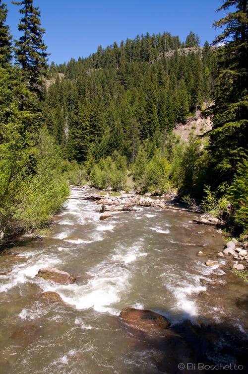
From the roadside trailhead, just north of Sherwood Campground, descend 200′ to the East Fork Hood River. A narrow footbridge, supported by a huge fir log spans the river and sets you on your course. At the junction, turn right (N) and parallel the highway for the next half mile before it turns westward up Cold Spring Creek Canyon. At the next junction, continue straight ahead (W); the fork on the right is the return of the loop trail. Descend to a crossing of Cold Spring Creek, veering left to head up the canyon; the trail stays alongside the creek for the next mile.
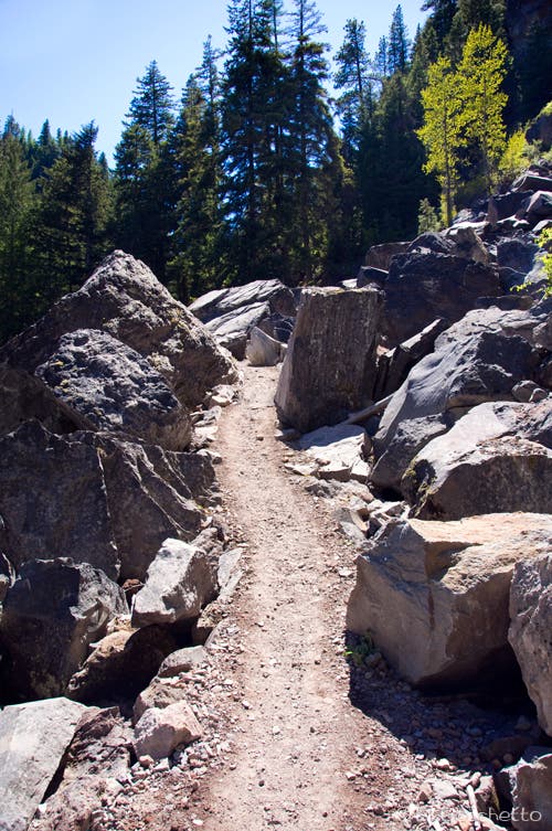
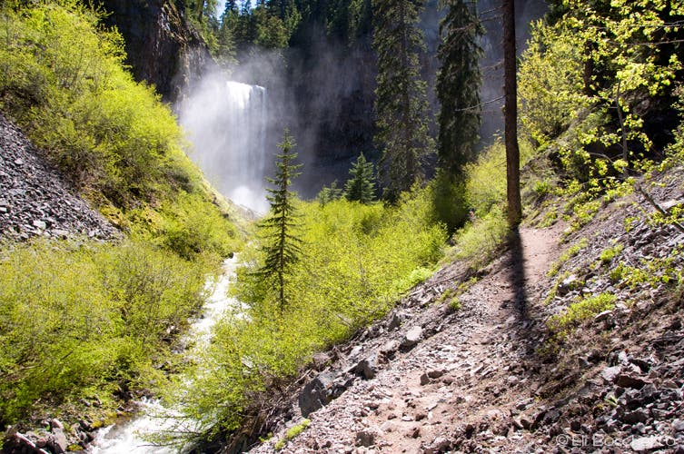
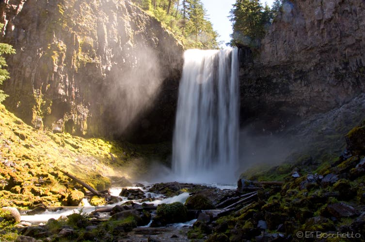
At the junction with the Polallie Trail, take the right fork. The original trail to the falls used the left fork and crossed a bridge to the other side, but just shortly beyond the trail and bridge have been wiped out by washout and rockfall. Take a couple switchbacks through the rockfall and come to another fork, this time veering left. Less than a half mile up, the official trail ends at a viewpoint of 100′ Tamanawas Falls spilling over the edge of an ancient lava flow. A faint path on slippery rock continues up the side of the canyon to the hollow behind the falls.
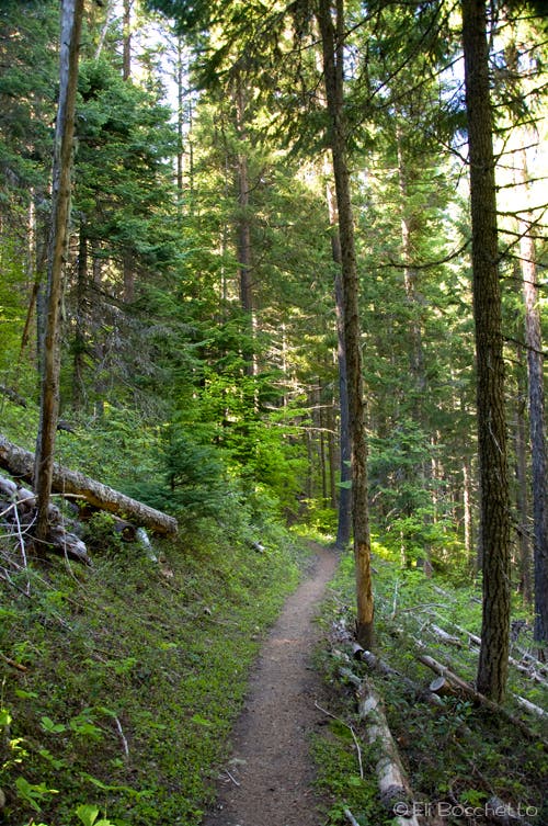
After suitably refreshed by Tamanawas’ showers of spray, head back down the trail to the previous junction. For a direct return, continue back on the same route. For a longer return, veer left up a long switchback to a junction with the Polallie Trail and turn right (E). The quiet, forested trail makes a gradual 1.5 mile descent toward Polallie Creek. Some guidebooks show access to a viewpoint along this route, but that path is obstructed by excessive blowdown and isn’t recommended. The trail then makes a U-turn to the right and heads back up the other side of the ridge, paralleling the highway.
Continue straight through a junction to Polallie Camp for a mile, cross a lower bridge over Cold Spring Creek, then return to the earlier junction with the Tamanawas trail. Complete the trip on familiar track a half mile back to your starting point.
Mapped by Eli Boschetto Bosco Mountain Photo
Trail Facts
- Distance: 8.1
Waypoints
TAM001
Location: 45.39719, -121.571764
Start the Tamanawas Falls trail at a large turnout just north of Sherwood Campground.
TAM002
Location: 45.397802, -121.572175
Cross a large bridge over the East Fork Hood River.
TAM003
Location: 45.397912, -121.572143
Trail junction; fork right (N) for Tamanawas Falls.
TAM004
Location: 45.403261, -121.571964
Trail junction; fork left to continue to the falls. The right fork is where you’ll return following the loop.
TAM005
Location: 45.403335, -121.572372
Cross a wooden bridge over Cold Spring Creek and veer left (W) to the falls.
TAM006
Location: 45.402753, -121.57573
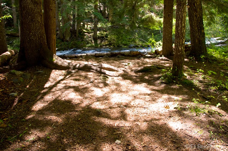
Small, creekside camp site; no fire ring.
TAM007
Location: 45.404943, -121.58138
View a large cascade on Cold Spring Creek.
TAM008
Location: 45.403891, -121.58487
Polallie Trail fork; veer right to avoid lower trail washout.
TAM009
Location: 45.40364, -121.585962
Trail fork; veer left to falls. On return, switchback up ridge for Polallie trail loop.
TAM010
Location: 45.401441, -121.588976
Tamanawas Falls; scramble over wet rocks into amphitheater behind falls.
TAM011
Location: 45.406688, -121.580376
Trail junction; turn right (E).
TAM012
Location: 45.416264, -121.571306
Side trail to Polallie Overlook. This trail is in heavy disrepair with lots of snags and blowdown.
TAM013
Location: 45.416784, -121.570829
Trail junction; continue straight (S).
TAM014
Location: 45.413485, -121.571252
Creek crossing.
TAM015
Location: 45.404168, -121.57077
Cross a wooden bridge over lower Cold Springs Creek. Continue up to previous junction with Tamanawas Trail; turn left (E) to complete.
East Fork
Location: 45.397791, -121.572127
Cross the East Fork Hood River on a wide footbridge near the Tamanawas trailhead.
Directions
Location: 45.397934, -121.572003
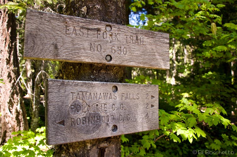
Follow signs for Tamanawas Falls for the first part of the trail; first to the falls, then on the Polallie Loop.
Creekside Camp
Location: 45.402699, -121.575775
Arrive early and score this small, creekside camp for an easy overnight.
Rockfall
Location: 45.403463, -121.586337
Switchback through a large rockfall. The lower Tamanawas trail has been wiped out; veer onto the Polallie trail for a short distance before getting back to the falls trail.
Approaching Tamanawas
Location: 45.402209, -121.587984
Near the falls, the trail opens up for nice views.
Tamanawas
Location: 45.401422, -121.588917
Tamanawas Falls thunders over the lip of an ancient lava flow. Scramble over slick rocks into the hollow behind the falls.
Polallie Trail
Location: 45.407956, -121.577389
The narrow Polallie Trail descends through shady forest to Polallie Creek.
Exposure
Location: 45.411813, -121.571188
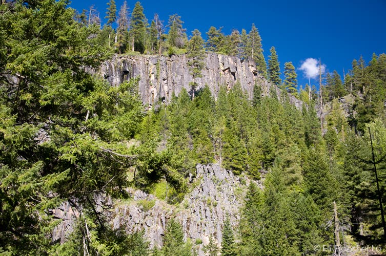
Across the canyon, look for colorful, lichen-stained outcrops of volcanic basalt.