Portland, OR: Multnomah Falls Loop

Less than a half-hour from Portland, Multnomah Falls, on the Oregon side of the Columbia River Gorge, draws over 2 million visitors per year, and on most spring and summer weekends its apparent. One has but to hike just a short ways above the roadside falls to leave the crowds behind and plunge into deep old-growth forest, displaying scores of wildflowers, alongside the rushing cascades and waterfalls of Multnomah and Wahkeena Creeks.
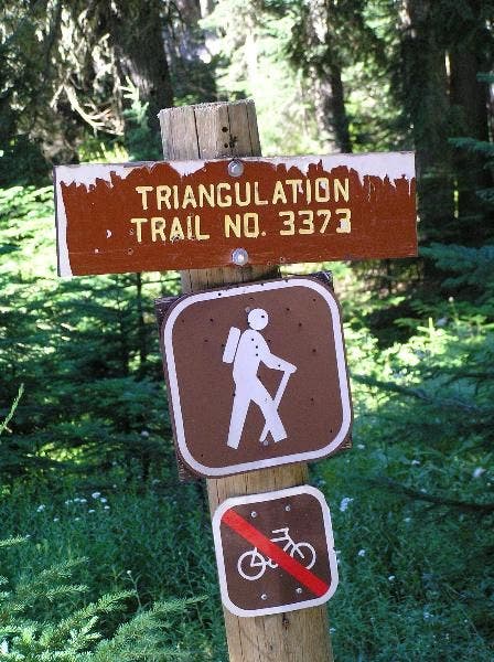
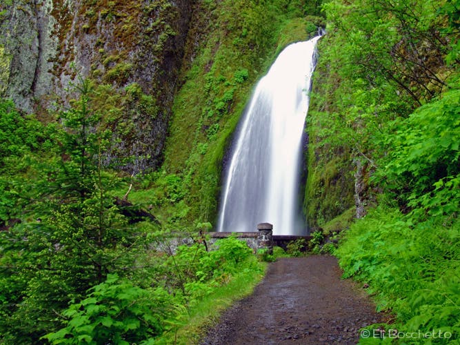
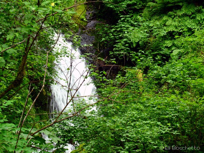
Start the loop counter-clockwise at the Multnomah Lodge by picking up the 0.5 mi. Return Trail west, alongside the Historic Columbia River Hwy to Wahkeena Falls. After crossing the bridge at the base of Wahkeena Cascade, the paved Wahkeena Trail #420 climbs to another bridge that crosses the base of the tiered falls. Continue up switchbacks amid slopes decorated with candyflower, larkspur, columbine, and windflower. When the pavement ends, a short spur heads right (N) to Lemmon’s Point, offering views of the Columbia River Gorge and Beacon Rock. After checking out the point, continue up the trail alongside Wahkeena Creek. Look for an unmaintained spur trail on the right that leads down to “secret” Necktie Falls. Continue up several more switchbacks to Fairy Falls, a gorgeous cascading veil. Shortly past Fairy Falls, the trail forks with options to continue up via Wahkeena Trail #420 or Vista Point Trail #419. Either path takes you to the crest of the loop. (If you continue up Trail #420, you will fork left (E) at the junction with Angel’s Rest Trail #415. For an optional side trip, fork right 1.9 mi. to Angel’s Rest.)
From the 4-way junction at the loop crest, stay on the Wahkeena Trail by taking the lower, left-bearing (NE) fork (Another optional side trip, the right Trail 420C leads 1.6 mi. to Devil’s Rest.) The trail meanders another mile through fir and hemlock, sprinkled with more columbine, wild iris, strawberry, monkeyflower and tiger lily, until it meets up with Multnomah Creek and the junction with Larch Mountain Trail #441. Turn left (N) and head downstream (Turning right up Trail #441 leads 5 steep miles to Larch Mtn.). The first of the falls encountered on the way down is 55′ Ecola Falls. The view from the trail above the falls can be obstructed; there is a very loose, steep spur that descends to the base – use discretion. Shortly past Ecola Falls the trail switchbacks down to similar-looking Wisendanger Falls. A short spur leads to the water, and rock-hopping to the base of the falls is easy (except during periods of heavy flow).
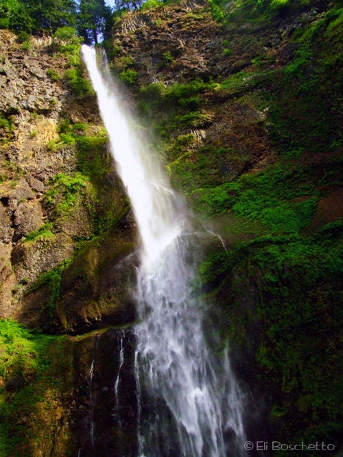
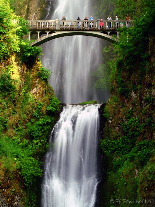
The trail continues down alongside Multnomah Creek, crosses, then forks to the left to the lookout platform at the brink above 620′ Multnomah Falls; here’s where you’ll pick up lots more trail company. Check out the views above the falls and out over the Gorge. The trail then takes several long, winding switchbacks down through moss-covered rockfall, sprinkled with Oregon grape, stonecrop, starflower and bleeding heart to the Benson Bridge, a 45′ stone bridge built in 1914 that spans the outlet between Multnomah’s upper and lower falls. Finish up by continuing down to the base, and reward your efforts with a soft-serve ice cream at the Lodge’s snack bar.
Mapped by Eli Boschetto
Trail Facts
- Distance: 7.4
Waypoints
MLT001
Location: 45.5772075, -122.1195478
Start the loop at the Return Trail, on the west end of the parking area.
MLT002
Location: 45.5753452, -122.1279904
Cross the bridge at Wahkeena Cascade and start up paved switchbacks on Wahkeena Trail #420.
MLT003
Location: 45.5742409, -122.1274996
Bridge below Wahkeena Falls.
MLT004
Location: 45.5736688, -122.1264838
Junction; fork right for a view from Lemmon’s Point.
MLT005
Location: 45.574016, -122.1266125
Lemmon’s Point. Columbia River and Beacon Rock views.
MLT006
Location: 45.5732008, -122.1264589
Look for spur to “hidden” Necktie Falls.
MLT007
Location: 45.5737377, -122.1271268
Obstructed views of Necktie Falls.
MLT008
Location: 45.5720855, -122.1262094
Wahkeena Creek crossing.
MLT009
Location: 45.5712942, -122.1256951
Creek crossing. Look for yellow monkeyflower.
MLT010
Location: 45.570299, -122.1246178
Fairy Falls. Enjoy a snack and a view of the falls on the trailside bench nearby.
MLT011
Location: 45.5699942, -122.1242386
Junction with Vista Trail #419; either fork meets up at loop crest.
MLT012
Location: 45.5686156, -122.1228218
Junction with Trail #415. Continue straight to stay on loop; fork right for side trip to Angel’s Rest.
MLT013
Location: 45.5699905, -122.1179312
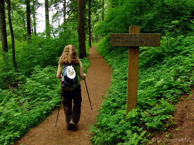
Crest of loop trail. Vista Trail #415 heads down to the left. Loop trail continues straight and left; fork right on Trail #420C for side trip to Devil’s Rest.
MLT014
Location: 45.5709439, -122.1158695
Creek crossing. The next section of trail is heavily flowered with larkspur, cow parsnip, wild iris, tiger lily and columbine.
MLT015
Location: 45.57171, -122.1072006
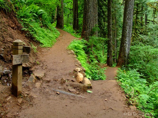
Junction with Trail #441. Fork left to continue on loop; fork right for 5 mi. hike to Larch Mtn.
MLT016
Location: 45.5738657, -122.10742
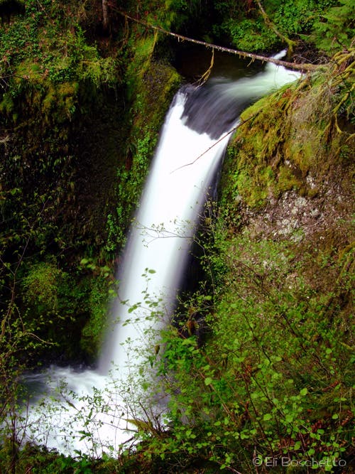
Ecola Falls. There is a VERY steep, loose spur that goes to the bottom – use discretion.
MLT017
Location: 45.5747065, -122.1084988
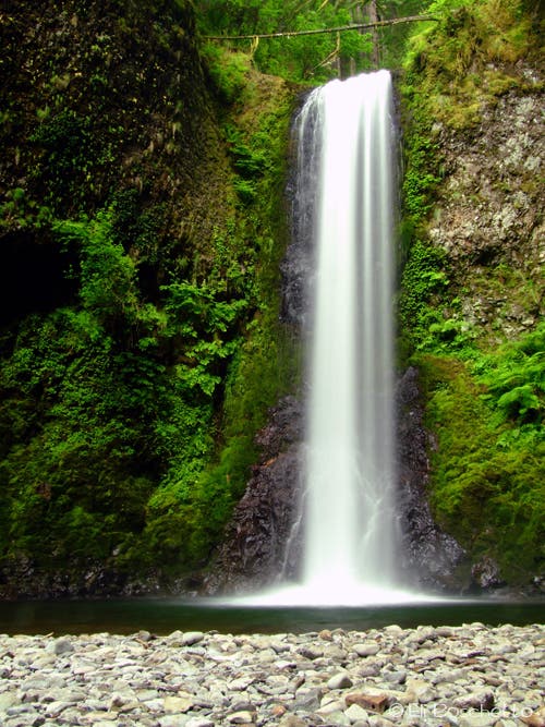
Wisendanger Falls. From water-level, an easy rock hop gets you to the base of the falls.
MLT018
Location: 45.5757772, -122.1123447
Creek crossing.
MLT019
Location: 45.5757129, -122.1134341
0.25 mi. spur to view platform above Multnomah Falls.
MLT020
Location: 45.5757354, -122.1150327
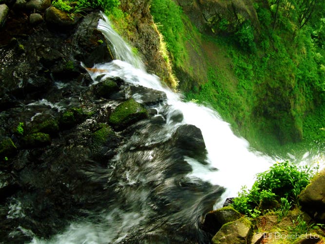
Viewing platform at the brink of 620′ Multnomah Falls.
MLT021
Location: 45.5777843, -122.1143159
Junction with Gorge Trail #400 to Oneonta Gorge; fork left to continue down loop.
MLT022
Location: 45.5769219, -122.1162879
Benson Bridge. Enjoy the cool spray of the upper falls, while peering over the brink of the lower falls.
MLT023
Location: 45.5776278, -122.1171141
Multnomah Lodge. Finish with a soft-serve ice cream, and check out the visitor center’s historic photos.
Trailhead
Location: 45.5772223, -122.1193779
Start the loop hike with the Return Trail to Wahkeena Falls. © Eli Boschetto
Wahkeena Falls
Location: 45.5742559, -122.1273494
0.2 miles up the Wahkeena Trail, cross the bridge beneath Wahkeena Falls. © Eli Boschetto
Secret Falls
Location: 45.5738654, -122.127167
Use a short, overgrown spur to a viewpoint of this hidden waterfall. © Eli Boschetto
Wahkeena Creek
Location: 45.5720592, -122.1261826
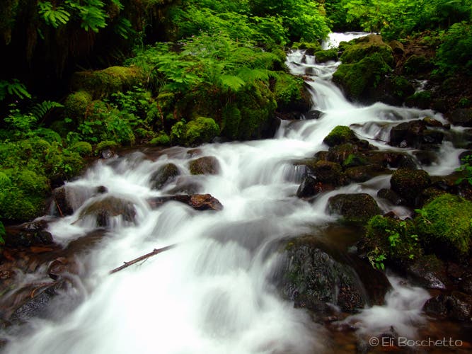
Cascade above crossing. © Eli Boschetto
Monkeyflower
Location: 45.5712856, -122.1255496
Bright yellow monkeyflower decorate many sections along Wahkeena Creek. © Eli Boschetto
Fairy Falls
Location: 45.5702079, -122.1246243
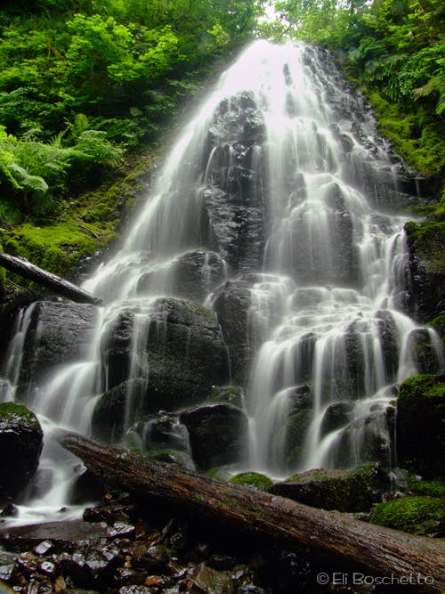
This 20′ cascading fan waterfall is right along the trail, and makes beautiful long-exposure shots. © Eli Boschetto
Larkspur
Location: 45.5719052, -122.1159124
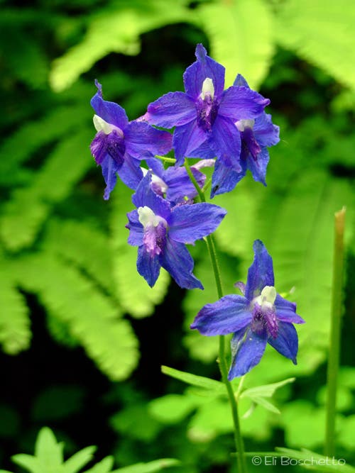
These tall blue flowers inhabit many sections of the Multnomah Loop trail. © Eli Boschetto
Fork in the Road
Location: 45.5699675, -122.1177471
Fork left to continue on the Multnomah Loop; fork right for a side trip to Devil’s Rest. © Eli Boschetto
Left Fork
Location: 45.5703506, -122.1175969
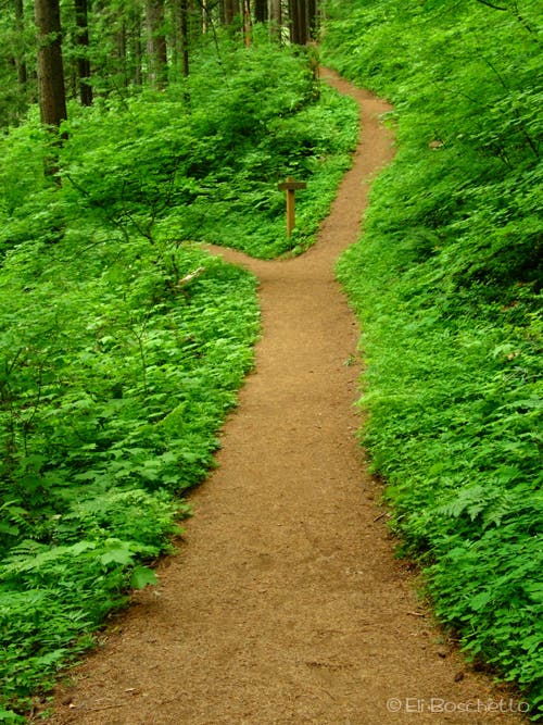
Hiker on the Multnomah Loop. © Eli Boschetto
Wild Iris
Location: 45.5733172, -122.1127474
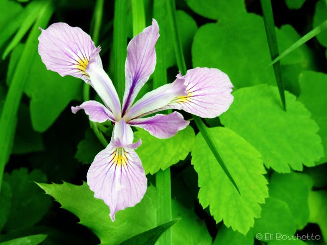
These pretty purple flowers can be found along some sections of the Multnomah Loop trail. © Eli Boschetto
Cow Parsnip
Location: 45.5723258, -122.1147001
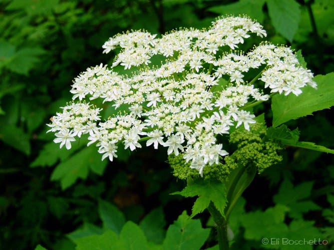
Tall, bunched white flowers along the Multnomah Loop trail. © Eli Boschetto
Columbine
Location: 45.5734073, -122.1094751
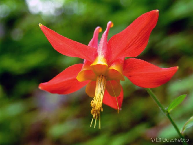
Unusual-looking red flower along the Multnomah Loop trail. © Eli Boschetto
Multnomah Trail
Location: 45.5716799, -122.1070719
Hang a u-turn at this trail junction to continue down to Multnomah Falls. © Eli Boschetto
Ecola Falls
Location: 45.5741057, -122.1074474
This 55′ plunging waterfall is best seen from the trail above. © Eli Boschetto
Wisendanger Falls
Location: 45.5745638, -122.1081769
A pretty plunging waterfall with a small rocky beach, accessible by a short rock hop. © Eli Boschetto
Over the Edge
Location: 45.5757429, -122.1148825
From the playform, view of Multnomah Creek tumbling over Multnomah Falls. © Eli Boschetto
Upper Falls
Location: 45.5768468, -122.1161807
The upper section of Multnomah Falls, seen from the Benson Bridge. © Eli Boschetto
Benson Bridge
Location: 45.5774025, -122.1169639
Benson Bridge, between upper and lower Multnomah Falls. © Eli Boschetto