Portland, OR: Larch Mountain Crater

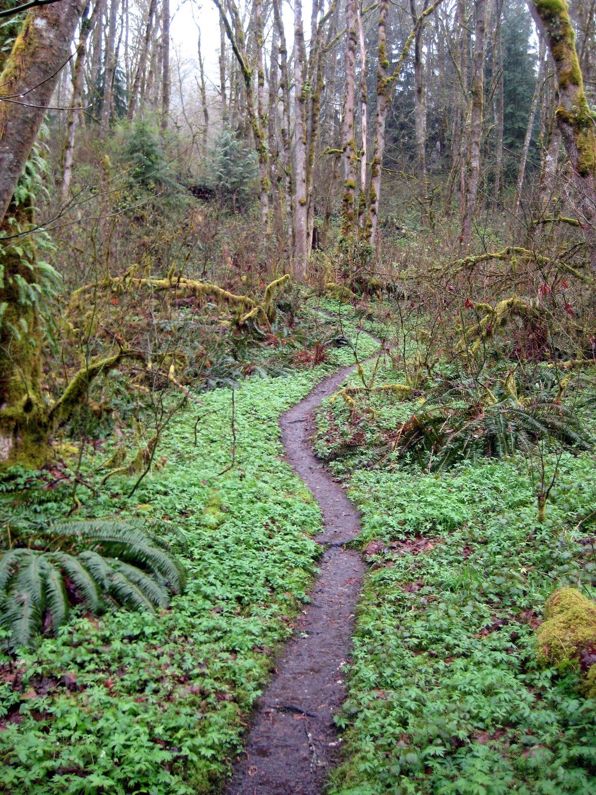
Skip the stiff climb up Larch Mountain and the crowded lower parking lots on the Historic Highway. This lesser-used route offers a more moderate ascent to the top of this ancient shield volcano and more quiet time on the trail. The hike starts 11.3 miles up Larch Mountain Road at a locked gate. Walk a quarter mile up the rocky service road to a junction with the Larch Mountain Trail #441. Bear left and descend through old-growth hemlock and fir; trillium, monkey flower and bleeding heart dot the ground.
Half a mile later, fork right onto Multnomah Spur #446. Nearly a mile in, cross Multnomah Creek, then immediately veer right onto Multnomah Creek Trail #444 and enter the “crater” of Larch Mountain, a boggy marsh carpeted with Indian hellebore. Past the crater, the ascent to the summit begins on easy switchbacks.
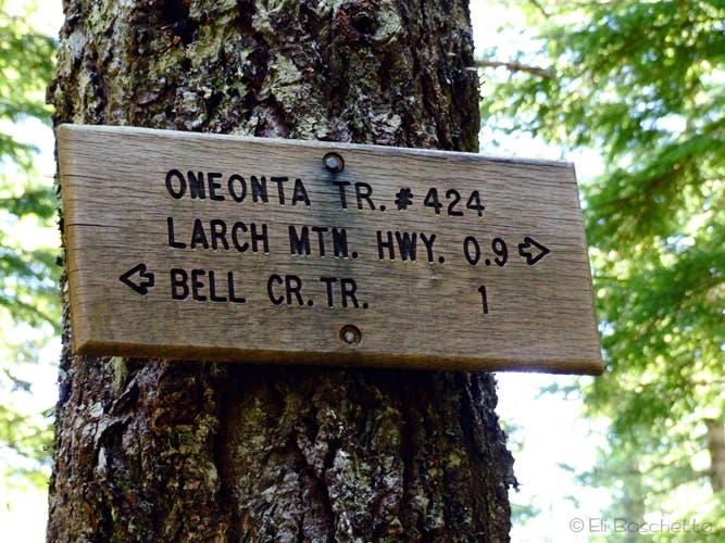
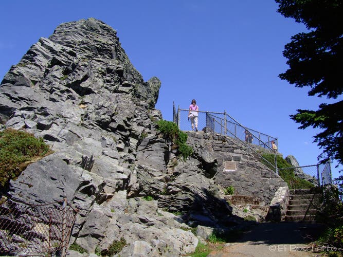
At mile 3.5, crest the ridge and turn right onto Oneonta Trail #424; the trail ends 0.9 mile later at Larch Mountain Road. Continue up the road 0.4 mile to Larch Mountain Park, and climb the stairs to the rocky promontory of Sherrard Point. You’ll find grand views over the Columbia River Gorge and Mounts St. Helens, Rainier, Adams, Hood and Jefferson.
Finish the loop by heading back down the stairs and forking right at a junction to the summit proper, an open area in the trees (no views). Pick up the trail to the right and descend through a short stretch of snaggly forest, then back into the greener fir and hemlock. In no time, you’ll reconnect with the forest road; turn left for the short descent back to your car.
Note: Early season hikers may find Larch Mountain Road closed just past MP 10 and a small parking area on the west side. The walk up the road from this point is 1.5 miles. The trail can retain a lot of snow on the north-facing slopes above the crater well into early summer, making navigation tricky in some areas.
-Mapped by Eli Boschetto, Bosco Mountain Photo


Trail Facts
- Distance: 11.3
Waypoints
LMC001
Location: 45.5492064, -122.0918922
From the trailhead, hike southeast up the rocky forest road.
LMC002
Location: 45.5456331, -122.0893571
Turn left, heading east, onto Larch Mountain Trail #441.
LMC003
Location: 45.5451433, -122.0880711
Pass a small campsite with fire ring.
LMC004
Location: 45.5470406, -122.0818377
Bear right (east) onto Multnomah Spur Trail #446. Hike through forests of hemlock and fir.
LMC005
Location: 45.5469354, -122.0787692
Cross Multnomah Creek on a wooden bridge, then bear right (south) onto Multnomah Creek Trail #444.
LMC006
Location: 45.5426825, -122.0799816
The trail travels inside the Larch Mountain Crater, a boggy marsh filled with Indian hellebore (a highly poisonous plant).
LMC007
Location: 45.5396459, -122.0839993
Fallen trees block the trail; jog around to the right.
LMC008
Location: 45.5392585, -122.0850543
Cross the first of three small creek crossings.
LMC009
Location: 45.5377872, -122.0867775
Another small creek crossing.
LMC010
Location: 45.5315813, -122.0783518
Hop across the route’s last creek crossing. Monkeyflower flourish in this area.
LMC011
Location: 45.5341347, -122.071104
Look for views of Mounts St. Helens and Rainer in an opening above a slide area.
LMC012
Location: 45.5350201, -122.065849
Turn right (southeast) on Oneonta Trail #424.
LMC013
Location: 45.528056, -122.0814336
The Oneonta Trail ends here. Turn right onto the road.
LMC014
Location: 45.5289827, -122.0876908
Continue northwest at the Larch Mountain Park entrance.
LMC015
Location: 45.5296663, -122.088393
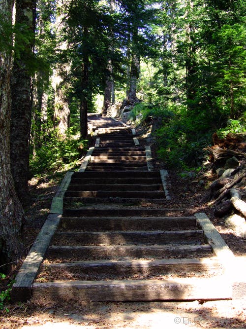
Pick up the trail to Sherrard Point at the northwest corner of the parking area. The trail to the top of Sherrard Point climbs a set of stairs.
LMC016
Location: 45.5327545, -122.0876356
Sherrard Point: Enjoy the views of Mounts St. Helens, Rainier, Hood, Jefferson, and Adams. Turn around and descend the stairs. In 650 feet, bear right toward Larch Mountain’s summit proper.
LMC017
Location: 45.5314701, -122.0891762
Bear right, heading southwest.
LMC018
Location: 45.5306509, -122.0899379
Crest the summit of Larch Mountain, an open area in the trees with no views. Info: This ancient volcano was actually named for the noble fir, which was called larch by local lumbermen. (There are no larch trees on Larch Mountain). Next, pick up the trail on the right, heading west.
LMC019
Location: 45.5311134, -122.0920751
The trail passes a very old campsite with moss-covered picnic tables.
LMC020
Location: 45.5456355, -122.0894551
Back at the forest road, turn left (north) to return to the trailhead.
Mount Hood
Location: 45.5327478, -122.0874918
Spectacular views of Mount Hood await from the top of Sherrard Point. © Eli Boschetto
Oregon Oxalis
Location: 45.5474463, -122.0904207
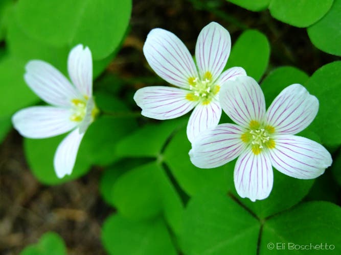
Lots of this little white flower line the trails on Larch Mtn. © Eli Boschetto
Larch Mountain Trail
Location: 45.5456317, -122.0892781
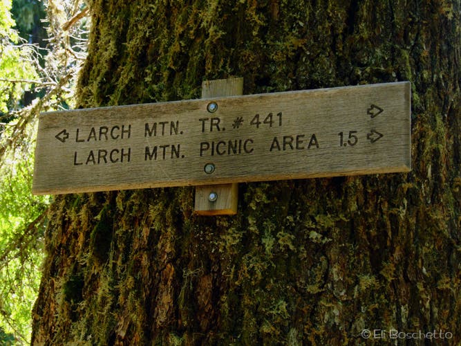
Follow the signs to Larch Mountain; go left for the crater loop. © Eli Boschetto
Old Growth
Location: 45.5470856, -122.0802069
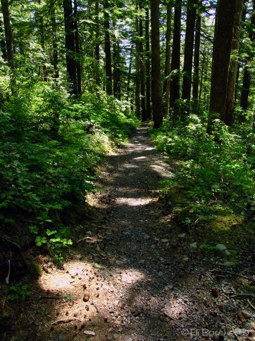
Wander through forest of hemlock and fir on the Larch Mountain Trail. © Eli Boschetto
Multnomah Trail
Location: 45.5466724, -122.0783186
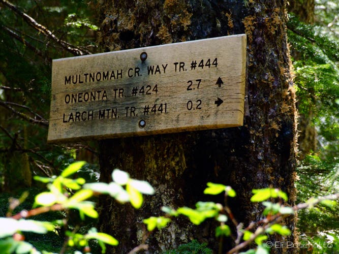
After crossing Multnomah Creek, head up the Multnomah Creek Trail to Larch Mountain © Eli Boschetto
Hellebore
Location: 45.5420513, -122.0804107
Highly poisonous, the swampy Larch Mountain Crater is full of Indian hellebore. © Eli Boschetto
Trillium
Location: 45.5408264, -122.0817947
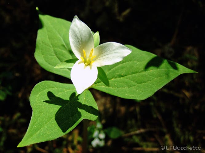
At a higher elevation than most other Gorge hikes, trillium blooms here later in the season. © Eli Boschetto
Mountain Window
Location: 45.5320864, -122.079134
An opening in the trees offers views of Mts. St. Helens and Rainier. © Eli Boschetto
Monkeyflower
Location: 45.5344162, -122.070508
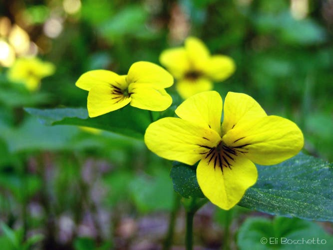
Small Lewis’ monkeyflower can be found in moist, shaded areas along the trail. © Eli Boschetto
Fork Right
Location: 45.5350324, -122.0656371
Follow the signs to Larch Mountain summit. © Eli Boschetto
Sherrard Steps
Location: 45.5319812, -122.0885754
Take the paved stairs to the top of Sherrard Point for stunning views. © Eli Boschetto
Sherrard Point
Location: 45.532387, -122.0882642
The trail to the top of Sherrard Point offers spectacular views of the Columbia Gorge and the Cascade volcanoes. © Eli Boschetto
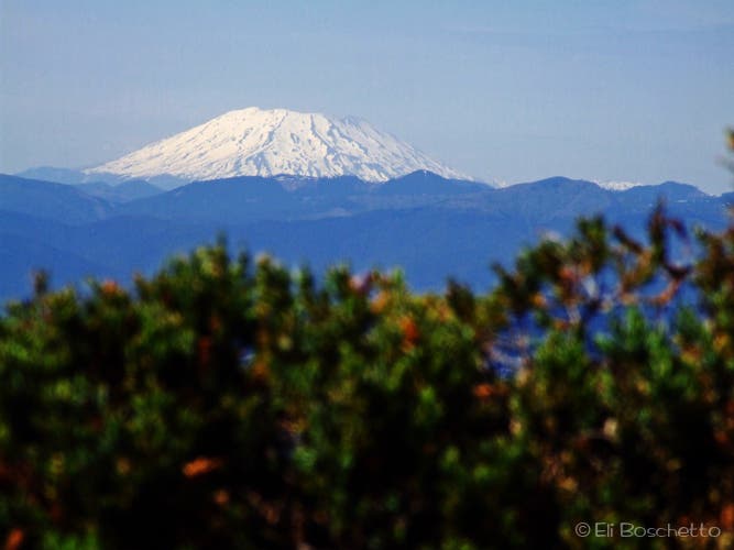
Mount St. Helens
Location: 45.5328379, -122.0878887
View of Mount St. Helens from Sherrard Point. © Eli Boschetto
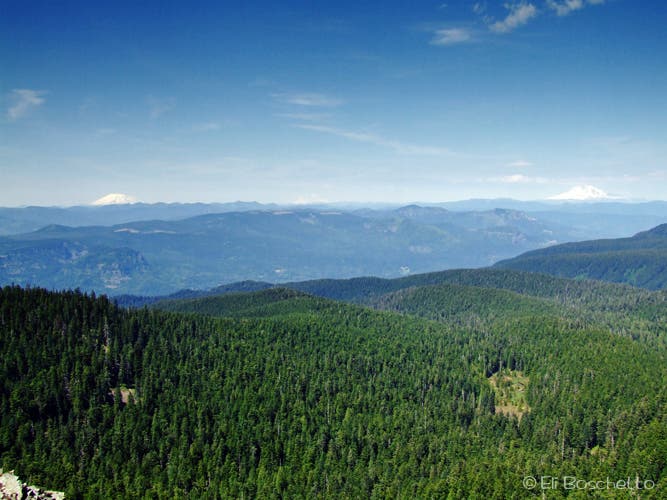
3-Mountain Day
Location: 45.5328455, -122.0876527
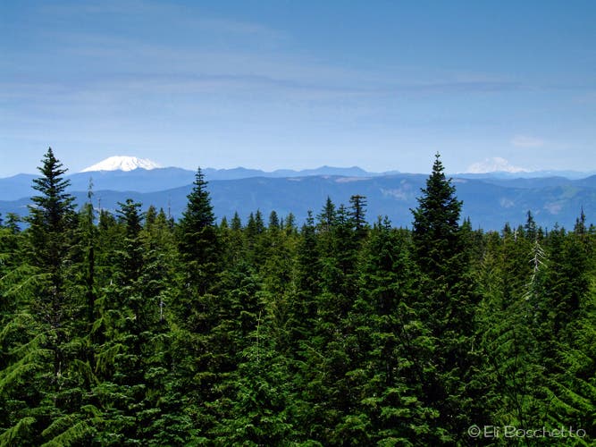
View Mounts St. Helens, Rainier and Adams from the top of Sherrard Point. © Eli Boschetto
Sunshine
Location: 45.5320864, -122.0935535
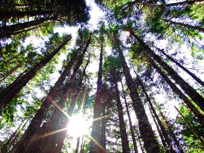
Sunlight filters through wooded forest on Larch Mountain. © Eli Boschetto
Bleeding Heart
Location: 45.541405, -122.0937252
This delicate little pink flower is scattered along the Larch Mountain Trail. © Eli Boschetto