Published June 11, 2015 08:06PM
Phoenix's Best Local Hikes
Get crowd-free, after-work views; see the Superstition's greener side; and overnight in a heavenly oasis on Phoenix's best local hikes.
'Top of Tom's Thumb Trail. Photo by Laurence Parent'
After Work
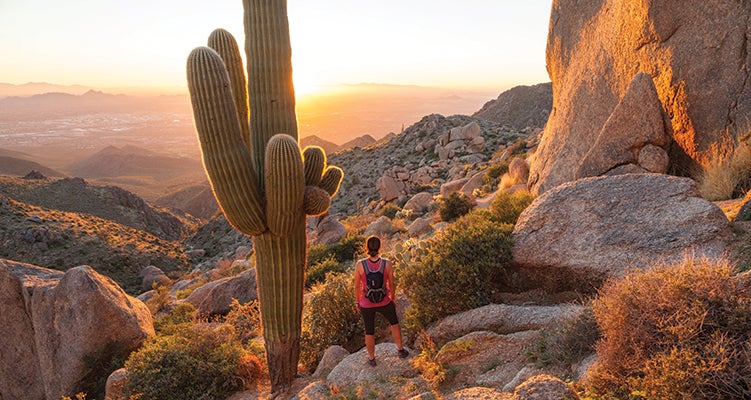
Tom’s Thumb Trail, McDowell Sonoran Preserve
Unlike the Valley’s more popular summit trails up Camelback Mountain and Piestewa Peak, hikers travel the 5.7 miles (round-trip) to Tom’s Thumb for the crowd-free view as much as the workout. The route switchbacks 1,000 feet in 2 miles on a rocky staircase to the base of the 180-foot-tall granite plug. Backtrack .3 mile and hike another .8 mile to Lookout Point for a panorama of the Mcdowells Range and the Valley. Return the same way.
Trailhead:33.694423, -111.801789Drive Time: 50 mins. Info:mcdowellssonoran.org
Dayhike
Haunted Canyon Trail, Superstition Wilderness
See the greener face of the Superstitions with a hike up Haunted Canyon Trail (#203), located on the wilderness area’s east side. From the Haunted Canyon trailhead, it’s a 6-mile (one-way) ramble up-canyon long the gently flowing Pinto Creek to the historic Tony Ranch cabin and nearby spring (hence the greenery). Have lunch beneath an old cottonwood tree, then return on the creekside path, or hike west an extra 2 miles up steep switchback to Bull Basin saddle and savor a hawk-eye’s view of the wilderness.
ADVERTISEMENT
Trailhead:33.423848, -111.007233Drive Time: 1 hr. 45 mins. Info:bit.do/hauntedcanyon
Overnight
Hellsgate Trail, Hellsgate Wilderness
Don’t let the name scare you away. Sure, it can get scorching hot from June to August, but this 8-mile (one-way) out-and-back has a heavenly destination. Take the Hellsgate Trail (#37) through manzanita scrubland and across the exposed Apache Ridge to a steep, 2,000-foot descent in the last two miles to Tonto Creek Canyon. Set up camp at the confluence of Tonto and Haigler Creeks, on the sandy beach beneath giant sycamore trees.
Trailhead:34.267378, -111.140378Drive Time: 1 hr. 45 mins. Info: fs.usda.gov/tonto
See the rest of the country’s best local hikes
