Published September 20, 2013 03:31PM
Phoenix: Blodgett Basin Trail
This little-used trail plunges 1,700 feet through wildflower country to a cool reward by West Clear Creek. Watch for cairns on this 6.8-mile hike to avoid involuntary bushwhacks.
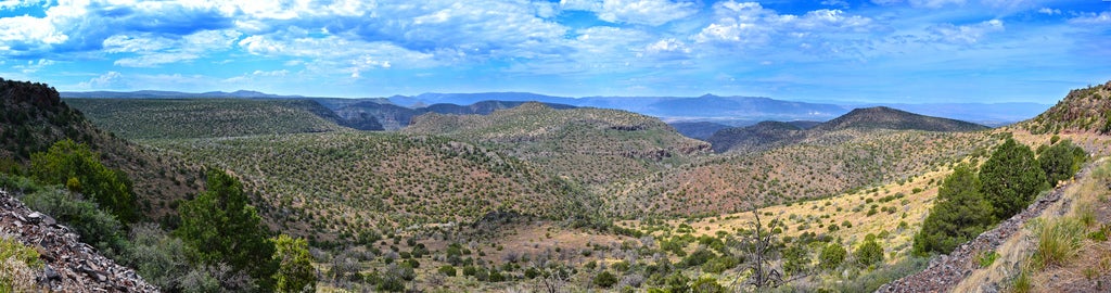
'Coconino National Forest'
Trail Facts
- Distance: 5.4
Waypoints
BBT001
Location: 34.5627937316894, -111.673233032227
Trailhead marked by a post and caged cairn; follow jeep road SW
BBT002
Location: 34.5587921142578, -111.678909301758
Turn L onto rough trail, leaving jeep road
BBT003
Location: 34.5570869445801, -111.680648803711
Rim of tank @ L offers beautiful views into desert riparian area
BBT004
Location: 34.5545845031738, -111.683135986328
R past fence; follow fence line
BBT005
Location: 34.5496864318848, -111.690032958984
Hop over barbed wire to continue along trail; hoodoos appear below @ L
BBT006
Location: 34.5452461242676, -111.693794250488
Creek comes into view as lush green line below
BBT007
Location: 34.546329498291, -111.69361114502
Trail descends through tight switchbacks
BBT008
Location: 34.542724609375, -111.697700500488
Pass through level area of high brush to approach creeklet ahead
BBT009
Location: 34.5416984558106, -111.699012756348
Faint trail follows ridge, paralleling creek on L
BBT010
Location: 34.5415191650391, -111.702346801758
Break in barbed wire marks the trail’s route
BBT011
Location: 34.541072845459, -111.704551696777
Cross the wash to catch overgrown trail on the other side
BBT012
ADVERTISEMENT
Location: 34.5403861999512, -111.704948425293
Trail register appears on R; cross road to cool down in West Clear Creek before backtracking to car