Published September 20, 2013 03:31PM
Philadelphia: Mt. Minsi via the AT
Wander through white pine, Eastern hemlock, and mountain laurel to the summit of Mt. Minsi on this 4.2-mile out-and-back sprinkled with lovely mountain overlooks.
'Nicholas A. Tonelli'
Trail Facts
- Distance: 3.4
- Miles from city center: 104
Waypoints
DWG001
Location: 40.9800834655762, -75.142448425293
Hike E from parking area @ signed trailhead
DWG002
Location: 40.9787330627441, -75.1408309936524
Lake Lenape, named for native tribe of the Delaware Valley
DWG003
Location: 40.9759826660156, -75.1399154663086
Bear L, staying on white-blazed AT
DWG004
Location: 40.9738655090332, -75.1379699707031
Council Rock
DWG005
Location: 40.9698829650879, -75.1379318237305
Bear L @ Y
DWG006
Location: 40.967716217041, -75.1369857788086
Eureka Creek; bear L over creek
DWG007
Location: 40.9684181213379, -75.135498046875
Bera R up rock steps to stay on AT; walk 40 paces ahead to Lookout Rock with views of Kittatinny Ridge and Delaware River
DWG008
Location: 40.9656677246094, -75.1333847045898
Bear R @ rock wall
DWG009
Location: 40.9639663696289, -75.1295318603516
Turn L @ T with fire road, then quick R to stay on AT
DWG010
Location: 40.9627151489258, -75.1268157958984
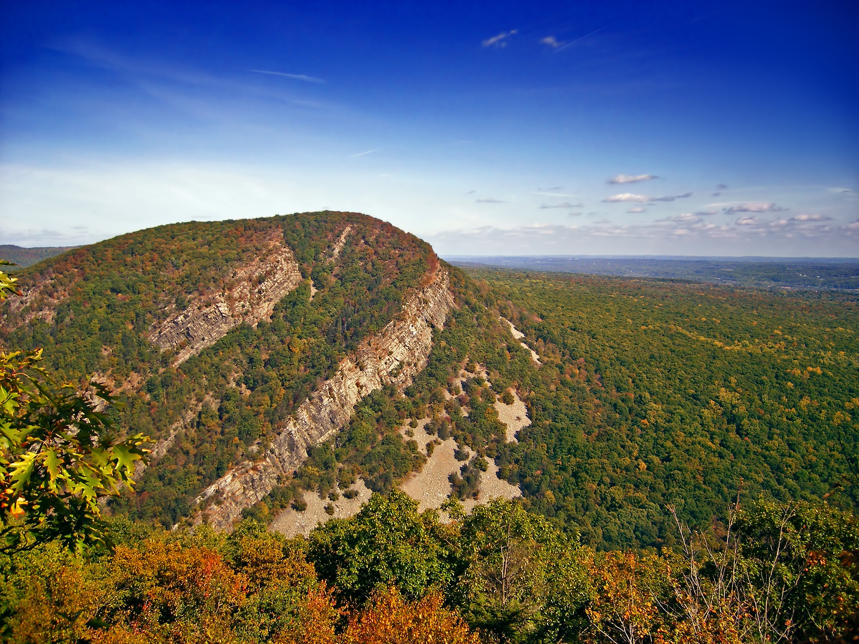
Lookout: Turnaround for many dayhikers; view of craggy quartzite layers that hug SW side of Mt. Tammany, a.k.a. Indian head (look for profile of Chief Tammany in rock)
DWG011
ADVERTISEMENT
Location: 40.9597511291504, -75.1285858154297
Tree-shaded summit of 1,480-foot Mt.Minsi
DWG012
Location: 40.9589347839356, -75.1286163330078
Expanisve vista just off AT of 330-mile Delaware River, farmland, and small towns of Portland, PA and Warrington, NJ