Pacific Crest Trail: CA Section 20

Trail Facts
- Distance: 366.5
Waypoints
PCT397
Location: 36.05455, -118.130684
Kennedy Meadows Trailhead @ N end of campground
PCT398
Location: 36.078884, -118.124031
Bridge over South Fork Kern River
PCT399
Location: 36.101185, -118.11898
Creeklet
PCT400
Location: 36.128685, -118.13385
Another creeklet running beside the trail
PCT401
Location: 36.138817, -118.139748
Haiwee Trail junction; stay straight
PCT402
Location: 36.152466, -118.147133
Creek
PCT403
Location: 36.181915, -118.12883
Bridge over South Fork Kern River; be sure to take a look under the bridge where you’ll find the nests of hundreds of swallows. Because of their droppings, go upstream of the bridge to get water. There is an excellent campsite high on the S bank.
PCT404
Location: 36.182533, -118.128166
Trail junction; Go straight and head into Cow Creek Canyon
PCT405
Location: 36.227318, -118.134613
R @ Junction to Monache Meadows, the largest in the Sierras
PCT406
Location: 36.225132, -118.130066
Cross a creek
PCT407
Location: 36.224117, -118.129013
Olancha Pass Junction; stay straight, eventually the trail curves N
PCT408
Location: 36.224667, -118.128036
Trailside camp
PCT409
Location: 36.225266, -118.12748
Trail junction to Olancha Pass Trail
PCT410
Location: 36.227482, -118.127647
Creek
PCT411
Location: 36.232018, -118.121986
Creek
PCT412
Location: 36.273418, -118.136467
Creek
PCT413
Location: 36.286266, -118.140419
Creek
PCT414
Location: 36.296467, -118.130783
Creek
PCT415
Location: 36.321518, -118.13102
Dry creek, good camping on N side
PCT416
Location: 36.355835, -118.123299
Crestline saddle with views E down toward the high-elevation desert of the Owens Valley
PCT417
Location: 36.369816, -118.137352
Junction to a spring .25-mi. to R, plenty of flat camping amongst the large foxtail pines in this area
PCT418
Location: 36.413033, -118.139099
Junction with faint spur trail going R down to meadow with a hard-to-find spring
PCT419
Location: 36.427582, -118.147835
Unsigned spur to water and corral; take R
PCT420
Location: 36.429768, -118.165398
Go straight @ Mulkey Pass trail junction; going L about .25-mi. leads to a spring marked by a signed tree
PCT421
Location: 36.427185, -118.17643
Go straight @ Trail Pass trail junction; R leads to popular Hoseshoe Meadows Trailhead where you might be able to hitch into Lone Pine for supplies
PCT422
Location: 36.453201, -118.215683
Go straight @ Cottonwood Pass; R will also take you to Horseshoe Meadow
PCT423
Location: 36.454235, -118.224983
Chicken Spring Lake outlet; stop here for a swim in your first Sierra lake; excellent camping found 100 ft. from the S shore
PCT424
Location: 36.473618, -118.260498
Sequoia NP Boundary
PCT425
Location: 36.478767, -118.271935
Go straight @ Siberian Pass/Rock Creek Trail Junction
PCT426
Location: 36.490932, -118.319717
Creeklet
PCT427
Location: 36.493851, -118.320282
Go straight @ New Army Pass trail junction
PCT428
Location: 36.495682, -118.329384
Spur to Rock Creek Ranger Station
PCT429
Location: 36.496166, -118.337082
Cross Rock Creek; there is a bear locker here
PCT430
Location: 36.506783, -118.343002
Guyot Creek
PCT431
Location: 36.552418, -118.358704
Whitney Creek: take R @ spur to Crabtree Ranger Station to meet Mt. Whitney Trail; PCT continues L
PCT432
Location: 36.563618, -118.349434
Crabtree Ranger Station and bear box; John Muir Trail to Mt. Whitney across creek
PCT433
Location: 36.573349, -118.314651
Campsite by stunning Guitar Lake; great basecamp for Whitney attempt. Even if you decide not to summit, enjoy camping in this high-alpine cirque
PCT434
Location: 36.578617, -118.291985
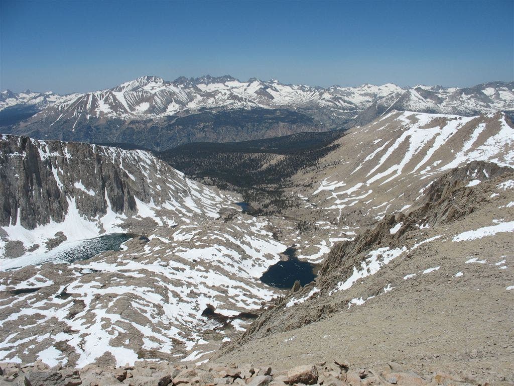
Summit Mt. Whitney, highest point in lower 48; enjoy views of the Great Western Divide, the central Sierras, and the Owens Valley below
PCT435
Location: 36.558849, -118.36187
Rejoin PCT/JMT; from here to Red’s Meadow, the PCT and JMT are the same trail. Follow all JMT signs until Devils Postpile NM.
PCT436
Location: 36.594131, -118.371117
Wallace Creek and High Sierra Trail junction and bear box
PCT437
Location: 36.598915, -118.374153
Wright Creek
PCT438
Location: 36.620144, -118.380638
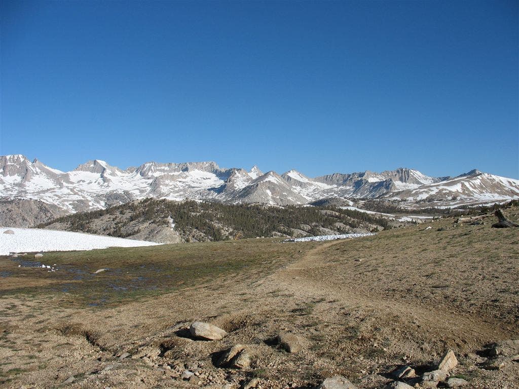
Bighorn Plateau
PCT439
Location: 36.635017, -118.385468
Bear box
PCT440
Location: 36.639717, -118.388046
Spur to Tyndall Creek Ranger Station
PCT441
Location: 36.640934, -118.387398
Shepard Pass trail
PCT442
Location: 36.642132, -118.387413
Tyndall Creek
PCT443
Location: 36.643002, -118.387451
Bear box
PCT444
Location: 36.64505, -118.38813
Lake South America trail
PCT445
Location: 36.694534, -118.373535
Forester Pass: highest point on PCT and entrace into Kings Canyon NP
PCT446
Location: 36.730915, -118.372833
Center Basin Creek
PCT447
Location: 36.751518, -118.395287
Bear box
PCT448
Location: 36.7593, -118.40583
Vidette Meadow campsite and bear box
PCT449
Location: 36.760216, -118.407166
Camp in Lower Vidette Meadows
PCT450
Location: 36.7603, -118.412102
Bubbs Creek/PCT Junction; head uphill
PCT451
Location: 36.768066, -118.411415
Bullfrog Lake Trail junction. Not the PCT, but spur trail to Independence for a necessary resupply
PCT452
Location: 36.773682, -118.381714
Kearsage Pass Trail Junction
PCT453
Location: 36.773132, -118.376564
Kearsage Pass, leaving Kings Canyon NP into Inyo National Forest to Onion Valley
PCT454
Location: 36.774826, -118.343178
Golden Trout Lakes Junction
PCT455
Location: 36.772533, -118.341202
Onion Valley Trailhead
PCT456
Location: 36.772949, -118.413651
Trail junction
PCT457
Location: 36.773285, -118.417564
Resume PCT
PCT458
Location: 36.789616, -118.412102
Glen Pass
PCT459
Location: 36.801815, -118.403198
Rae Lakes, Sixty Lakes Basin trail junction
PCT460
Location: 36.806583, -118.398048
Bear box
PCT461
Location: 36.811218, -118.40065
Spur to Rae Lakes Ranger Station
PCT462
Location: 36.814632, -118.404999
Bear box @ Lower Rae Lakes and good camping
PCT463
Location: 36.832947, -118.408798
Spur to Baxter Pass near Dollar Lake
PCT464
Location: 36.8498, -118.41243
Crossing at South Fork Woods Creek
PCT465
Location: 36.873432, -118.436966
Wooden suspension bridge over Woods Creek and bear locker
PCT466
Location: 36.90255, -118.400551
Sawmill Pass trail junction
PCT467
Location: 37.030518, -118.456902
Pinchot Pass
PCT468
Location: 36.969433, -118.44117
High water log crossing at South Fork Kings River
PCT469
Location: 37.031715, -118.460098
Mather Pass
PCT470
Location: 37.054501, -118.514702
Deer Meadow campsite
PCT471
Location: 37.052647, -118.578674
Middle Fork Kings River Junction; follow signs for JMT N into LeConte Canyon
PCT472
Location: 37.110615, -118.604897
Campsite at Big Pete Meadow
PCT473
Location: 37.113251, -118.633163
Helen Lake Outlet, climb continues
PCT474
Location: 37.118668, -118.659866
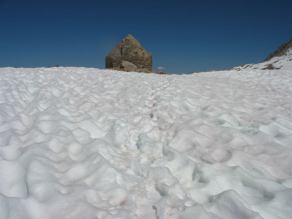
Muir Hut on Muir Pass
PCT475
Location: 37.111984, -118.670914
Crossing at Evolution Lake inlet
PCT476
Location: 37.187855, -118.745514
Nice, flat camp on Mc Clure Meadow with sublime views of The Hermit and Evolution Peaks
PCT477
Location: 37.195, -118.77317
Old PCT junction @ Evolution Creek; high-water crossing can be swift
PCT478
Location: 37.195465, -118.78167
Rejoin new PCT @ crossing of Evolution Creek
PCT479
Location: 37.193016, -118.794968
Bridge over South Fork San Joaquin River and Goddard Canyon trail junction
PCT480
Location: 37.202965, -118.800537
Cross metal bridge
PCT481
Location: 37.22525, -118.832748
Bridge, leaving Kings Canyon NP into Sierra National Forest
PCT482
Location: 37.225899, -118.860786
Florence Lake trail junction
PCT483
Location: 37.2421, -118.871696
Spur to Florence Lake trail and Muir Trail Ranch
PCT484
Location: 37.253551, -118.864647
Senger Creek
PCT485
Location: 37.270134, -118.876549
Outlet of eastern of Sally Keyes Lakes
PCT486
Location: 37.280918, -118.874649
Outlet of Heart Lake
PCT487
Location: 37.289917, -118.872803
Selden Pass
PCT488
Location: 37.321884, -118.868286
Leaving PCT to cross Bear Creek at three forks section; use caution at dangerous ford
PCT489
Location: 37.330166, -118.866882
Return to PCT at normal crossing of Bear Creek
PCT490
Location: 37.368, -118.888153
PCT leaves Bear Creek to climb ridge
PCT491
Location: 37.382534, -118.91037
Trail to Bear Ridge trailhead and foot access to Vermillion Valley Resort
PCT492
Location: 37.412518, -118.92437
Leaving PCT for ferry across Edison Lake to Vermillion Valley Ranch at this junction
PCT493
Location: 37.405216, -118.942368
Ferry landing
PCT494
Location: 37.375702, -119.012451
Vermillion Valley Resort (http://www.edisonlake.com) first beer and one-night stay in platform tents free for thru-hikers; meals in diner are pricey, but filling
PCT495
Location: 37.470165, -118.923233
Silver Pass
PCT496
Location: 37.501301, -118.924835
Bridge over Fish Creek
PCT497
Location: 37.527317, -118.949135
Outlet of Purple Lake; no camping allowed
PCT498
Location: 37.539318, -118.97097
Creek
PCT499
Location: 37.563465, -119.033714
Deer Creek; campsites
PCT500
Location: 37.591148, -119.058487
Creek below Red Cones and Mammoth Pass Trail
PCT501
Location: 37.609917, -119.075348
Rainbow Falls trail
PCT502
Location: 37.615002, -119.074852
Red’s Meadow Resort: great diner and moderately stocked store; thermal showers at group campsites; shuttles run to Mammoth Mountain Ski Area and town bus runs into Mammoth town
PCT503
Location: 37.627018, -119.085548
Bridge near Devils Postpile
PCT504
Location: 37.632801, -119.088654
Resume PCT @ split with JMT
PCT505
Location: 37.653168, -119.080032
Bridge over Middle Fork San Joaquin River
PCT506
Location: 37.682449, -119.097519
Another trail to Shadow Lake
PCT507
Location: 37.681984, -119.086334
Agnew Meadow parking lot
PCT508
Location: 37.6828, -119.084618
High trail trailhead
PCT509
Location: 37.723267, -119.132484
Great camping with view of the Minarets, Banner Peak and Mount Ritter — the centerpiece summits of the grand Ritter Range
PCT510
Location: 37.725349, -119.134415
Trail to Clarke Lake
PCT511
Location: 37.728535, -119.17128
JMT and PCT merge @ Thousand Island Lake
PCT512
Location: 37.761833, -119.249367
Donohue Pass trail; enter Yosemite National Park
PCT513
Location: 37.777416, -119.261833
Bridge over Lyell Fork
PCT514
Location: 37.7943, -119.263
Campsite in grass just off trail along Lyell Fork
PCT515
Location: 37.866749, -119.322151
Bridge and trail junction to Tuolumne Pass
PCT516
Location: 37.868717, -119.333069
Reach Y. Go R to stay on official PCT. To L is short spur to backpacker’s campground and Tuolumne Meadows General Store.
PCT517
Location: 37.869873, -119.332703
Bridge over Lyell Fork of the Tuolumne River. Deep pools great for swimming and bBig, flat rocks for stretching out.
PCT518
Location: 37.877834, -119.33876
L @ T toward Tioga Road and Wilderness Center; smooth cap of Lembert Dome to N
PCT519
Location: 37.87698, -119.353065
Turn L @ parking lot and follow gravel road into broad river plain of Tuolumne Meadows; enjoy wide views to the carved granite spires of the Cathedral Range.
PCT520
Location: 37.874298, -119.357101
520: Tuolumne Meadows General Store–fully stocked and package service @ US Post Office; backpacker’s campsite S of road behind group campsite fire ring.
PCT521
Location: 37.879101, -119.366852
R @ 3-way following PCT N to Glen Aulin.
More PCT: Next Section | Previous Section
The Big Hill
Location: 36.565891, -118.349266
Postcard views of Mount Whitney’s helmet-shaped crest from the west. ©Jack Haskel
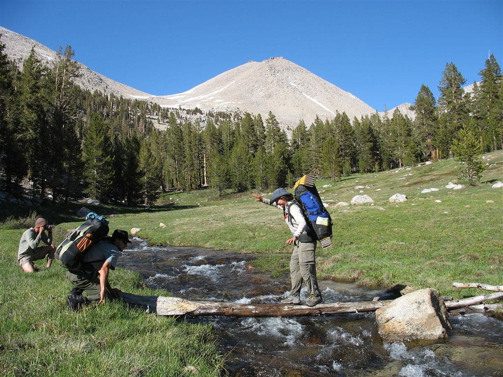
Crossing Whitney Creek
Location: 36.562225, -118.350609
A PCT’er negotiates a creek crossing while a fellow hiker balances the log. ©Jack Haskel
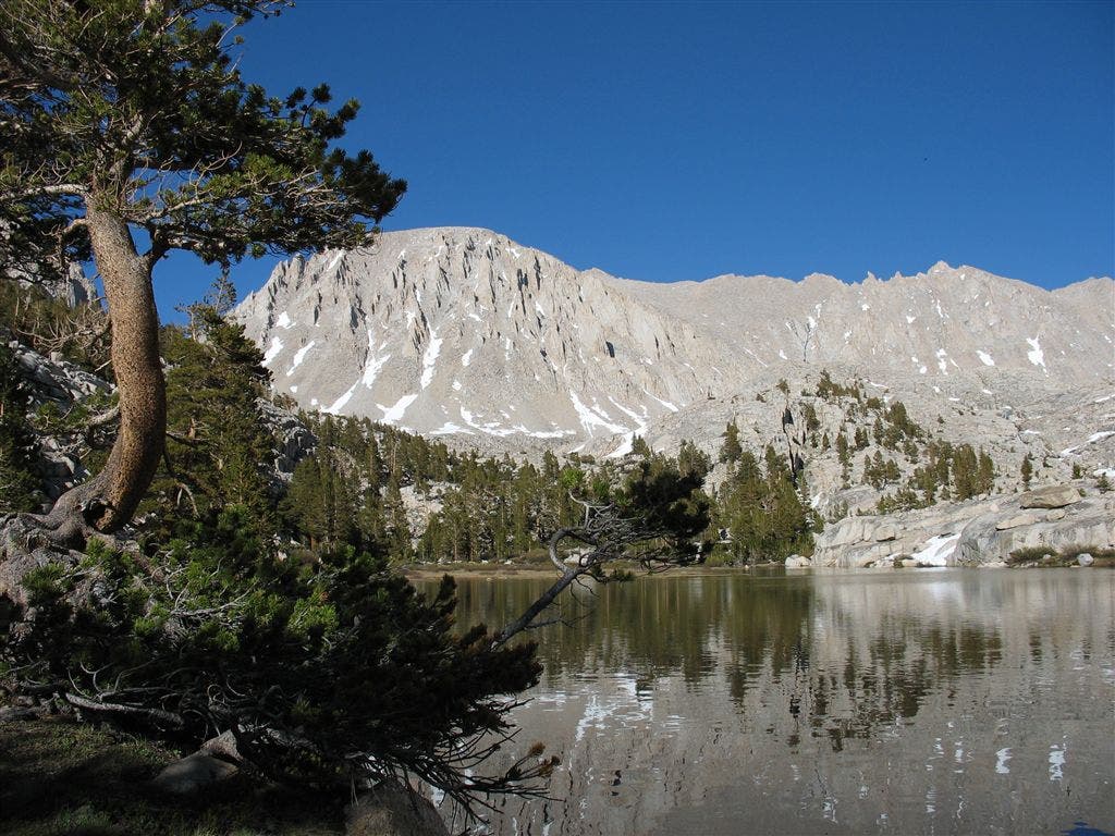
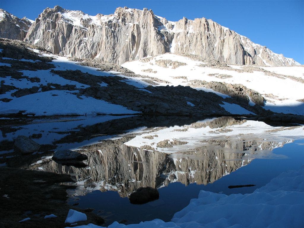
Mount Hitchcock Reflection
Location: 36.567314, -118.304596
This ridge frames the south end of the Whitney Basin. ©Jack Haskel
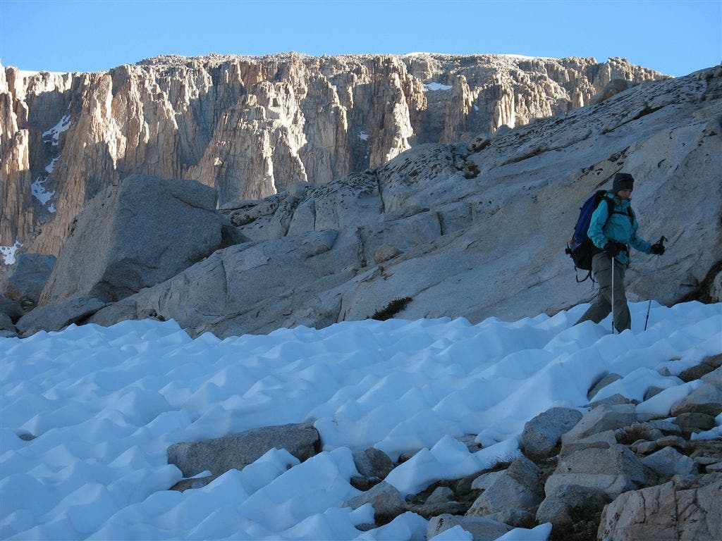
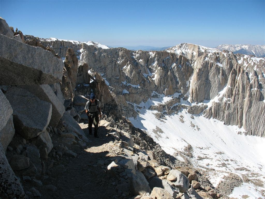
Climbing to Trail Crest
Location: 36.56123, -118.298599
Still in the shadow of early day, a PCT’er climbs to the turnoff for Mount Whitney. ©Jack Haskel
Summit Push
Location: 36.575817, -118.293854
A PCT’er climbs along the block-filled route to Whitney’s summit. ©Jack Haskel
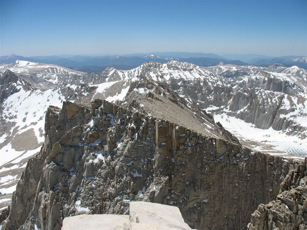
Along the Sierra Crest
Location: 36.572765, -118.289734
This view over Mount Muir and the tilted ridge south of Whitney reveals a snowy landscape stretching to the Great Western Divide. ©Jack Haskel
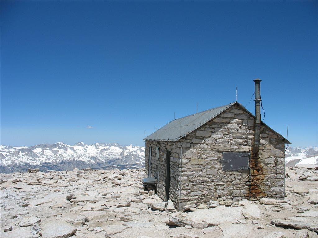
Whitney Hut
Location: 36.579483, -118.292244
The Mount Whitney Hut and was built in 1909 as a station for meteorological observations and is now a National Historic Landmark. The metal roof of this hut attracts lightning which can be conducted through the building to individuals inside. Do not seek shelter here during a storm. It is unsafe to be anywhere on top of the mountain or any exposed high place during a thunderstorm.©Jack Haskel
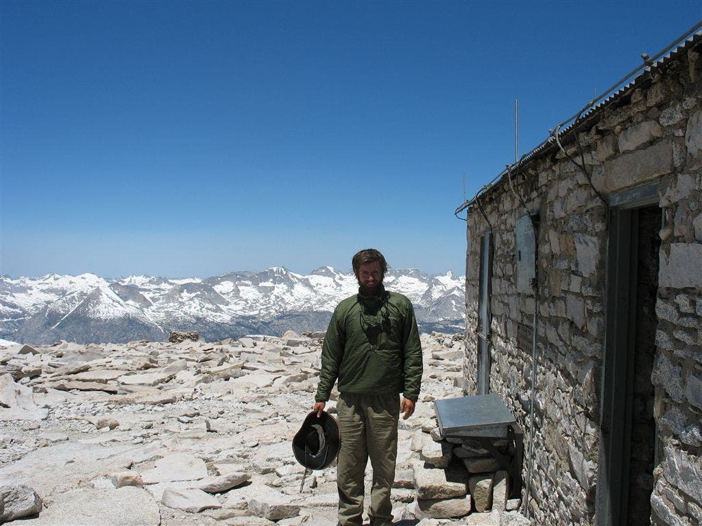
Jack at the register
Location: 36.579128, -118.290726
Map contributor Jack Haskel stands next to the Whitney Hut with the Kaweah Peaks in the background. ©Jack Haskel
Into the Whitney Basin
Location: 36.577785, -118.293678
The iconically shaped Guitar Lake rests in the Whitney Basin, with the Great Western Divide and Kaweah Peaks in the background. ©Jack Haskel
Bighorn Plateau
Location: 36.615692, -118.376556
A day north of Whitney, this large plateau is up high for miles and the vista is pure Sierra: jagged peaks all around and no one is sight. Go to the Full Section. ©Jack Haskel
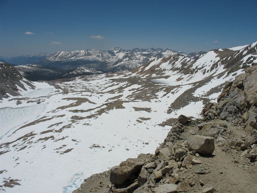
Climbing to Forester Pass
Location: 36.691372, -118.373734
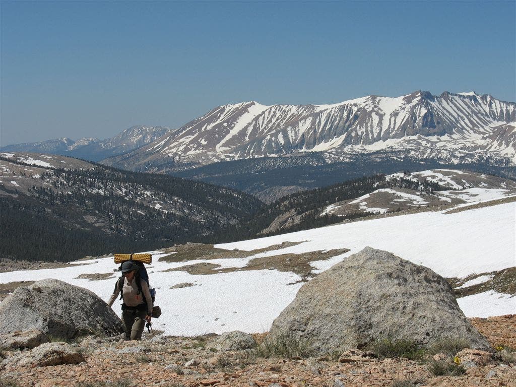
With the Kaweah Ridge behind, a PCT’er continues the trip north. ©Jack Haskel
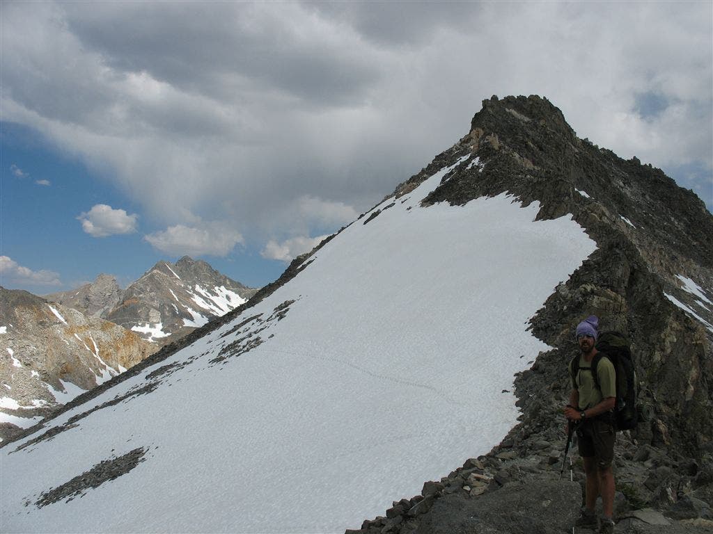
Snowfield
Location: 36.680347, -118.379646
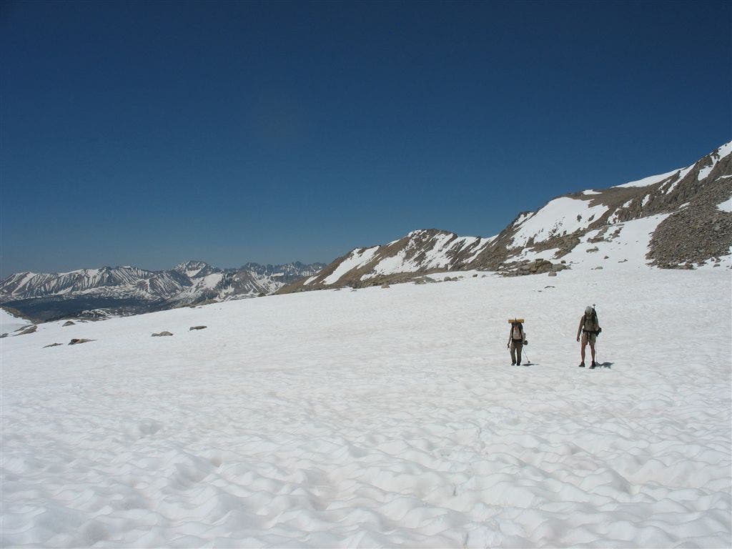
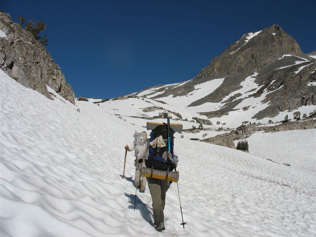
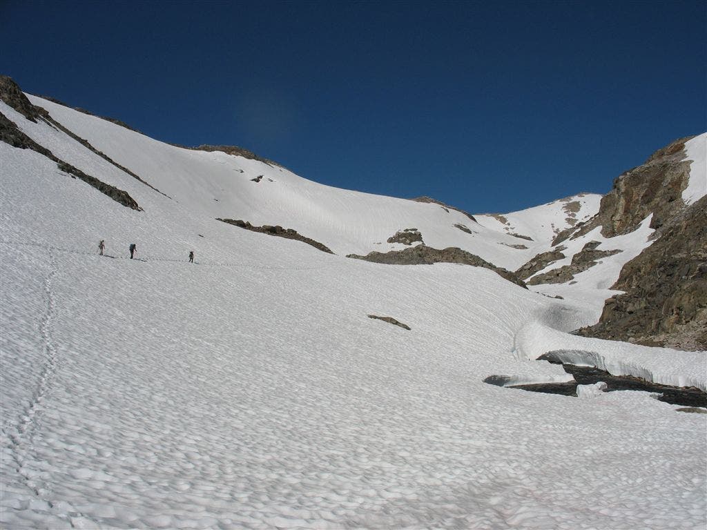
Two PCT’ers traverse a deep snowfield south of Forester Pass. ©Jack Haskel
Steep View
Location: 36.693253, -118.372925
Knife-edged switchbacks provide long-range views over the Great Western Divide. ©Jack Haskel
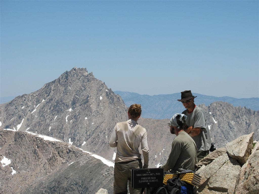
At the pass
Location: 36.694328, -118.372299
Three PCT’ers relish in cresting Forester, the highest pass on the PCT. ©Jack Haskel
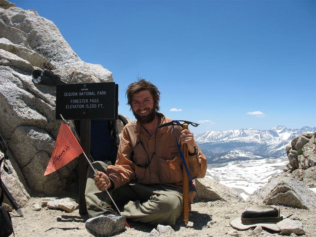
Jack at the Pass
Location: 36.695133, -118.373558
Contributor Jack Haskel sits on the Sequoia-Kings Canyon boundary at Forest Pass. ©Jack Haskel
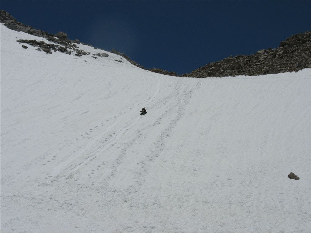
Long Glissade
Location: 36.698452, -118.370148
Coming off of Forester, a PCT’er takes the short way down. ©Jack Haskel
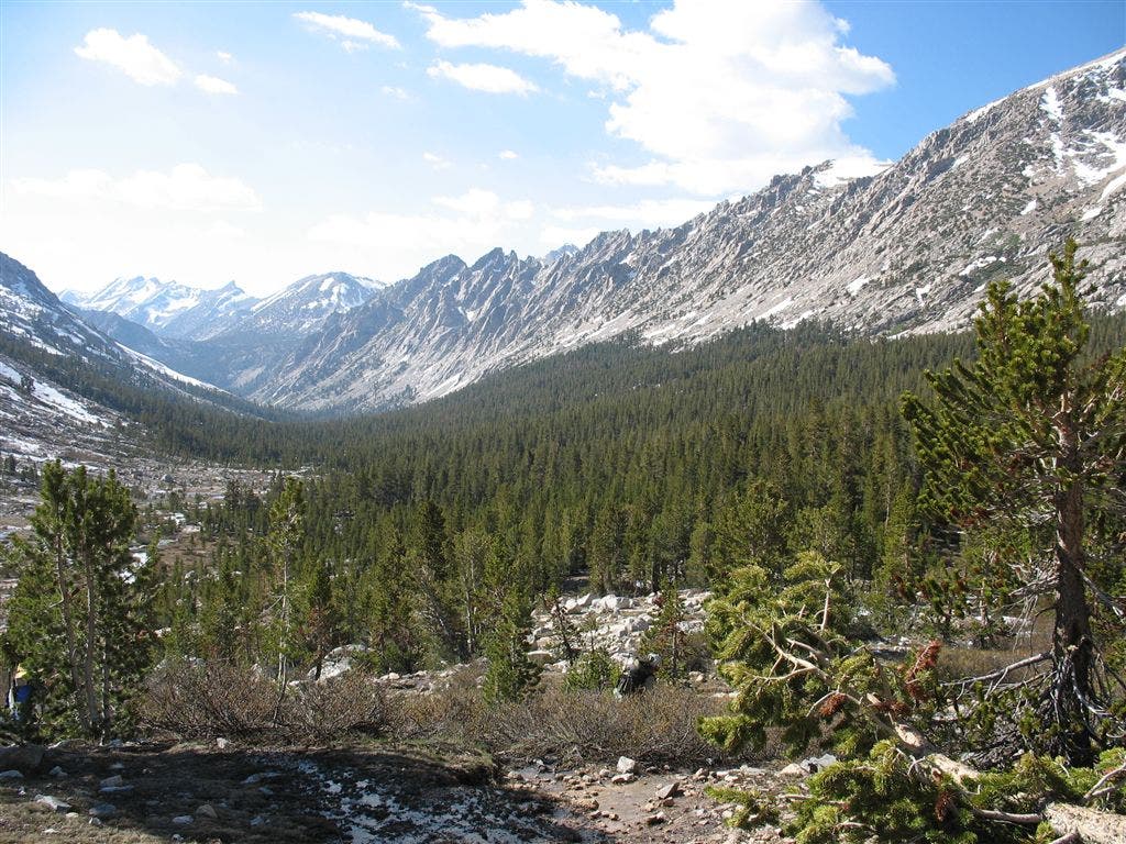
Kings Canyon
Location: 36.713058, -118.368805
After Forester, the PCT enters the north end of Kings Canyon, a deep, glacially carved trench.
©Jack Haskel
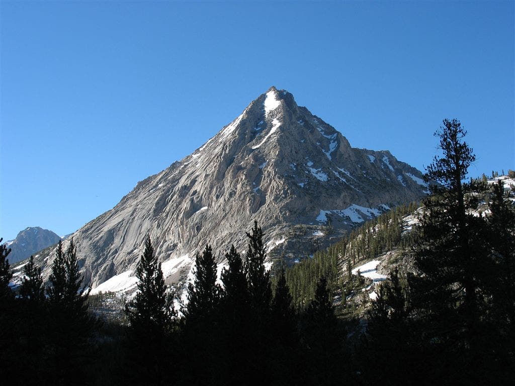
East Vidette
Location: 36.764217, -118.408012
Rising above Kings Canyon and Vidette Meadow is the triangular point of East Vidette. ©Jack Haskel
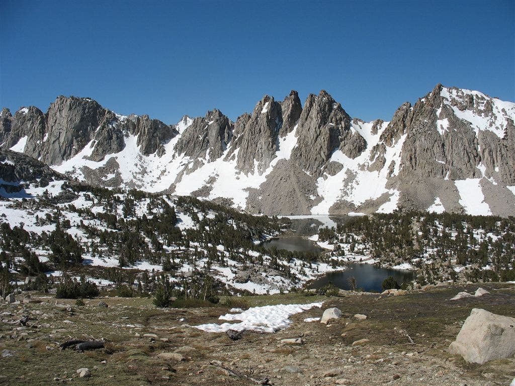
Kearsarge Pinnacles
Location: 36.773869, -118.380409
Travelling to Kearsarge Pass, the jagged edge of the Kearsarge Pinnacles stand above a lake-dappled basin. ©Jack Haskel
Kearsarge Pass
Location: 36.773193, -118.375023
A PCT’er stands at the Kings Canyon border at Kearsarge Pass. ©Jack Haskel
Rae Lakes
Location: 36.799355, -118.401932
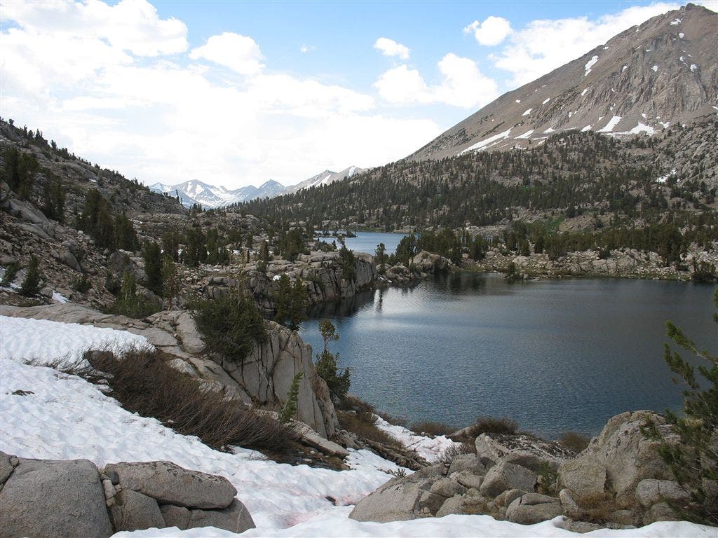
A granite-encrusted lake basin with a narrow isthmus. ©Jack Haskel
Painted Lady
Location: 36.804203, -118.400131
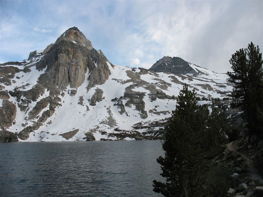
The Painted Lady, a dome of varicolored bands, hovers over Upper Rae Lake. ©Jack Haskel
Rae Lakes and Fin Dome
Location: 36.812553, -118.403992
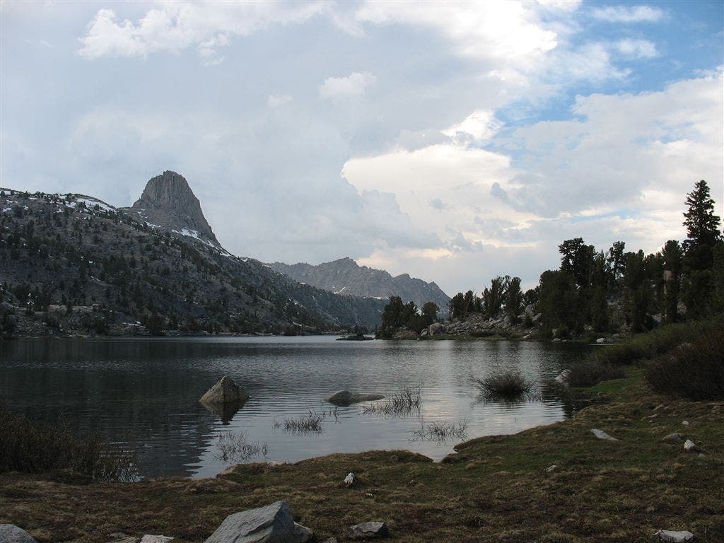
Views over the granite domes and craggy tars of the popular Rae Lakes Basin. ©Jack Haskel
Lonesome Path
Location: 36.838673, -118.407402
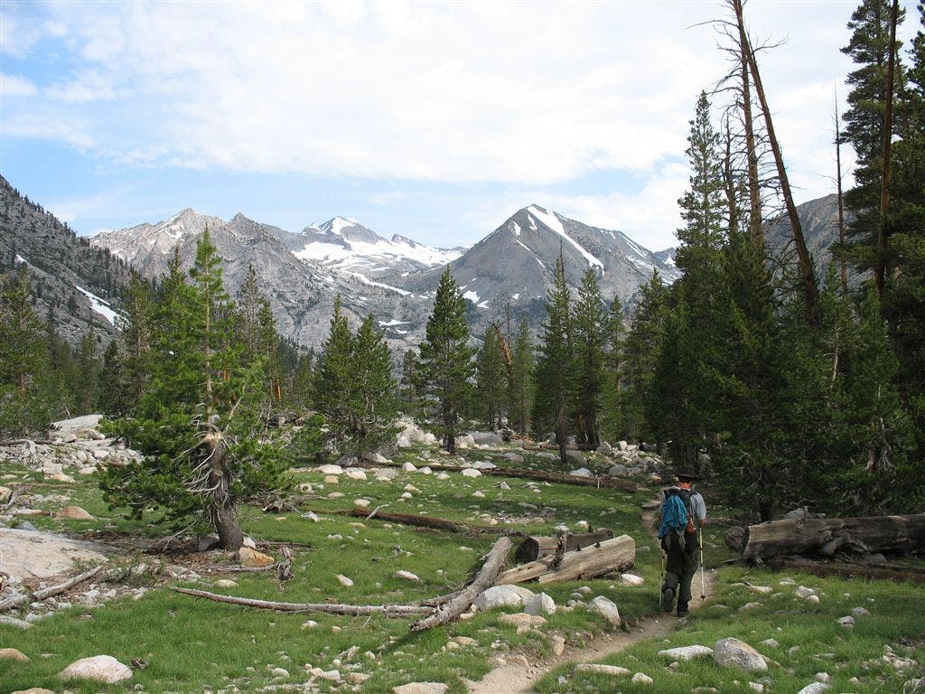
A PCT’er strides into the verdant reaches of Kings Canyon. ©Jack Haskel
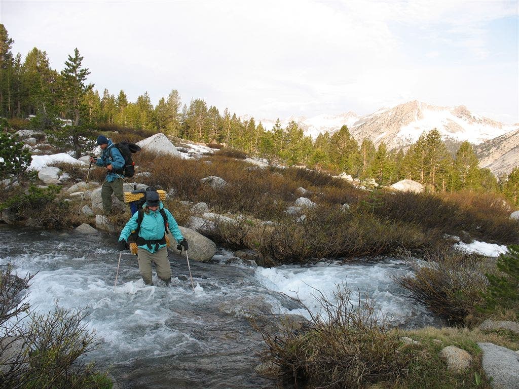
Big ford
Location: 36.827454, -118.409203
A PCT’er crosses a cold, swift creek in Kings Canyon NP. ©Jack Haskel
Storms approaching Mather Pass
Location: 36.936062, -118.412262
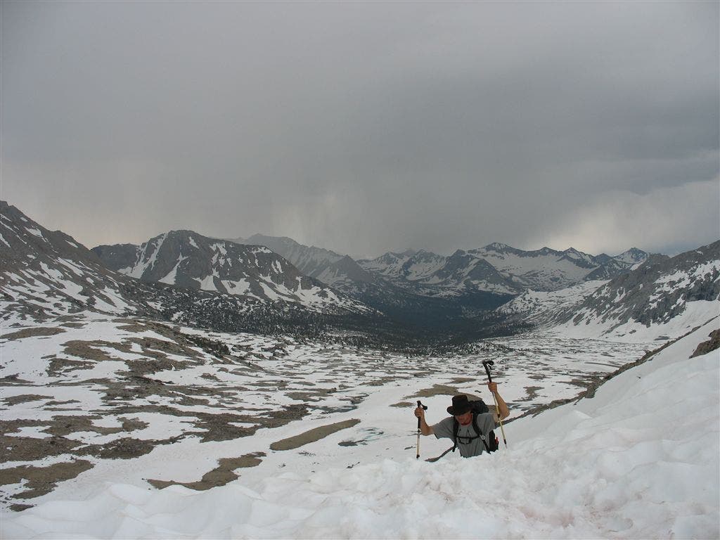
A PCT’er big-sticks to Mather Pass, with a storm brewing to the south. ©Jack Haskel
Up to Mather Pass
Location: 37.030827, -118.459854
Deep snow on the path to Mather Pass. ©Jack Haskel
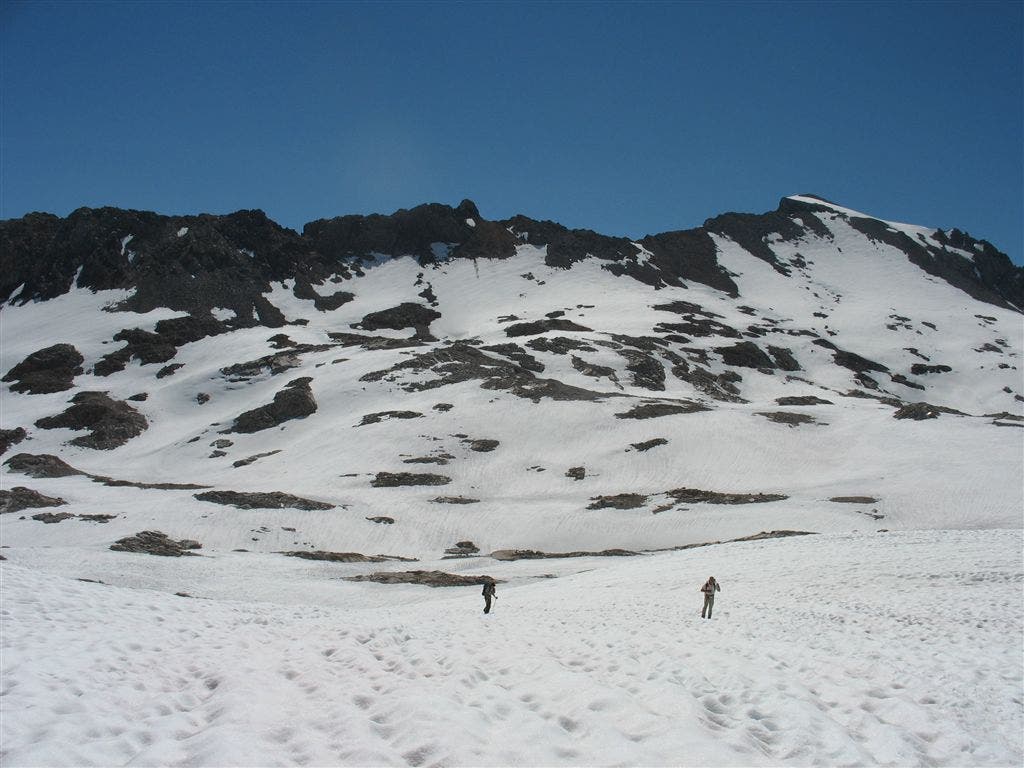
Long Slog to Muir Pass
Location: 37.121632, -118.652321
High snow blankets the bench leading to Muir Pass. ©Jack Haskel
The Muir Hut
Location: 37.112892, -118.667641
Perched on an exposed ridge, the Muir Hut welcomes weary hikers with shelter. ©Jack Haskel
Climbing to Muir Pass
Location: 37.114338, -118.663544
The large basin of Helen Lake makes for a long final climb to Muir Pass. Deep ©Jack Haskel
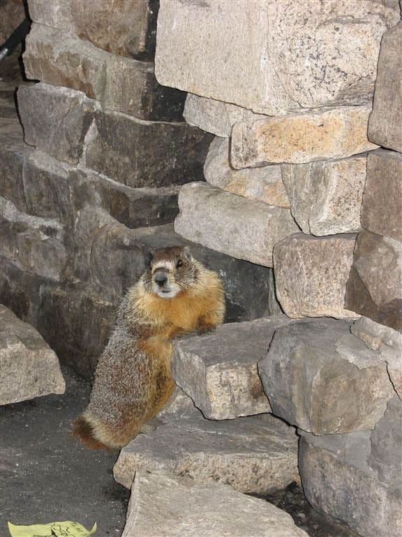
One of the locals
Location: 37.112171, -118.670166
A local marmot hangs out in the Muir Hut. ©Jack Haskel
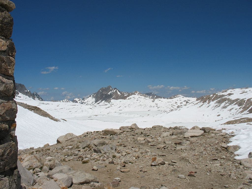
Evolution Basin from Muir Pass
Location: 37.113525, -118.671295
The snow basin of Wanda Lake opens up once you crest Muir Pass. ©Jack Haskel
Evolution Valley View
Location: 37.175343, -118.701752
Looking down from Evolution Lake’s bench see far-off views north over the Goddard Divide. ©Jack Haskel
Flooded Meadow
Location: 37.187057, -118.742035
Evolution Creek reaches the trail in high water. In low water, the creek flows past the little green clumps in the center of the frame. ©Jack Haskel
Evolution Valley
Location: 37.187328, -118.746628
Evolution Creek floods McClure Meadow, creating a virtual lake. The Hermit and Mt. Darwin Bench reflect in the glassy watercourse. ©Jack Haskel
Sierra Alpenglow
Location: 37.186157, -118.743744
Early stages of dusk paint the Hermit and Mt. Mendel soft-pink against azure skies. ©Jack Haskel
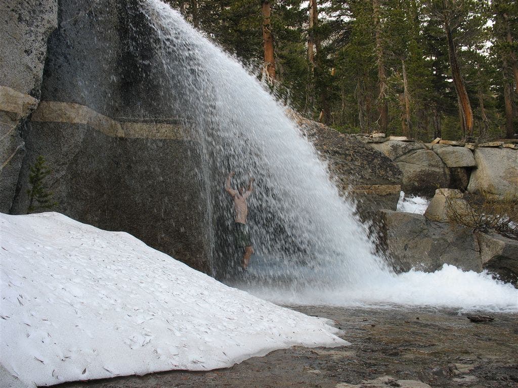
A Raging Shower
Location: 37.195347, -118.781235
Contributor Jack Haskel showers under the frigid spill-off from Evolution Creek. ©Jack Haskel
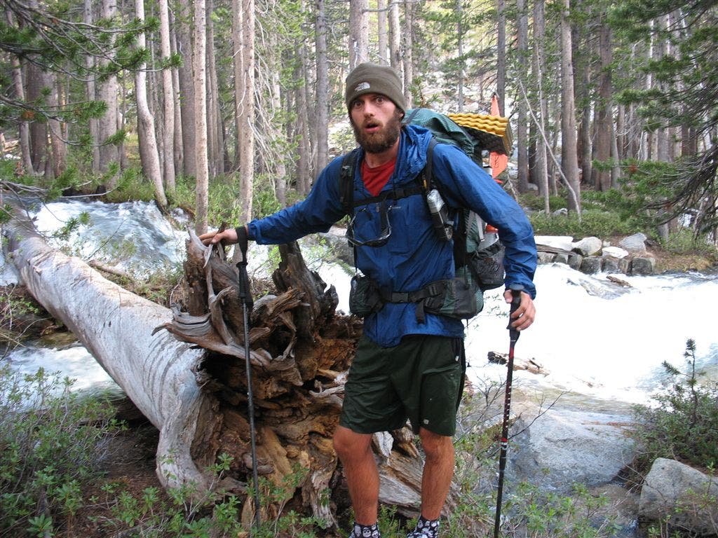
Freaked-out Crossing
Location: 37.194897, -118.785561
Contributor Jack Haskel stands gape-mouthed at the relentless torrents of Evolution Creek. Be wary: early-spring melt in the Sierras can create dangerous fords. ©Jack Haskel
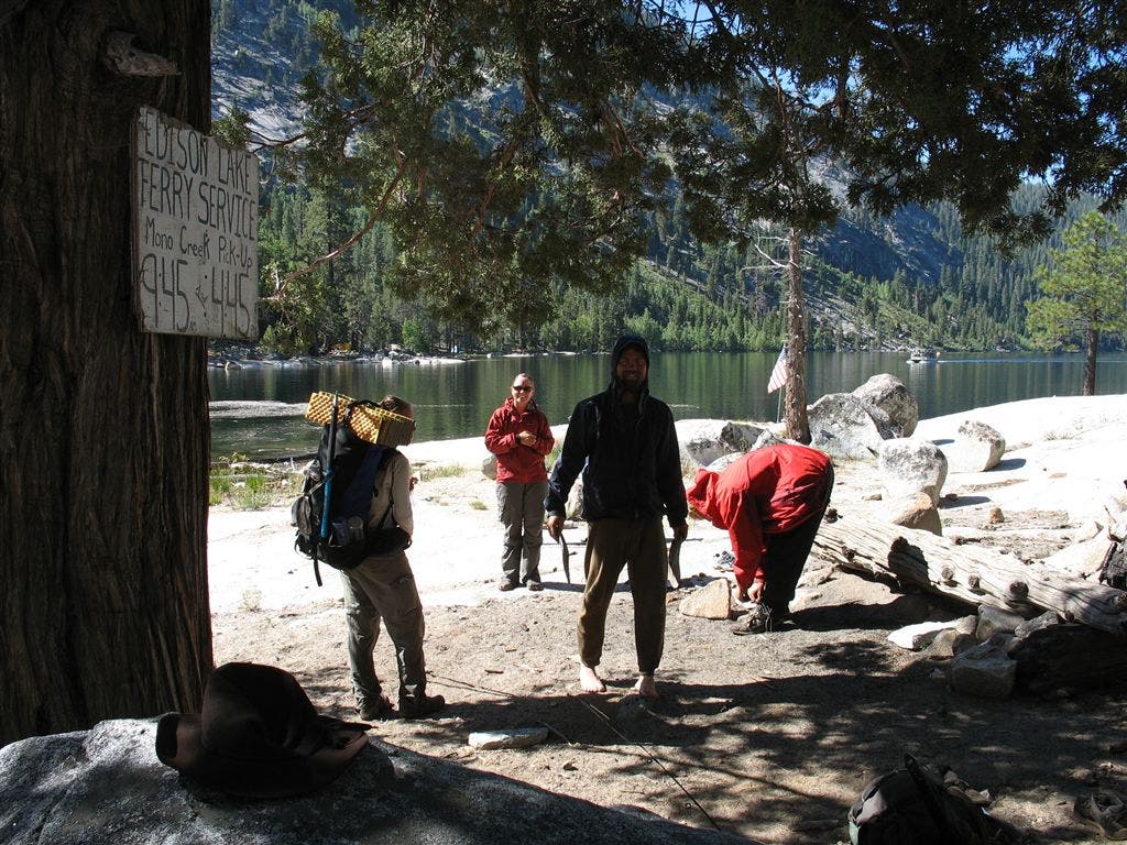
Fery Landing
Location: 37.405888, -118.94194
PCT’ers wait at the Edison Lake boat dock for the ferry to Vermillion Valley Resort. ©Jack Haskel
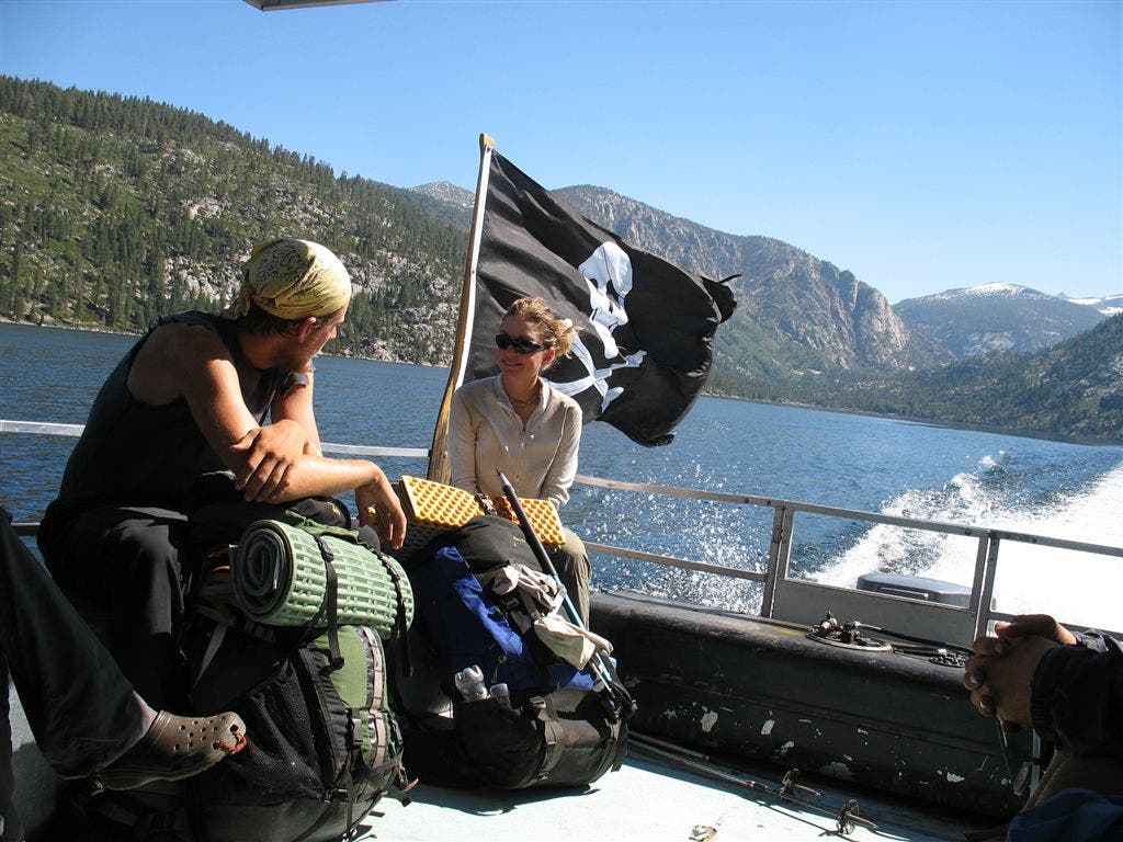
Edison Queen
Location: 37.389061, -118.955963
With the Vermillion Cliffs in the background, PCT’ers rest on the deck of the Edison Queen, Vermillion Valley Resort’s ferry shuttle. ©Jack Haskel
Raging Creek
Location: 37.441914, -118.918121
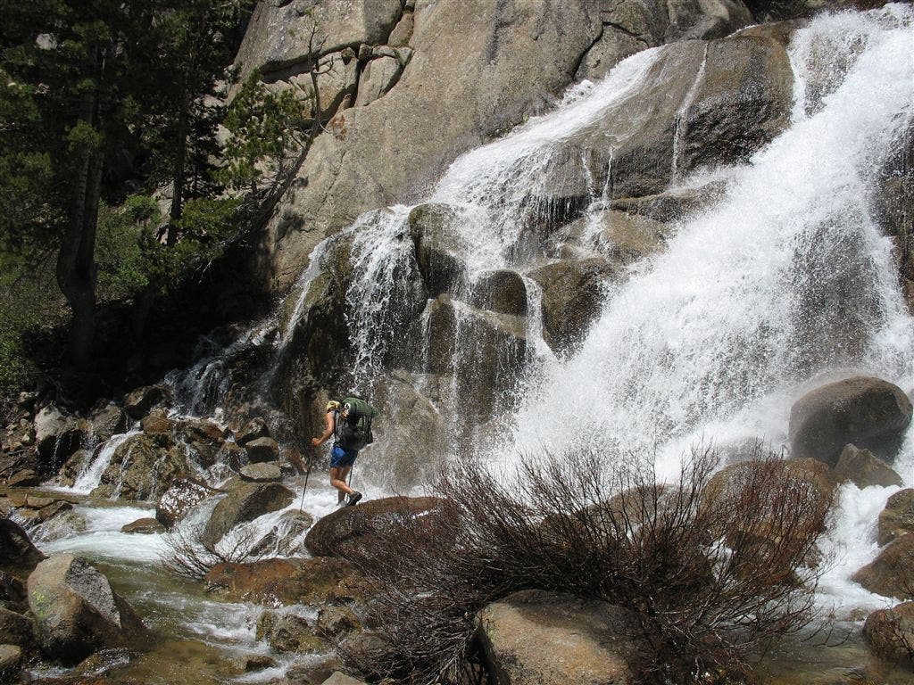
A lone PCT’er makes the slippery crossing where Silver Pass Creek tumbles from the bedrock. ©Jack Haskel
Jack at Silver Pass
Location: 37.470451, -118.922585
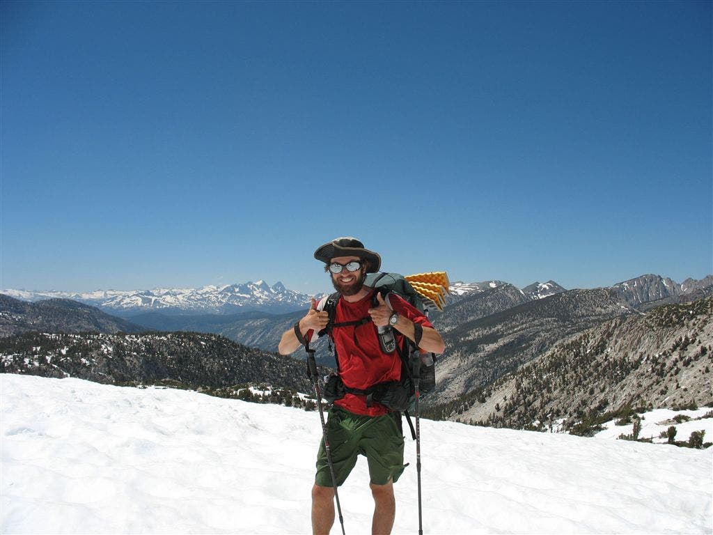
Contributor Jack Haskel gives two thumbs-up to the views at Silver Pass, which span the Cascade Valley, Ritter Range and craggy Silver Divide. ©Jack Haskel
Glissade from Silver Pass
Location: 37.470451, -118.923401
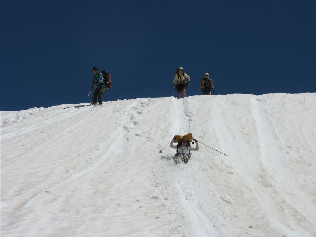
PCT’ers line up for a sweet snow slide session. ©Jack Haskel
Silver Pass Glissade
Location: 37.471649, -118.922852
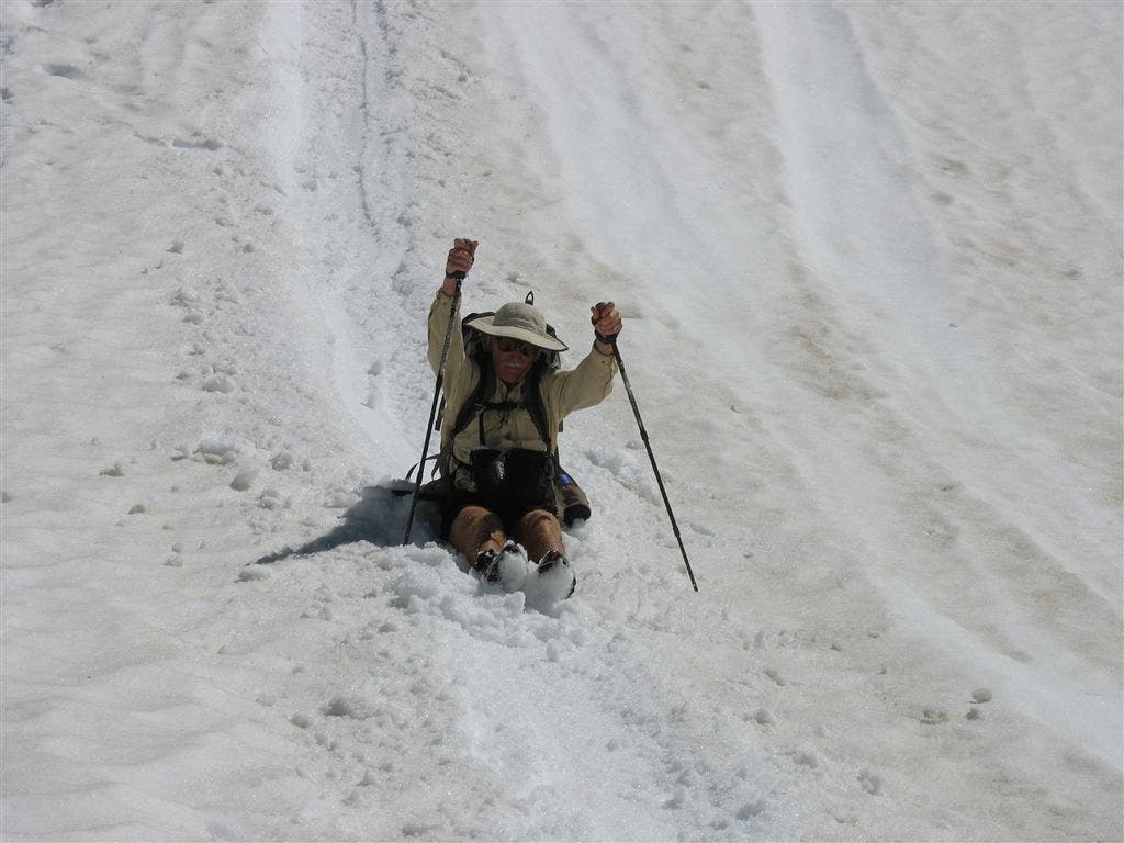
A PCT’er shows how it’s done on the glissade down Silver Pass. ©Jack Haskel
Lazy bends of Tully Hole
Location: 37.501957, -118.920959
©Jack Haskel
The Postpile From Above
Location: 37.615276, -119.087456
©Jack Haskel
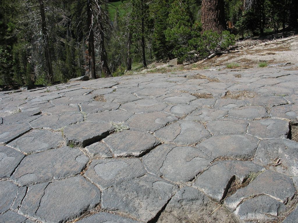
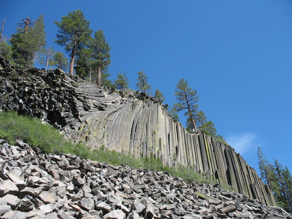
Devils Postpile
Location: 37.616638, -119.087456
One of the world’s finest examples of columnar basalt that towers 60 feet high and display an unusual symmetry. ©Jack Haskel
Banner and Ritter
Location: 37.733742, -119.154396
Banner Peak and Mt. Ritter from the PCT. ©Jack Haskel
Banner Peak
Location: 37.732197, -119.183014
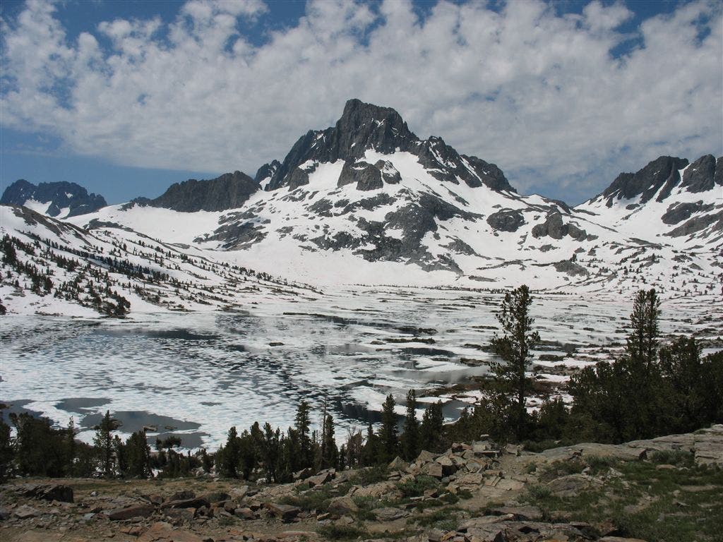
Snow-clad Banner Peak rises above the iced-over Thousand Lake basin. ©jack Haskel
Donohue Pass
Location: 37.758003, -119.243179
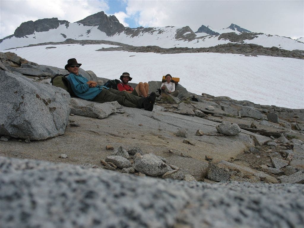
PCT’ers rest at the entrance to Yosemite National Park. ©Jack Haskel
Jack at the Muir Hut
Location: 37.112171, -118.671341
Contributor Jack Haskel stands at the doorway to the Muir Hut before the descent into the Evolution Basin. ©Jack Haskel
Inside the hut
Location: 37.111717, -118.670074
A couple PCTer’s take a break in the warmth of the Muir Hut©Jack Haskel
Jack at VVR
Location: 37.376022, -119.012016
Contributor Jack Haskel stands at the VVR Mexico-to-Canada sign that greets thru-hikers. ©Jack Haskel