Published May 9, 2018 06:28PM
Explore Oregon and Washington's Columbia River Gorge
Pacific Northwesterners cherish this wilderness mecca, with its vibrant greenery, roaring waterfalls, and bird’s-eye summit views. But many hikers have stayed away since the Eagle Creek fire tore up nearly 49,000 acres of the Gorge last year. Bad decision. Enjoy the best of the National Scenic Area—and avoid the fire damage—with these tips and trips.
'Mallory Roe'
The Insider
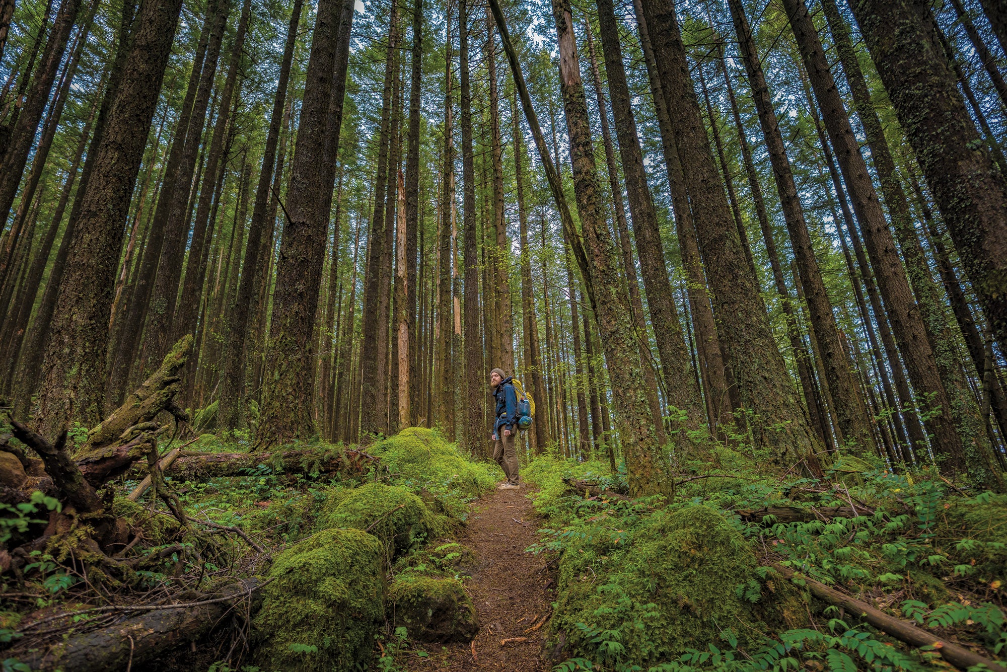
It’s Ryan Ojerio’s job to know the trails in the Columbia River Gorge. As a Regional Manager for the Washington Trails Association, the Portland native has managed the maintenance and construction of local paths and led advocacy, outreach, and education in the area for the last decade.
Best dayhike
“If I could teleport myself somewhere, it is and will always be Table Mountain,” Ojerio says, which should tell you a little bit about the views from the 3,417-foot summit—and how hard it is to get to. It’s a 7.2-mile approach that includes crossing creeks, negotiating boulderfields, and, of course, climbing up and around Table’s iconic south face: a sheer, 800-foot-tall plate of basalt. To do it, start from the Bonneville trailhead and hike .6 mile to meet up with the Pacific Crest Trail. Follow the PCT through a mix of dense rainforest and regenerating timber to the summit spur near mile 6. There, climb 1.2 miles up the spine—it gains 1,700 feet—to the crow’s nest-like perch. See the fire damage across the water before spotting 12,281-foot Mt. Adams to the north and Mt. Hood’s pyramid to the south. Scan over the Columbia River to spy the steel bridge connecting Stevenson and Cascade Locks. It marks where a major landslide sheared off the south slope of Table Mountain between 1060 and 1760 AD, sending it into the river and creating a natural land bridge that the natives referred to as the “Bridge of the Gods.”
Best payoff
No matter where you end up in the Gorge, Beacon Rock is hard to miss. The 848-foot tall volcanic plug—where Lewis and Clark first measured the tides of the river—stands like a stone sentinel over the Columbia. It’s a popular, mile-long StairMaster climb to the top, but you can lengthen the approach with Ojerio’s spin on the classic: Instead of starting at the Beacon Rock trailhead, begin farther south on the underrated River to Rock Trail. The .8-mile-long path contours north from the Columbia to the base of Beacon Rock, wending beneath 100-foot-tall Douglas firs and past Riddell Lake. “It extends the hike and adds a little more diversity than just going straight up the rock,” Ojerio says.
ADVERTISEMENT
Top overnight
With most of the Oregon side of the Gorge off-limits between Angel’s Rest and Starvation Falls because of fire damage, you’ll need to venture higher to find trails long enough to service a multiday adventure. Think of it as a blessing because the views are bigger and the trails emptier. Ojerio’s favorite trip: the 13.8-mile lollipop-loop tracing Mt. Hood’s eastern skyline from Polallie Creek. Highlights include a flower-ridden meadow campsite and a rocky ridge with wide-open scenery. From the trailhead (30 minutes south of Hood River) on OR 35, connect the East Fork Trail to the Elk Meadows Trail, which twists through stands of skyscraping pines en route to its grassy namesake at mile 6.3. Tent in a field of summer wildflowers like purple tundra aster in the shadow of 11,240-foot Mt. Hood before veering onto the Bluegrass Ridge Trail, where an old burn zone offers straight-shot views to the toothy skyline. Join back up with the Elk Meadows Trail at mile 11.5 and head back to your car.
Beat the rain
Escape to the eastern side of the Gorge when the forecast calls for precip. There, on the other side of the Cascades, rainforests and mountains give way to the desertscape of Coyote Wall. Check it out on the 7.7-mile Labyrinth Loop, which leads past grassy plateaus, rock outcroppings, and mini canyons. “It’s like a different planet,” Ojerio says. From the Coyote Wall trailhead, take the Labyrinth Trail uphill through oaks to river views before looping back on the Atwood Road Trail and a Jeep road.
Damage control
The Oregon side of the Columbia River was ravaged by September’s fire, but the Washington side remained largely untouched. That makes the latter your best bet for finding a riverside hike—and the best view across the river to the damage. Cure your curiosity on the 8.3-mile Cape Horn Loop, which offers plenty of cross-river views as it circles through stands of maple and oak and meadows of purple delphinium (blooming in May and June). You’ll see Angel’s Rest, the popular Oregon overlook that’s now a cemetery of charred tree trunks.
ADVERTISEMENT
Après
With 12 breweries dotting the Gorge, good beer and fare await. Ojerio likes Walking Man Brewing in Stevenson, Washington, for its namesake IPA and chicken gyro, and Thunder Island Brewing in Cascade Locks, Oregon, for its outdoor patio.
Trip planner
SEASON April to October PERMIT Required for overnighting; register at recreation.gov (free) or try for a walk-in ($5/person per day) at the Wenatchee River Ranger Station. Northwest Forest Pass is required for parking in some federal sites, and the Discover Pass is required in Washington state parks.