Updated December 3, 2024 08:13PM
This Steep Hike Up Old Rag Mountain Gives The Best Views In Shenandoah
Navigate switchbacks, boulder scrambles, and rock mazes on Old Rag Mountain, one of Shenandoah's most famous peaks.
(Photo: ablokhin via Getty Images)
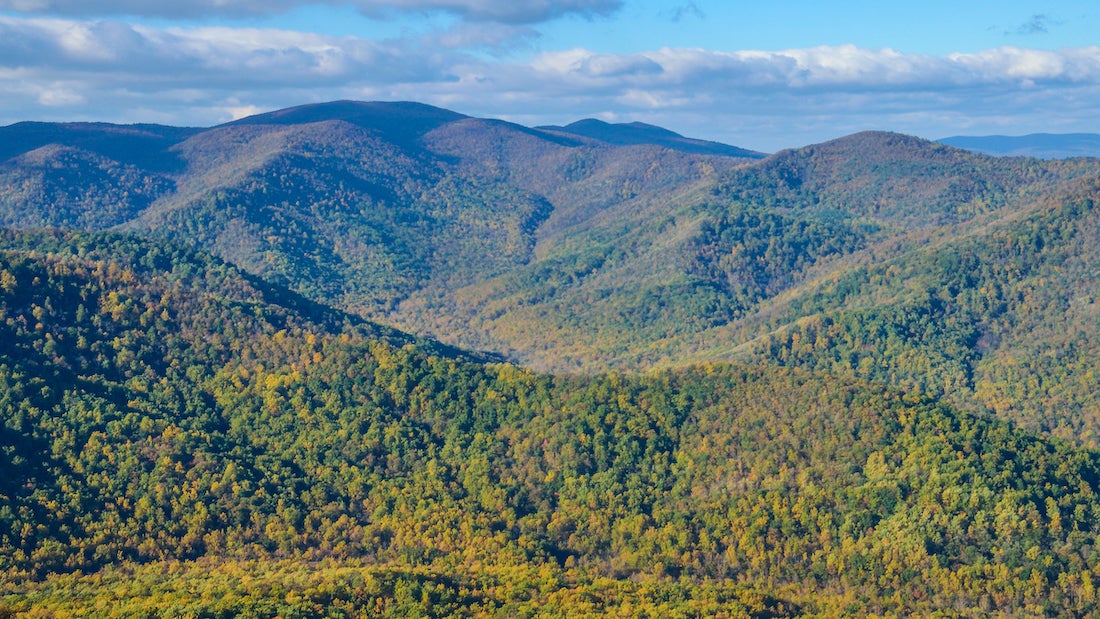
Weaving around car-size boulders to the summit of 3,268-foot Old Rag Mountain is the quintessential Shenandoah thrill–and its airy precipice is also the best place for 360-degree views (especially for leafpeeping in early November). But unknown it is not, so pack a headlamp and set out on this 8.6-mile circuit Old Rag hike three hours before sunset to enjoy a crowd-free summit.
Take the Ridge Trail up shady switchbacks to an open ridgeline and two miles of scrambling to the Big Whoa–a sweeping panorama of mountainsides. Descend via the Saddle Trail and Weakley Hollow Fire Road to close the loop.
More Info: Shenandoah National Park, (540) 999-3500; nps.gov/shen
ADVERTISEMENT
How to Hike Old Rag Mountain
On the Old Rag hike, start in the Old Rag lower lot and fee station and follow Weakley Hollow Road about 0.5 mile to the upper lot and trailhead. Note: The upper lot usually fills more quickly than the lower lot.
From the Weakley Hollow Trailhead in the upper parking lot, head out on the blue-blazed Ridge Trail. Follow the Ridge Trail as it curves to the right (following blue blazes) in a young hardwood forest of oak, maple, and hickory. About a mile and a half in, the hike’s first switchback cuts to the left. Eight more switchbacks remain on the ascent to the summit. The terrain is not extremely steep on this stretch, but there is a persistent incline en route to the top.
ADVERTISEMENT
Close to 2 miles into the hike, look up and to the right for a great view of this hike’s highpoint: the rocky Old Rag summit. There’s still a bit of a climb to get there, but plenty of scenic vistas along the way will make it worth it. For example, check out Robertson and Corbin mountains to your right 2.6 miles into the hike.
Just a couple minutes on trail later, the hike to Old Rag turns into a scramble over midsized boulders and through narrow, rocky passages. Several spots may require hand-over-hand climbing: make sure your footing and hand placements are secure as you proceed. There are two rock mazes to navigate in this section: blue blazes and arrows are painted on the boulders.
About 3.25 miles into the hike, a huge boulder hugs the trail here: this spot is a great photo-op of the Old Rag summit and the valley below.
Just a couple more minutes on the trail later, you’ll reach the summit of Old Rag Mountain at 3,268 feet. Go past the cement post to get unrivaled panoramic views of Shenandoah. Take a break for a well-deserved lunch, and then pick up the blue-blazed Saddle Trail to begin your descent.
ADVERTISEMENT
We recommend descending via the Saddle Trail. This side of Old Rag offers a more gentle descent: no scrambling required on the way down.
About 4.9 miles into the trail, you’ll pass Old Rag Shelter. This shelter is intended for day use only, but it’s a great rest and photo spot. Continue on the Saddle Trail as it curves to the right.
Want to hike among history? At 5.2 miles, just off the right side of the trail is a hidden cemetery dating back to the 1700’s. Look closely: At first glance, the headstones look like small rocks coming out of the ground.
A tenth of a mile later, turn right at the T-junction onto the Weakley Hollow Fire Road, and follow it as it curves to the right. The road is marked with yellow blazes as the gradual descent to the parking lot continues.
ADVERTISEMENT
Just over a mile later, you’ll run into two three-way junctions. Continue straight on the fire road for both. (On the first, the Robertson Mountain Trail veers off to the northwest, and on the second, the Corbin Hollow Trail continues to the northwest.)
At 7.6 miles, you reach the Hughes River crossing. The trail veers right toward three footbridges. On a hot summer day, this is a great place to cool off and enjoy the relaxing sound of a running stream.
From there, follow the trail to the Weakley Hollow Trailhead and retrace your steps to the car.
Permit Information
Old Rag hikers must get an Old Rag day-use ticket in advance and a Shenandoah National Park entrance pass. The 2024 season tickets open February 17. They cost $2, and you can reserve them up to 30 days in advance. There are 800 tickets available each day between March 1 and November 30. There are 400 released 30 days before the hike date, and the remaining 400 are released five days before the hike date. You can only purchase day-use tickets online; they are not available at park entrance stations.