New York City, NY: Long Path Loop

Secluded trails winding through mixed forest. Fifty-mile views from rock domes. With charms like these—and the proximity to New York City—you’d expect to share every step, but this 18-mile overnighter sticks to the park’s quietest corner.
From the parking lot off Orange County Road 106, follow the red-blazed Ramapo-Dunderberg Trail on the ridge of Black Rock Mountain. Stay straight and take in views of lakes shining like drops of mercury on a leafy background. At mile 1.8, turn left (north) onto blue-blazed Lichen Trail and descend to the Long Path. At a four-way junction, head straight on the red-blazed Arden-Surebridge Trail for a short detour to the Lemon Squeezer. Return to the junction and head north on the Long Path.
Contour around Surebridge Mountain and past the shelter. Stay on the Long Path for a mile-long, low-country stretch in the shadow of 1,378-foot Fingerboard Mountain, then cross Arden Valley Road. Bear left and climb steeply up 1,319-foot Stockbridge Mountain—its three-mile-long ridge reveals vistas of Bear Mountain (east), the Catskills (northwest), and West Point (north). After Hippo Rock, turn right onto yellow-blazed Menomine Trail and descend to Lake Nawahunta. Cross Seven Lakes Drive, skirt Silver Mine Lake, then ascend along Bockey Swamp Brook to the William Brien Memorial Shelter in a hollow.
Next day, take the Red Cross Trail through a broad swath of lowland forest—one of the park’s least-visited areas. Stay right at the Y-intersection, and left to cross Tiorati Brook. Go straight in .6 mile, leaving the Red Cross Trail, toward Lake Askoti. Cross Seven Lakes Drive, and bend around Lake Skannatati on the Long Path. Turn left at the T-intersection, then left onto the Dunning Trail (yellow blazes). In .4 mile, continue straight to the Bald Rocks Shelter, then return via the Ramapo-Dunderberg Trail.
GEAR UP Eastern Mountain Sports, 66 Rockland Plaza, NY 59, Nanuet, NY. (845) 623-5282; ems.com
MAP New York-New Jersey Trail Conference Harriman-Bear Mountain Trails Maps ($10, nynjtc.org)
-Mapped by Jonathan Dorn
Trail Facts
- Distance: 29.0
Waypoints
HLP001
Location: 41.230234, -74.140291
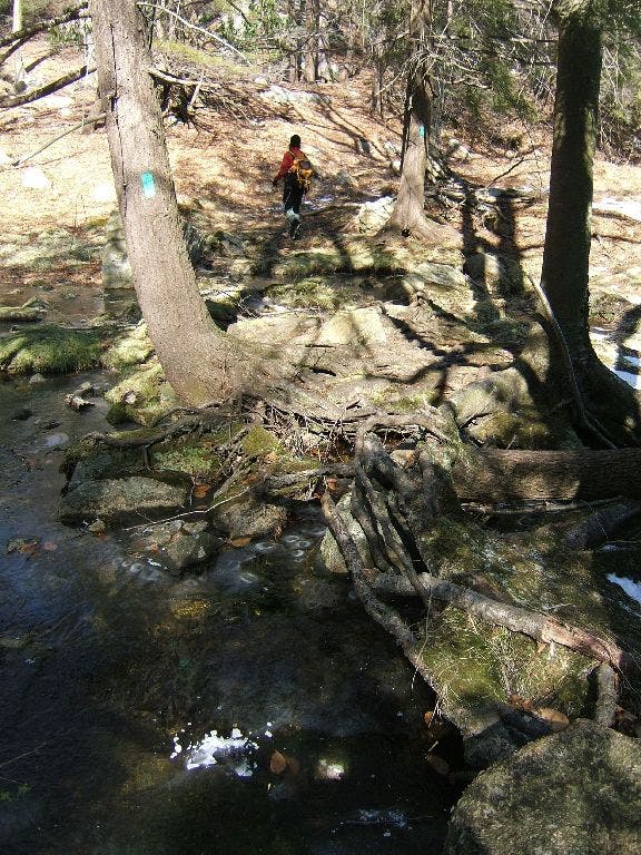
From the parking lot, cross the stream and head uphill following the obvious red blazes. In spring, the profusion of blooming rhododendron makes the trail feel almost tropical—here and in many other parts of Harriman where the bushes take advantage of the ample groundwater. This first stretch chugs steadily upwards, climbing the main ridge of Black Rock Mountain for 10 to 20 minutes, depending on how much coffee you drank this morning.
HLP002
Location: 41.235699, -74.140846
Reach the crest of the ridge and stay right at a 3-way junction on the red-blazed Ramapo-Dunderberg Trail. The next 30 minutes of walking offers some of the finest views in the entire park, as you cross a long bald ridge whose rocky top was scoured by wildfire years ago. You’ll occasionally dip into damp notches between domes; watch for deer and animal sign.
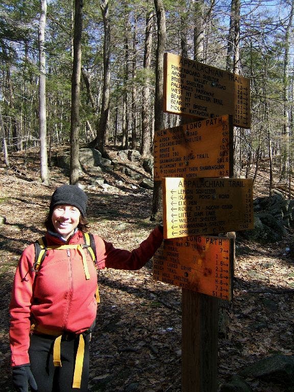
Signs, Everywhere Signs
Location: 41.263759, -74.124606
This sign illustrates the labyrinth of trails, and endless hiking opportunities, in Harriman. ©Jonathan Dorn
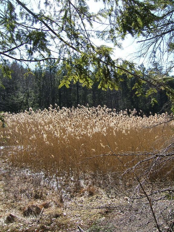
Golden Field
Location: 41.26684, -74.118984
Cattails blow in the gentle wind. ©Jonathan Dorn
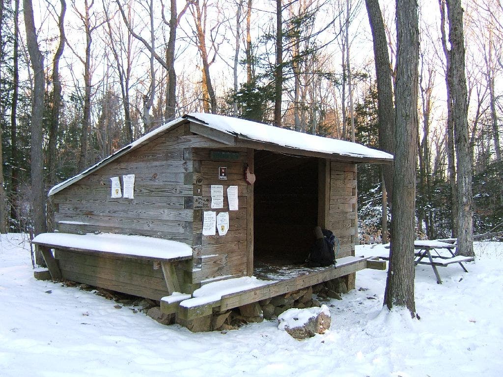
Shelter
Location: 41.268388, -74.11319
Me outside the shelter on the back side of Surebridge Mountain.
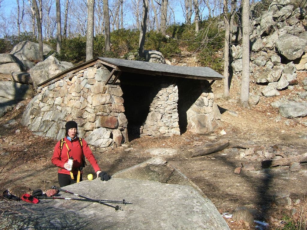
Stone Shelter
Location: 41.27979, -74.058816
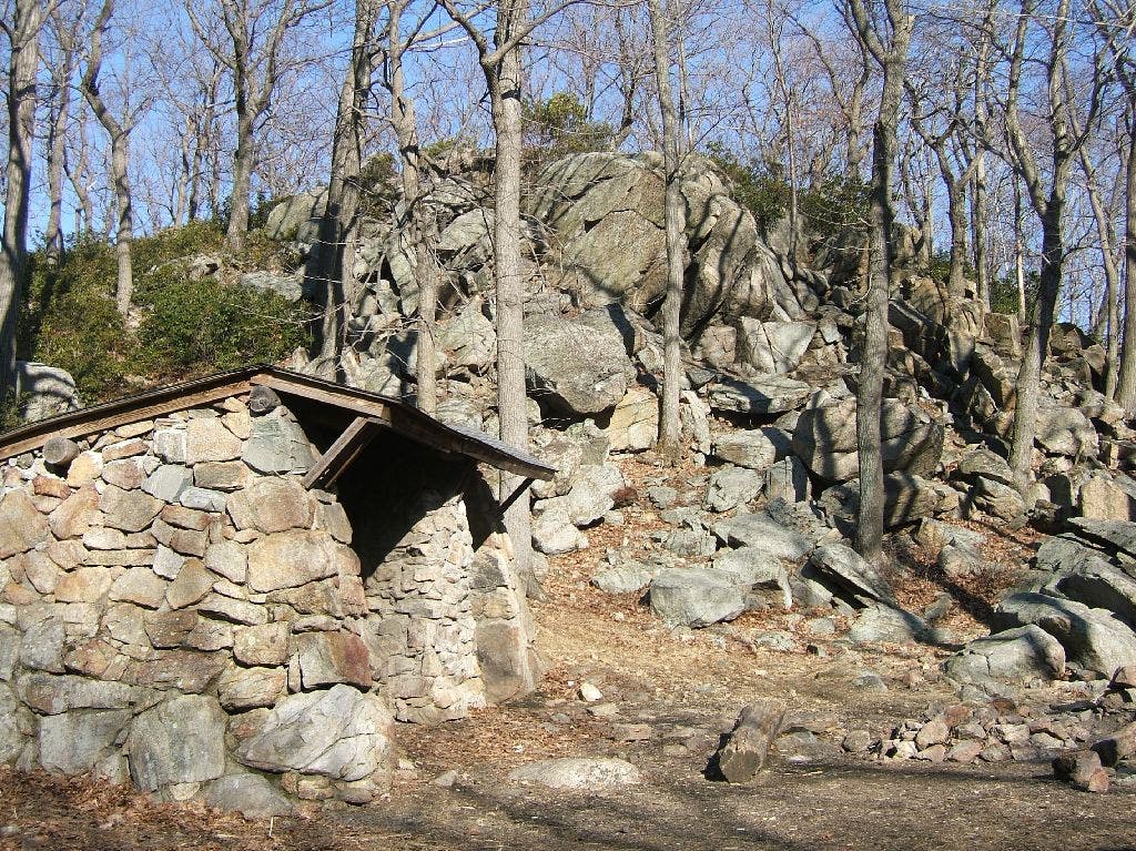
The William Brien Memorial Shelter sits in a scenic hollow. ©Jonathan Dorn
William Brien Shelter
Location: 41.279774, -74.059181
This 3-side stone shelter is just off the AT, 1373 miles from Springer, GA (the southern terminus of the AT). ©Jonathan Dorn
Lake Askoti
Location: 41.241344, -74.10218
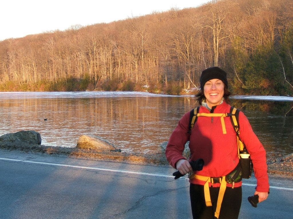
Kirsten at Lake Askoti at twilight. ©Jonathan Dorn
HLP003
Location: 41.242401, -74.132792
Bald Rocks Shelter. This is one of the danker and less appealing lean-tos in the park, but there are a number of fine spots in the trees for tents. Water is down the hill to the east; follow the obvious drainage from the shelter. It may take 5 minutes to reach water in dry conditions. Stay on red-blazed trail.
HLP004
Location: 41.244801, -74.132469
Continue straight at 4-way intersection with the Dunning (yellow) trail. The R-D Trail (red) stays high a bit longer, then drops into evergreen forest that’s so quiet in fall you can hear a pine needle drop. In spring, streams seem to burble off of every hillside, drowning out all else.
HLP005
Location: 41.249149, -74.128334
Hang a left onto the Lichen Trail (blue blazes) at a 3-way junction.
HLP006
Location: 41.253819, -74.128098
Continue straight at the 3-way junction onto the Long Path (light blue blazes and discs).
HLP007
Location: 41.256516, -74.12973
Bear left at the Y, staying on the Long Path, a trail that begins at the western end of the George Washington Bridge and runs more than 200 miles through the Palisades, Harriman, and the Catskills, finishing just short of the Adirondacks.
HLP008
Location: 41.256985, -74.130348
Turn right at the 4-way junction, staying on the Long Path. Side trip: Take a quick detour to the geological oddity known as the Lemon Squeezer, which is just ahead on the red-blazed Arden-Surebridge Trail. A giant fissure in a wall of rock, the Lemon Squeezer is the closest thing Harriman has to a slot canyon.
HLP009
Location: 41.263401, -74.124815
Continue straight on the Long Path at the 4-way with the Appalachian Trail.
HLP010
Location: 41.2668, -74.119118
One of many delightful spots in Harriman where a trail runs alongside a marshy field of cattails, which make a unique rustling noise as they sway in the wind. In the fall and winter, the shoots glow like golden straw in the sun.
HLP011
Location: 41.268268, -74.113503
This roomy shelter on the back side of Surebridge Mountain is a pleasant option for a first-night camp. It overlooks a mature and open hardwood forest that’s glorious in the fall. There are also campsites up the hill. Water is down the hill.
HLP012
Location: 41.268582, -74.112117
Continue straight on the Long Path through at 4-way with a forest road.
HLP013
Location: 41.277451, -74.096336
Cross paved Arden Valley Rd. after a long, low-country stretch in the shadow of Fingerboard Mountain to the east.
HLP014
Location: 41.280731, -74.093033
Bear left at 3-way, leaving the fire road you’ve been on since Arden Valley Rd. The Long Path now climbs fairly sharply to the crest of Stockbridge Mountain and follows it for about 3 miles with excellent views to Bear Mountain (east) and the Catskills (northwest). West Point Military Academy is due north about 5 miles.
HLP015
Location: 41.299042, -74.079499
Just past Hippo Rock, you’ll reach a gap in the Stockbridge Mountain ridge. An old carriage road runs through the gap. Take a right onto the road, which is now the yellow-blazed Menomine Trail. Watch your ankles here; it’s a fast descent for the next mile, but the road is strewn with ankle-twisting babyhead rocks.
HLP016
Location: 41.294092, -74.066412
Cross Seven Lakes Dr. Still following yellow blazes, pass through a picnic area and a parking lot, then turn right and cross a small bridge towards an old ski hill that still has part of a lift. The trail contours to the left around the hill, then hugs the western shore of Silvermine Lake. Leaving the lake, you’ll follow Bockey Swamp Brook uphill through a narrowing valley. Stay left on the yellow-blazed Menomine Trail at a 4-way.
HLP017
Location: 41.279703, -74.059519
Reach the William Brien Memorial Shelter, one of the best in the park for its scenic location, easy water access, and fun scrambling. Just beyond the shelter, continue straight at the junction with the Appalachian Trail. Continue to the next junction, a 3-way intersection with the Red Cross Trail, and turn right. The Menomine Trail ends here; the Red Cross is blazed, not surprisingly, with small painted red crosses. From here, you’ll follow the Red Cross Trail across a broad swath of central Harriman Park, passing mostly through lowland forest and marsh with fewer signs of traffic than almost anywhere else in the park.
HLP018
Location: 41.260551, -74.071114
Bear right at the Y-junction and continue following the trail west.
HLP019
Location: 41.260265, -74.081085
Stay left to cross Tiorati Brook, then Tiorati Brook Rd. Across the road, pick up an old forest road (still the Red Cross Trail) that leads to Hasenclever Mine, which dates back to 1765 and produced pig iron for the production of, among other things, guns for the Revolutionary Army. During that war, both British and American troops blazed trails through this area; two of the original routes are commemorated in the 1777 and 1779 Trails. A good book on local mine history is Edward Lenik’s Iron Mine Trails (available from the New York-New Jersey Trail Conference).
HLP020
Location: 41.251633, -74.083252
Just past the Hasenclever Mine, we inadvertently left the Red Cross Trail and followed an intermittent abandoned forest road to the southern tip of Lake Askoti. The forest is wide open in this area, so it’s easy to just aim for the lake (visible through the trees) and go.
Or you can stick on the Red Cross Trail to the northern tip of Lake Askoti, cross Seven Lake Dr., and take the Red Cross Trail to the Long Path. You’ll end on the N end of Lake Askoti, then road-walk S to Waypoint 21.
HLP021
Location: 41.241081, -74.102119
At the southern end of Lake Askoti, cross Seven Lakes Dr. and turn west onto the Long Path.
HLP022
Location: 41.243482, -74.117371
Hang a left at T-junction, then a quick left at a Y onto the yellow-blazed Dunning Trail. You’ll soon pass Hogencamp Mine, another one that dates to the 1700s.
HLP023
Location: 41.240887, -74.122036
Stay straight at 3-way with a forest road that leads down and to the left. The Dunning Trail climbs on a rocky doubletrack back to the Bald Rocks Shelter. Retrace your steps from earlier in the day back to your car to complete the hike.
Ramapo-Dunderberg Trail
Location: 41.236111, -74.140961
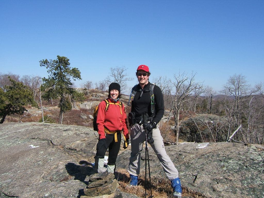
The views on this open ridge are more than photo-worthy. Plan your first break of the day on one of the giant boulders.
Bald Ridge
Location: 41.235729, -74.140839
This bald ridge features some of the finest views in Harriman. ©Jonathan Dorn
Long Path
Location: 41.256779, -74.130119
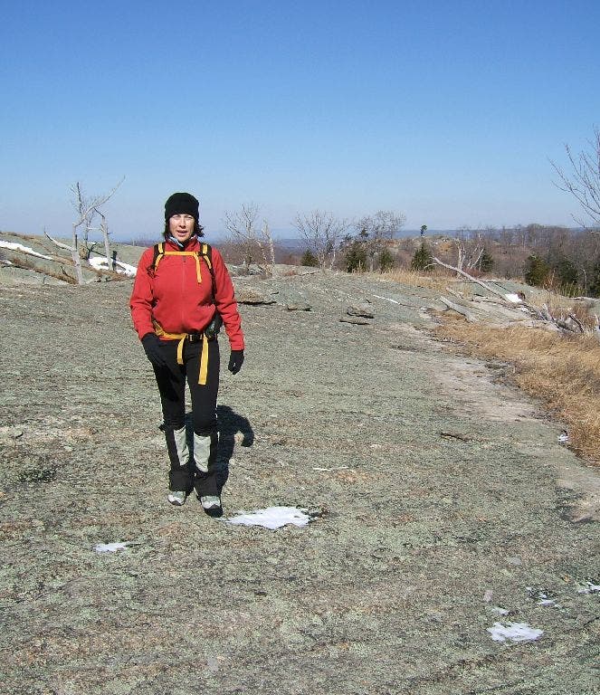
Kirsten crosses a gnarly section of the Long Path. ©Jonathan Dorn