Published September 20, 2013 03:16PM
New York City: Fingerboard Shelter via the AT
Tackle a section of America's first National Scenic Trail on this 15.8-mile out-and-back overnight near Lake Tiorati in Harriman State Park.
'TheTurducken'
Trail Facts
- Distance: 12.8
Waypoints
FBS001
Location: 41.2886390686035, -74.0231094360352
Head S along red-blazed Anthony Wayne Ski/
Bike Trail paralleling Beechy Bottom Brook; West Mtn.’s hills rise in E
FBS002
Location: 41.2825889587402, -74.0229034423828
R @ 4-way onto earliest section of AT (1923); follows Ramapo-Dunderberg Trail (white blaze, and white blaze/red dot)
FBS003
Location: 41.2823715209961, -74.0283279418945
Cross Palisades Pkwy. on AT toward Black Mtn. for Hudson River views
FBS004
Location: 41.2862091064453, -74.0459365844726
Scramble over rocks on long switchbacks into valley with small, tumbling streams. Optional spur: Turn R, go .5 mi. to idyllic blues of Silver Mine Lake
FBS005
Location: 41.2798118591309, -74.0591812133789
William Brien Memorial Shelter: Space for 8, spring-fed well. Camp or continue N on AT from the shelter
FBS006
Location: 41.2875709533691, -74.074577331543
Cross Seven Lakes Dr.; climb ridgeline and continue SW on AT
FBS007
Location: 41.2821807861328, -74.0876998901367
Approach N flank of Fingerboard Mtn.; wrap SW around gentle knoll
FBS008
Location: 41.2753715515137, -74.0939788818359
ADVERTISEMENT
Cross Arden Valley Rd. and pick up AT/Ramapo-Dunderberg Trail, heading S on exposed ridge. Highlight: Look for giant boulder perched on three smaller stones.
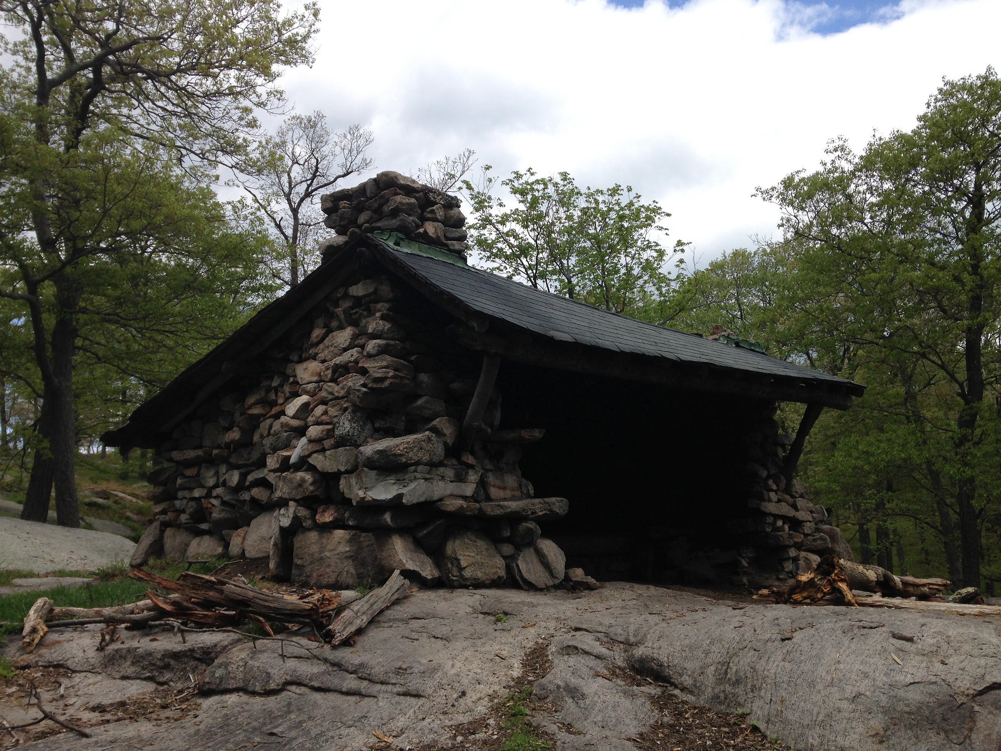
FBS009
Location: 41.2632293701172, -74.1040191650391
Fingerboard Shelter: 8-person stone hut, two fireplaces (1st-come basis, seasonal spring); backtrack to car Bonus: For a longer 22.8-mile, 3-day loop, go to http://backpacker.trimbleoutdoors.com/ViewTrip.aspx?TripID=20418