Published September 20, 2013 03:32PM
New York City: Burnham Hollow to McKenley Hollow
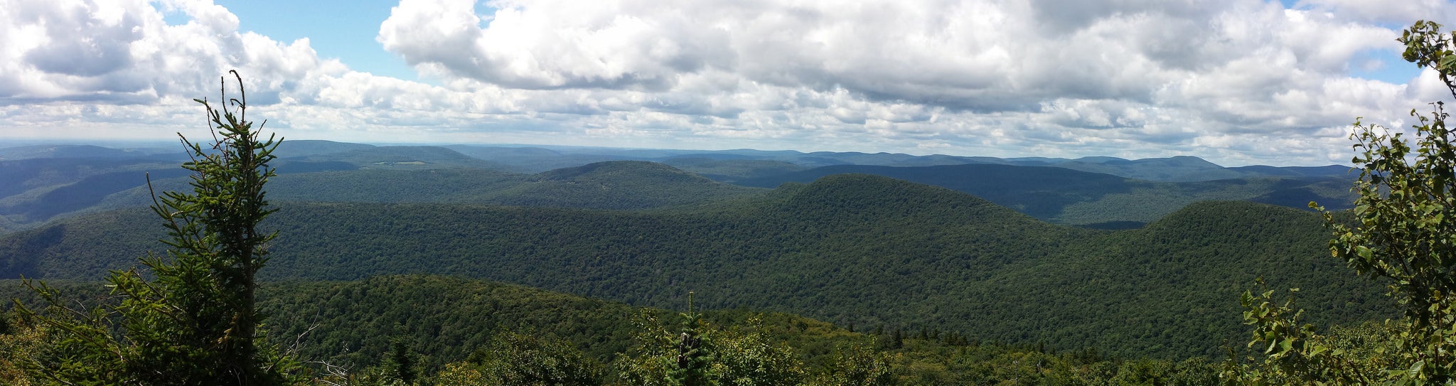
This 14-mile shuttle hike winds tranquil wooded slopes to five peaks over 3,400 feet in a remote section of the Catskills. Off-trail experience and navigation skills required.
'Kevin Kenny'
Trail Facts
- Distance: 18.1
- Miles from city center: 141
Waypoints
FBE011
Location: 42.0908546447754, -74.488166809082
Balsam Mt: Official summit slightly E of main trail; backtrack to previous waypoint, then turn L onto red trail
FBE001
Location: 42.0547790527344, -74.4667663574219
Cross Elk Brook; begin steep climb on undesignated trail, bearing S
FBE007
Location: 42.0350646972656, -74.49658203125
Big Indian Summit (3,700 ft.); descend W off tree-covered peak
FBE008
Location: 42.0343017578125, -74.4994277954102
R on Pine Hill West Branch Trail; keep on blue-blazed trail.
For campsite and water: Turn L in 1.4 miles on Seager-Big Indian Trail and camp near Shandaken Lean-to
FBE006
Location: 42.0324096679688, -74.4770660400391
Find route through isolated col; scramble up second peak
FBE002
Location: 42.044246673584, -74.4674606323242
Keep S
FBE003
Location: 42.0392227172852, -74.4677200317383
Tough going: Keep S, staying on the easiest grade under a thick hardwood canopy
FBE004
Location: 42.0334854125977, -74.4682388305664
Incline eases on the northernmost arm of Fir Mountain
FBE005
Location: 42.0277824401856, -74.4690628051758
ADVERTISEMENT
Fir Mountain (3,620 ft.): Sign summit book; continue off-trail, swinging NW
FBE010
Location: 42.084903717041, -74.4974670410156
Stay on blue trail; drop packs for this quick out-and-back trail to the summit
FBE009
Location: 42.0618782043457, -74.5067443847656
Eagle Mtn. (3600 ft.); trail continues N, rolling over Hayes Mtn.
FBE012
Location: 42.0702171325684, -74.4740600585938
McKenley Hollow; drive or road-hike 2.5 miles back to car