Published September 17, 2018 10:33PM
To Avoid Mt. Rainier's Crowds, Go Off Trail
Venture off the path to find solitude in one of America’s busiest parks.
'Dan Waters'
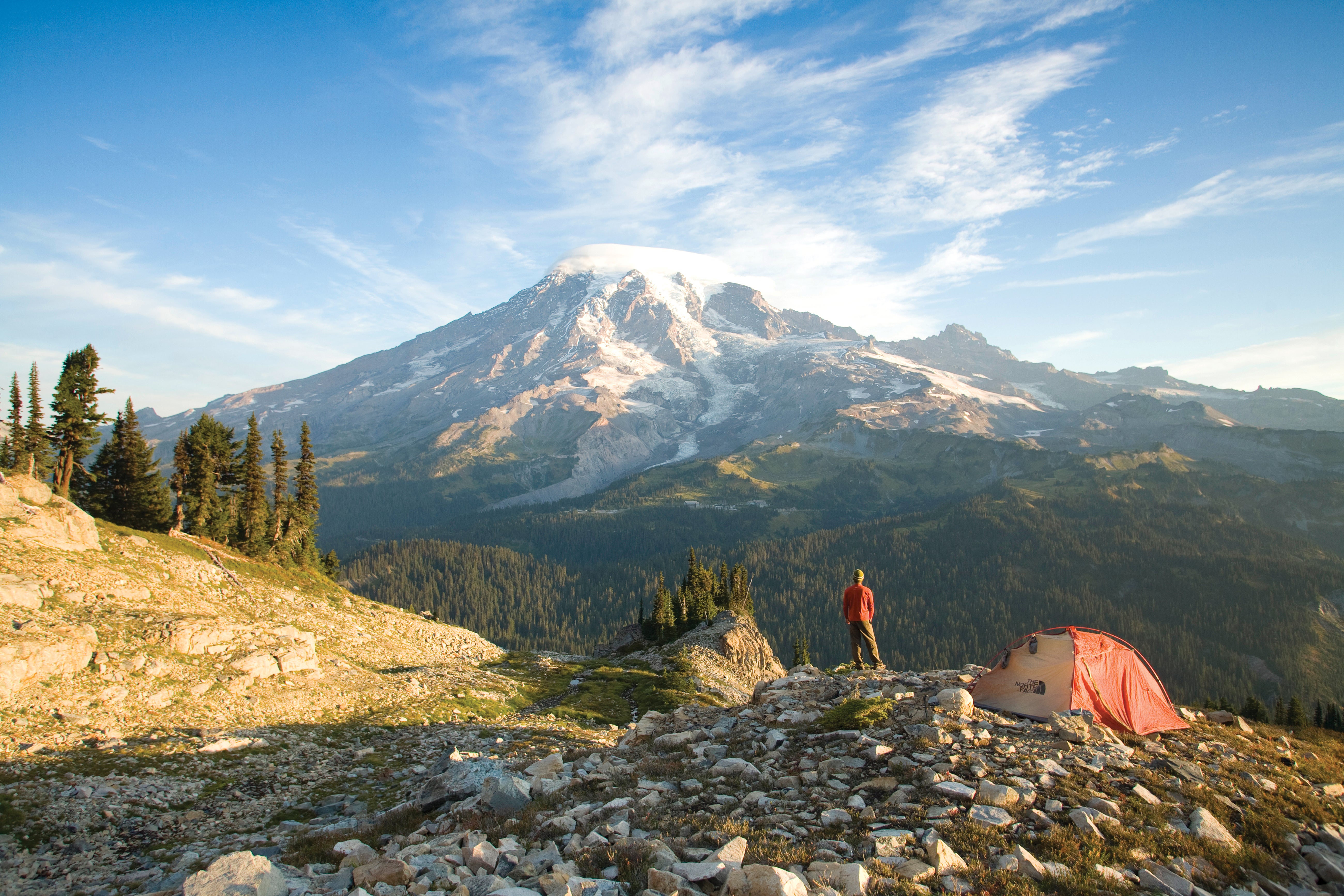
I shove my way through one last patch of underbrush and the sky opens, revealing a dreamy meadow that unfurls like a runway to the glistening, white hulk of Mt. Rainier. A chain of green hillsides dotted with blue tarns roll over each other all the way to the edge of a glacier on the mountain’s north side. Above, the 14,410-foot summit wears a wispy scarf of clouds.
Mt. Rainier National Park is a busy place. Looming above Seattle like a beacon on the horizon, it drew more than 1.4 million visitors in 2017. Of those, more than 55,000 were backpackers—making it the eighth-most popular park for our tribe. With 275 miles of trail to go around, that’s 200 backpackers per trail mile per year. The park has tried to smooth it over with a quota system, but the fact remains that Mt. Rainier’s backcountry campsites often feel more crowded than the line at the information offices.
But here I am, utterly alone, scouting the perfect spot to pitch my tent among postcard views of the Cascades’ crown jewel. No other tents perch on nearby knolls or on the edge of treeline. No pots or cookware clang from the other side of the meadow. No people wander into my viewshed. Why? There are no trails.
ADVERTISEMENT
Stuck in the complex maze of online permit reservations and wait lists for the park’s named campsites, I discovered a little-known loophole: cross-country backpacking. If you’re up for routefinding through steep rainforest, battling glacial scree, and wandering circles in search of flat spots, your options for camping in the park are virtually endless. There’s one rule: You must go at least a quarter of a mile from any trail or road (plus 100 feet from water). That means pretrip research, navigation skills, and a little bit of grit are, of course, essential to claiming your own corner of the mountain, but anyone can do it.
Permits for the park’s 87 backcountry zones are available for hikers with appropriate experience (yes, they check), so the morning of my trip I snagged a golden ticket to the Upper Carbon River unit and, after a short trip down a closed dirt road, headed out from the Ipsut Creek Campground. I linked the Wonderland and Spray Park Trails nearly 7 miles just past Cataract Valley, where I left carefully crafted singletrack behind.
As I ventured deeper into Seattle Park, each grassy patch or rippling glacial stream I passed seemed like a better place to pitch my tent than the last. I wandered the untrammeled soil in search of perfection until it was nearly dark, finally deciding on a hilltop overlooking it all, a mile from where I started.
ADVERTISEMENT
It’s strange to feel alone in such a popular place, and I’m still half-expecting to hear another hiker stumble in as the last light fades. But tonight,
it’s just the mountain and me.
On the still-lit massif, a house-size chunk of ice falls from the steep Willis Wall, throwing up a cloud of white and a rumble that takes a few seconds to reach me. I look around instinctively to see if anyone else saw it. But of course, there’s no one there.
DO IT Best bet: Plan an on-trail hike as you normally would, then venture off-trail when you’re in the backcountry zone. Season June to October Permit Required (free); obtain a walk-in at any wilderness information center or ranger station.