Mountain Map: Coast Range - Olympic Mountains

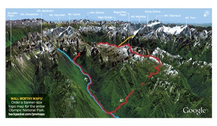
'Olympic Mountains, WA (Image by Google Earth)'

Olympic Mountains, WA (Image by Google Earth)

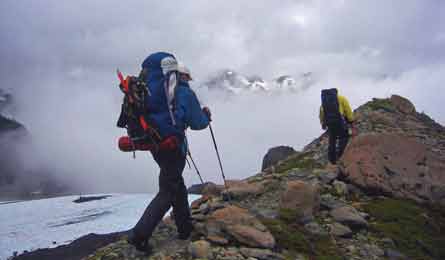
Photo by Jeff Schumacher

Photo by Kirkendall-Spring
Whatever your alpine pleasure—glaciers, peaks, 360-degree vistas, waterfalls, hot springs—you’ll find them here. The range juts 7,000 feet up from the Pacific Ocean, dominating the Olympic Peninsula with craggy ridges, 266 glaciers, and lush old-growth forest. Explore it top to bottom with these five must-do routes.
High Divide
Hikers who scale the High Divide’s airy, 5,000-foot ridgeline will trek above lake-filled basins and score unrivaled views of 7,980-foot Mt. Olympus—the tallest peak in the range. Get there about midway through a 17.5-mile lasso loop: Start on the Sol Duc River Trail, and hike southeast up the valley .8 mile to Sol Duc Falls, where the river splits into three channels and plummets into a mossy gorge. Keep climbing another 6.7 miles to a grassy camp just east of Heart Lake. On day two, ascend past fir and avalanche lilies, which bloom right after the snow melts, to the crest of the ridge. Now comes the big show: Trace the spine west for aerial views of eight teal lakes and Mt. Olympus looming above the Hoh River valley. At mile 9.7, take a quarter-mile (round-trip, nontechnical) detour to tag 5,474-foot Bogachiel Peak. Close the loop on Deer Lake Trail. Trip ID* 23205
Olympic Hot Springs This 28.7-mile out-and-back leads to a chain of backcountry soakers. Follow the Sol Duc River east for 6.9 miles before starting a 2.1-mile grind, gaining nearly 2,000 feet, to a camp on Appleton Pass. The next day, trace Boulder Creek northeast to 95°F hot springs—fringed with ferns and Oregon grape and shaded by cedars. Sleep at the sites just 100 yards away. Trip ID 1647723
Mt. Townsend
Snag 6,280-foot summit views of Seattle’s skyline, Mt. Rainier, and Royal Basin (flanked by Olympic’s highest concentration of 7,000-foot peaks) on this 8.5-mile round-trip. Trip ID 754806
Blue Glacier
Climb to the base of Mt. Olympus on a 33.2-miler that dead-ends at the toe of 2.6-mile-long Blue Glacier, the largest ice sheet in the Olympics. Follow the Hoh River Trail through a primeval forest of red cedars and Sitka spruce. Basecamp in Lewis Meadow. The next day, tick off 6.7 miles (and 3,700 feet of elevation gain) to the 900-foot-thick glacier on Mt. Olympus’s north face. Trip ID 1647710
Sunrise Ridge
While most folks take the easy jaunt to Hurricane Hill, you’ll get instant views—without the crowds—on this neighboring ridgetop hike. The trail rolls 2.8 miles (one-way) northeast above fir-dotted meadows toward 6,454-foot Mt. Angeles. Views stretch northwest to the peaked ridgelines on Vancouver Island and northeast to the snowy Cascades. Magenta paintbrush, bistort, and lupine color the hillsides from July to August. Trip ID 1647753
*Get free GPS data and print custom maps by adding the Trip ID to backpacker.com/hikes/_______.