Published September 20, 2013 02:37PM
Mount Rainier National Park: Shriner Peak Lookout
This 8.2-mile out-and-back is rarely hiked. If your legs can take a stiff, 3,434-foot climb, the payoff is best-in-show vistas of Rainier and its neighbors.
INFO For information on permits, current trail and camp conditions, and wilderness guidelines, go to nps.gov/mora/planyourvisit/wilderness-camping-and-hiking.htm.
PERMIT A wilderness permit is required for all overnight camping in the backcountry. Reservations requests accepted by fax or mail, starting on March 15th of each year ($20/reservation). Download form at nps.gov/mora/planyourvisit/wilderness-reservation-information.htm.
CONTACT Mt. Rainier National Park, (360) 569-2211; nps.gov/mora
ADVERTISEMENT
Trail Facts
- Distance: 13.2
Waypoints
SPL001
Location: 46.80265, -121.555237
Begin long climb under old-growth Douglas fi rs and hemlocks. Note: Bring stiff boots, sun hat, plenty of agua
SPL002
Location: 46.798805, -121.535873
Overlook S across water-sculpted gash of Panther Creek Valley; lupine and avalanche lilies add color to old burn area
SPL003
Location: 46.800247, -121.531166
Switchback on slopes of bear grass and paintbrush
SPL004
Location: 46.800365, -121.539345
Continue steep grind
SPL005
Location: 46.8022, -121.540024
After a 2,000-foot climb, trail crests ridge with big views across Ohanapecosh River to icecapped Mt. Rainier. Rest on outcrop, then continue NE
SPL006
ADVERTISEMENT
Location: 46.805737, -121.535973
Zigzag past rock gardens and scurrying marmots
SPL007
Location: 46.806404, -121.533066
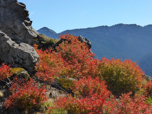
This long ridge is full of reds, blues, and yellows. In season, take photos of wildfl owers, huckleberries, or fall colors
SPL008
Location: 46.807541, -121.530518
Trail reenters forest; enjoy shade before sun-baked stretch ahead
SPL009
Location: 46.810192, -121.53096
Cliffside meadow dotted with stunted alpine fi r; footing gets rocky, tricky. Blue grouse, warblers, elk frequent this ridge
SPL010
Location: 46.813572, -121.530502
Shriner’s grassy 5,834 ft. pinnacle. Old, 2-story tower offers vistas of Mt. Adams, the Goat Rocks, and Mt. St. Helens. Camp nearby (with permit) for a sunrise glow on Rainier.