Published September 20, 2013 01:59PM
Mount Rainier National Park: Mirror Lakes via Kautz Creek
This ambitious 12.4-mile dayhike runs along a creekbed raged by two major floods, through fragile wildflower meadows, and visits a pod of backcountry lakes.
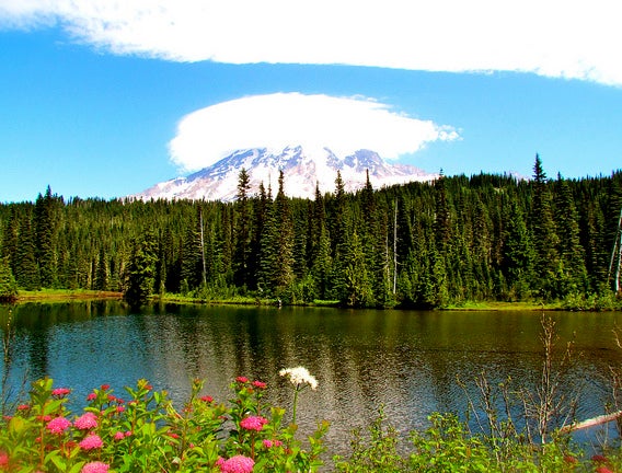
'Mirror lake (Photo by Jeff Gunn)'
The first mile-long stretch of trail travels across the Kautz Creek mudflow, which was formed in 1947 from sediment and boulders deposited by a glacial flood. Another flood-of-the-century charged through in November 2006. After a mile, cross Kautz Creek on a split-log footbridge—clear days reveal 14,410-foot Mount Rainier rising dramatically behind the creek.
The trail steepens at this point and climbs several switchbacks that zigzag above the creek. After five miles, cruise across wildflower-filled meadows beneath Mount Ararat, then head northwest on Wonderland Trail to the Mirror Lakes spur trail. Follow this 0.6-mile path to a small group of lakes tucked beneath South Tahoma Glacier. No camping allowed.
Editor’s Note: Floods in 2006 might have slightly altered the route identified on our map.
INFO For information on permits, current trail and camp conditions, and wilderness guidelines, go to nps.gov/mora/planyourvisit/wilderness-camping-and-hiking.htm.
ADVERTISEMENT
PERMIT A wilderness permit is required for all overnight camping in the backcountry. Reservations requests accepted by fax or mail, starting on March 15th of each year ($20/reservation). Download form at nps.gov/mora/planyourvisit/wilderness-reservation-information.htm.
CONTACT Mt. Rainier National Park, (360) 569-2211; nps.gov/mora
Trail Facts
- Distance: 20.0
Waypoints
MIR001
Location: 46.736183, -121.855736
Hike north on Kautz Creek Trail. This gentle stretch of trail runs across the Kautz Creek mudflow where sediment and 13-foot boulders were deposited by the Kautz Glacier outburst flood in 1947.
MIR002
Location: 46.747063, -121.84816
Cross Kautz Creek on split-log footbridge (use caution during high water). On clear days, you’ll see 14,410-foot Mount Rainier rising dramatically to the northeast behind the creek. Trail narrows ahead.
MIR003
Location: 46.757011, -121.853188
Ascend several switchbacks that zigzag above Kautz Creek; prepare for steep climb through old-growth forest.
MIR004
Location: 46.766964, -121.853233
Hike northwest; terrain levels briefly.
MIR005
Location: 46.770397, -121.855362
Tackle 12 switchbacks that climb east. In 0.3 mile, head north to a narrow saddle.
MIR006
Location: 46.775383, -121.850754
ADVERTISEMENT
Continue heading north past an unnamed 5,115-foot summit that rises on the right. Ahead, trail travels north toward Mount Ararat, passing through the expansive meadows of Indian Henrys Hunting Ground.
MIR007
Location: 46.793404, -121.84053
Turn left @ T-junction onto Wonderland Trail; hike northwest through an alpine meadow dotted with seasonal wildflowers.
MIR008
Location: 46.794994, -121.842972
Trail curves to the right, heading northeast.
MIR009
Location: 46.795528, -121.841637
Bear right @ Y-junction onto 0.6-mile spur trail to Mirror Lakes.
MIR010
Location: 46.801315, -121.834702
Mirror Lakes: This small group of aptly-named lakes is nestled at the foot of South Tahoma Glacier. On wind-free days, look for the reflection of Mount Rainier’s glacier-covered slopes. To return to trailhead, retrace your route.