Published October 6, 2014 10:27PM
Masterpiece Trails: Making The Grade
Get the story behind the Edmands Tour, Presidential Range, White Mountains, New Hampshire—and how to see it yourself.
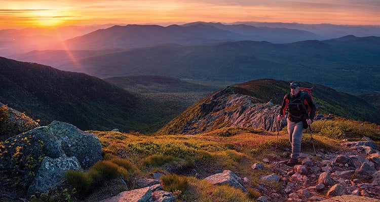
'Score panoramic views of the White Mountains from paths that won’t leave you panting. Photo by Harry Lichtman'
ON A MAP, the maze of trails on the north slope of the Presidential Range looks like a kid has gone crazy with an Etch-a-Sketch. More than 20 named paths crisscross a swath of mountainside less than 5 miles across. Many of them were built or backed by one man: an MIT-trained employee of the Harvard College Observatory named J. Rayner Edmands.
Starting in the 1880s, Edmands devoted more than two decades of summer vacations to trail work, linking the tiny community of Randolph (where he usually stayed during visits to the White Mountains) to the high peaks of the Presidentials. The one-time president of the Appalachian Mountain Club abhorred the typical Northeast rock-and-root clamber, favoring broad paths with few obstacles, modeled after the miners’ burro paths he’d seen in the Rocky Mountains. In laying out his gently graded paths, Edmands said he depended more on a barometer—to gauge elevation—than his compass. He believed a trail should be navigable without stumbles, even in the dark. The result? Paths that help you enjoy the views of New England’s highest peaks—with less punishment for your body.
The hike
Take a two-day, 14-mile tour of Edmands’s work through dense spruce and fir forest, past stunted krummholz, across jumbles of talus, to some of the region’s loftiest summits. Follow the Air Line, Short Line, and Randolph Path Trails to the Perch, a Randolph Mountain Club shelter near treeline on the same spot Edmands built a (long-gone) birch-bark cabin in 1892. Next day, continue up the Randolph Path to Edmands Col, where a plaque is dedicated to the man and his trails: always rising, never steeply. After bagging 5,712-foot Mt. Jefferson, head north along the Gulfside Trail, following 4-foot-tall cairns (Edmands’s system was to build two cairns 10 feet apart that could, in a whiteout, point the way to the next cairn cluster, about 50 feet away). Climb 5,794-foot Mt. Adams and then head down the Valley Way, thankful that Edmands relocated the original trail to find the gentlest possible route—though it still descends 3,550 feet in just 3.8 miles.
Trailhead Appalachia parking lot on US 2, 6 miles west of Gorham, NH; 44.371564, -71.288841Season May to October; expect bugs and lingering snow in early season. The Perch $10/night ($8 for Randolph Mountain Club members) Contactrandolphmountainclub.org