Published September 20, 2013 02:34PM
Los Angeles: San Gorgonio Mountain
Want to get higher than a Hollywood star? Shoot up 5,400 feet and scrape the sky on SoCal's tallest peak on this 13.2-miler in San Gorgonio Wilderness.
'Robb Hannawacker'
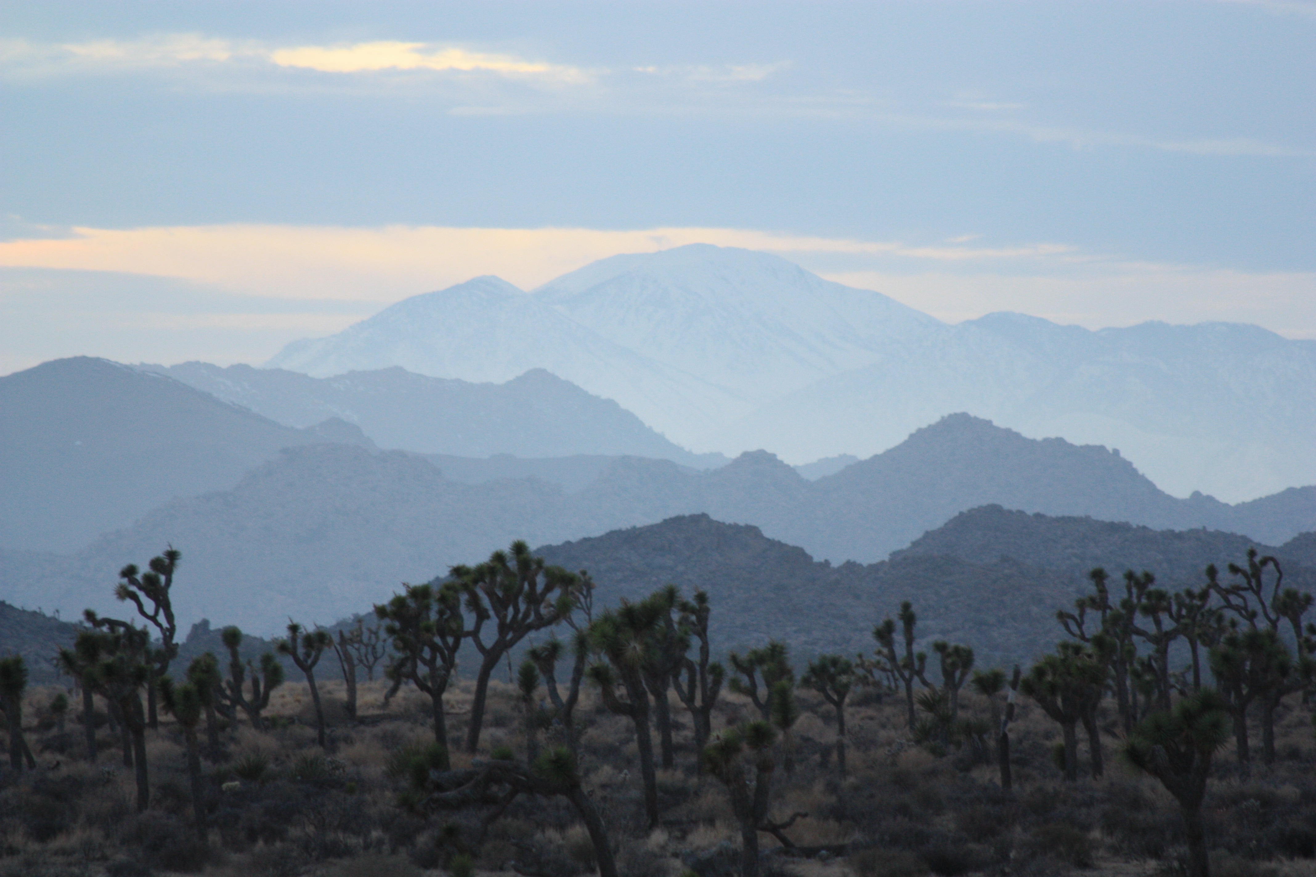
When SoCal hikers want to get high, many head for Gorgonio, which ranks among the ten most prominent peaks in the contiguous United States. This giant, multi-ecozone peak soars from relative lowlands to 11,501 feet. Bagging its bald summit requires a lots of elevation gain, so look to stretch your time out on top. It’s all open sky from this cloud-piercing lookout, which hovers nearly 10,000 feet above the deserts of Joshua Tree National Park to the west. If you’ve ever longed to be Zeus for a day, looming high above mere mortals, this is your throne. Free wilderness permit required, plus a $5 Adventure Pass.
Info: sgwa.org
Trail Facts
- Distance: 10.6
- Miles from city center: 82
Waypoints
MSG001
Location: 34.081859588623, -116.890800476074
Head E from parking lot (6,080 ft.) uphill through picnic area on dirt road along sandy fl ats of Mill Creek. In spring and fall, trails can be icy (bring crampons and ice axe)
MSG002
ADVERTISEMENT
Location: 34.079460144043, -116.88330078125
Official trailhead. Cross Mill Creek and begin brisk ascent of Mill Creek Canyon’s N wall
MSG003
Location: 34.0818862915039, -116.882316589355
Switchback N to bench. Pass Vivian Creek Camp on R; loop ENE along creek
MSG004
Location: 34.0885009765625, -116.879028320312
Follow bends of Vivian Creek
MSG005
Location: 34.0841751098633, -116.864143371582
Bear down for 1,200-ft. gain; Halfway Camp @ 8,100 ft.
MSG006
Location: 34.0855445861816, -116.847122192383
Cross High Creek and High Creek Camp; start 1,300-ft. climb up ridge
MSG007
Location: 34.093563079834, -116.840812683105
Small knob marks final push; see knife-edged Yucaipa Ridge to W and corrugated face of San Jacinto Peak to S
MSG008
Location: 34.1012992858887, -116.833999633789
R @ T; hike above the trees
MSG009
Location: 34.1012687683106, -116.830902099609
L @ Y; head over first summit (11,490 ft.), then cross saddle toward higher summit
MSG010
Location: 34.0991897583008, -116.824798583984
ADVERTISEMENT
Mt. San Gorgonio (11,499 ft.). SoCal’s rooftop yields vistas over the Inland Empire, scorched flats of Joshua Tree NP, and hazy cobalt of Pacific. Retrace route to car.