Los Angeles, CA: Mount Islip

Just an hour from downtown Los Angeles, this moderate route is a favorite with dayhikers and is used as a jumping-off point for a multi-day trip in the central San Gabriels. Start at a large parking area off the Angeles Crest Highway at the Islip Saddle (National Forest Adventure Pass required). Cross the road and begin climbing southeast on the well-graded trail. You’ll wind through fir and pine forests to a fire-road crossing and the well-established Little Jimmy Campground. A reliable, year-round spring just a few hundred yards from the campground makes it a popular spot for overnighters headed east toward Mount Baden-Powell.
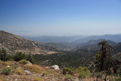
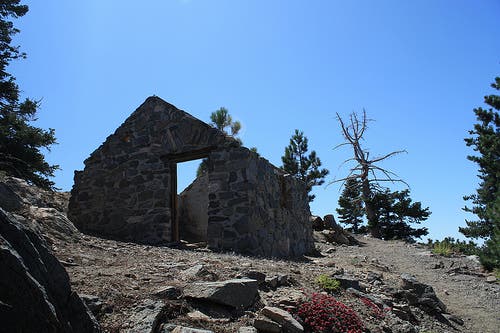
From the campground, the trail loops north and west past a few more secluded campsites before dipping over a ridge for the first trailside views of the Yerba Santa Amphitheater, Pine Flats, and the Crystal Lake Recreation Area. The trail follows a ridge above the basin for about 0.5 mile before a sharp switchback that heads east for the final approach to the 8,250-foot summit of Mount Islip (pronounced eye-slip). You’ll pass an old outbuilding—living quarters for old-time fire lookouts—before landing atop the sharp peak, which offers panoramic views of the San Gabriels and, on clear days, the ocean. Follow the same route back to the trailhead.
-Mapped by Casey Schreiner
Trail Facts
- Distance: 11.0
Waypoints
MTI001
Location: 34.357059, -117.851302
From the parking area, carefully cross the Angeles Crest Highway and look for a small metal sign marking the trailhead. Next, ascend a few manzanita-crowded switchbacks.
MTI002
Location: 34.354965, -117.849317
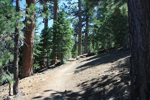
Less than half a mile in, the trail enters pine and fir forest. The remainder of the trip travels through shady forests on a moderately graded trail.
MTI003
Location: 34.355369, -117.840461
Continue straight on the footpath, crossing a fire road. This road runs roughly parallel to the trail heading toward the Little Jimmy Campground, but it is slightly longer than the trail and not as scenic.
MTI004
Location: 34.347626, -117.836394
Near mile 1.7, the trail dips and you’ll pass Windy Spring on the right. Though Windy Spring is pretty reliable (look for water-loving trees and shrubs nearby), the flow might drop to a trickle during drought conditions.
MTI005
Location: 34.347405, -117.830823
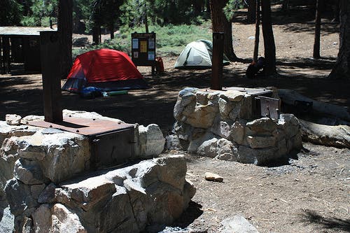
Bear right at the Y-junction to pass through the Little Jimmy Campground, a fairly well-maintained backcountry facility. Continue west, bypassing several picnic tables, camp stoves, and an outhouse. The trail picks up again to the west of the established campsites. The left-leading spur trail near the campground entrance is a 0.3-mile out-and-back to a small year-round spring.
MTI006
Location: 34.3469, -117.83184
About 100 yards from the campground entrance, rejoin the trail. You’ll loop north to climb a low ridge. The sites in this area overlook the main campground and offer great views of the Antelope Valley to the north.
MTI007
Location: 34.345498, -117.831188
Stay right at the Y-junction with Windy Gap Trail. This route crosses back over the ridge and heads west toward Mount Islip. The left-leading trail offers access to a saddle at Windy Gap and Hawkins Mountain, Throop Peak, and Mount Baden-Powell.
MTI008
Location: 34.344417, -117.831019
The trail makes a sharp curve to the right and begins climbing a long eastbound ridge overlooking the Yerba Santa Amphitheater, a huge valley walled-in on three sides by the San Gabriels. Damage from the 2002 Curve Fire is still plainly visible, but the views are outstanding. Look east toward the ridge of South Mount Hawkins and south and west toward the Crystal Lake Recreation Area.
MTI009
Location: 34.344198, -117.840084
Stay right on the Islip Trail at the Y-junction (bypass the Big Cienega Trail). After the junction, you’ll climb the final 150 feet toward the summit, switchbacking once then looping south of the summit before approaching from the north.
MTI010
Location: 34.345019, -117.839966
About 50 feet before the 8,250-foot summit, you’ll pass the remains of an old stone cabin to your left. Continue climbing toward the summit for panoramic views of the San Gabriels. The west-facing vista of Kratka Ridge, Twin Peaks, and the old CA 39 is especially beautiful.
Trailhead
Location: 34.356887, -117.850626
The trailhead, on the south side of the Angeles Crest Highway.
Shade
Location: 34.355004, -117.840128
Tall trees create some coverage along this typically shaded stretch of trail.
Little Jimmy Campground
Location: 34.347343, -117.830936
Maintained campsites include stoves, tent platforms, and an outhouse.
Trail
Location: 34.34699, -117.831545
Keep an eye out for this small sign marking the trail past the campground. The well-worn campground makes it tough to spot the trail entrance.
Views
Location: 34.344466, -117.831253
Just after mile 2.7, you’ll get this first trail-side view of the Yerba Santa Amphitheater.
Cabin
Location: 34.34511, -117.839731
The remains of an old stone cabin near the summit of Mount Islip.