Published September 16, 2020 03:53PM
Basecamp Weekend: Salmon River Mountains, ID
Pitch camp next to an alpine lake, rocky peaks, and a WWII plane wreck in Idaho’s Salmon River Mountains.
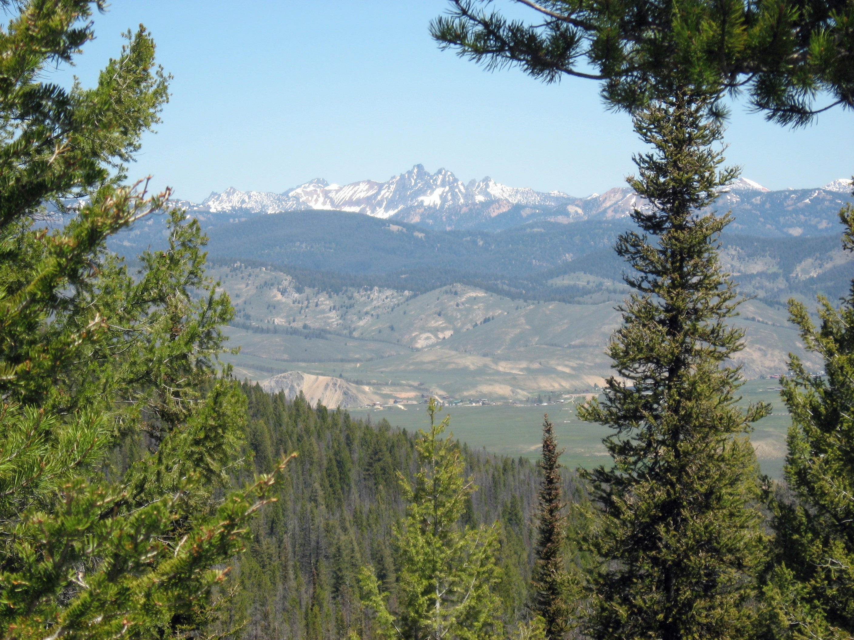
I clamber across another downed log on my circumnavigation of one of Idaho’s alpine lakes. The views are phenomenal even if the footing isn’t: Dark conifer forests run from the crystal-clear lake edge to jagged peaks, snow still clinging to the distant rock even at midsummer. Back at camp I can get the same vista without the aggravation, but the test of both my patience and the waterproofing of my boots is worth it as soon as a glint of sunlight on exposed metal ends my search for the unexpected piece of history abandoned beside the sunlit water. The fuselage of a WWII B-23 bomber rests on the marshy shore, the last remnant of a January 1943 crash-landing. Despite two weeks of sub-zero temperatures and a 40-mile hike through waist-deep snow, all eight crewmen survived. The solitary mile I have left to find dry socks and dinner at camp seems like a walk in the park by comparison.
Turn by turn
From the Loon Lake Trailhead
1) Start the hike on the Secesh River Trail (#80), negotiating roller coaster terrain as the trail alternates between river’s edge and rocky bluffs.
2) At mile 3.6, take a right turn to head east at the junction on the Loon Creek Trail (#84), climbing steadily to the alpine valley above the river canyon.
3) Come to a four-way junction at mile 5.1, with imposing views of the sprawling flanks and cliff-capped summit of Victor Peak dominating the southern skyline. Head south (hiker’s left) on the Loon Lake Trail to reach your campsite at mile 5.4, on the east side of the trail just before a U-bend in Loon Creek.
4) Tackle the off-trail section after setting up camp or the next morning. Follow Loon Lake Trail south.1 mile to the northern shore of the lake (visible through the trees). At the lake shore, take a left to trace the lake’s eastern edge for .7 mile to the plane crash site (mile 6.2) on the marshy southern shore. You can double-check your route loading the site’s coordinates (45.1588, -115.8412) into your phone or GPS.
ADVERTISEMENT
5) After reaching the crash site, finish the loop around the lake by fording Loon Creek and regaining the Loon Creek Trail (mile 6.7) on the west shore. Keep your eyes peeled for moose. Head north and take a right on Loon Lake Trail at the junction to return to camp, just south of the junction at mile 7.7.
6) The next morning, finish the loop on the Loon Lake Trail (FS Trail #81), heading north through dense new-growth lodgepole pine and Douglas fir (returning after a 2007 wildfire), returning to the trailhead at mile 12.1.
Campsite
Bed down in a primitive site tucked in the trees on the northern shore of Loon Lake, with views of jagged North Loon Mountain over the narrow, glacier-carved valley. There’s flat ground for half-dozen tents here, but no privies or services: plan to filter water from Loon Creek (south of camp). There are hiker-made fire rings, but check seasonal Payette National Forest restrictions before using one.
Crash Course
The B-23 bomber on the edge of the lake crash-landed there in January 1943, after low fuel and poor visibility forced the pilot to make an emergency landing midway through their training flight to Tacoma, Washington. Of the eight crew members (all survived the crash), five men remained in place, using the plane’s fuselage as cover for warming fires, while three others set out on foot for the town of McCall. The men at Loon Lake were able to fix their radio and send out a plea for help; thirteen days later, they were spotted by search-and-rescue aircraft, who landed on the frozen lake and flew them to safety. The three men en route to McCall, after days of following the Secesh River through waist-deep snow, came across Forest Service rangers at Lake Creek Guard Station, where they were fed and treated for frostbite. They had traveled 40 miles in 14 days without any winter gear, sometimes only gaining two miles a day in the snow-choked Secesh River canyon.
ADVERTISEMENT
DO IT Trailhead 45.2124, -115.8090; 37 miles north of McCall on the Warren Wagon Road Road driveable with 2WD Season April to October Permit None Contact (208) 634-0700; fs.usda.gov/payette