Updated December 4, 2024 11:05AM
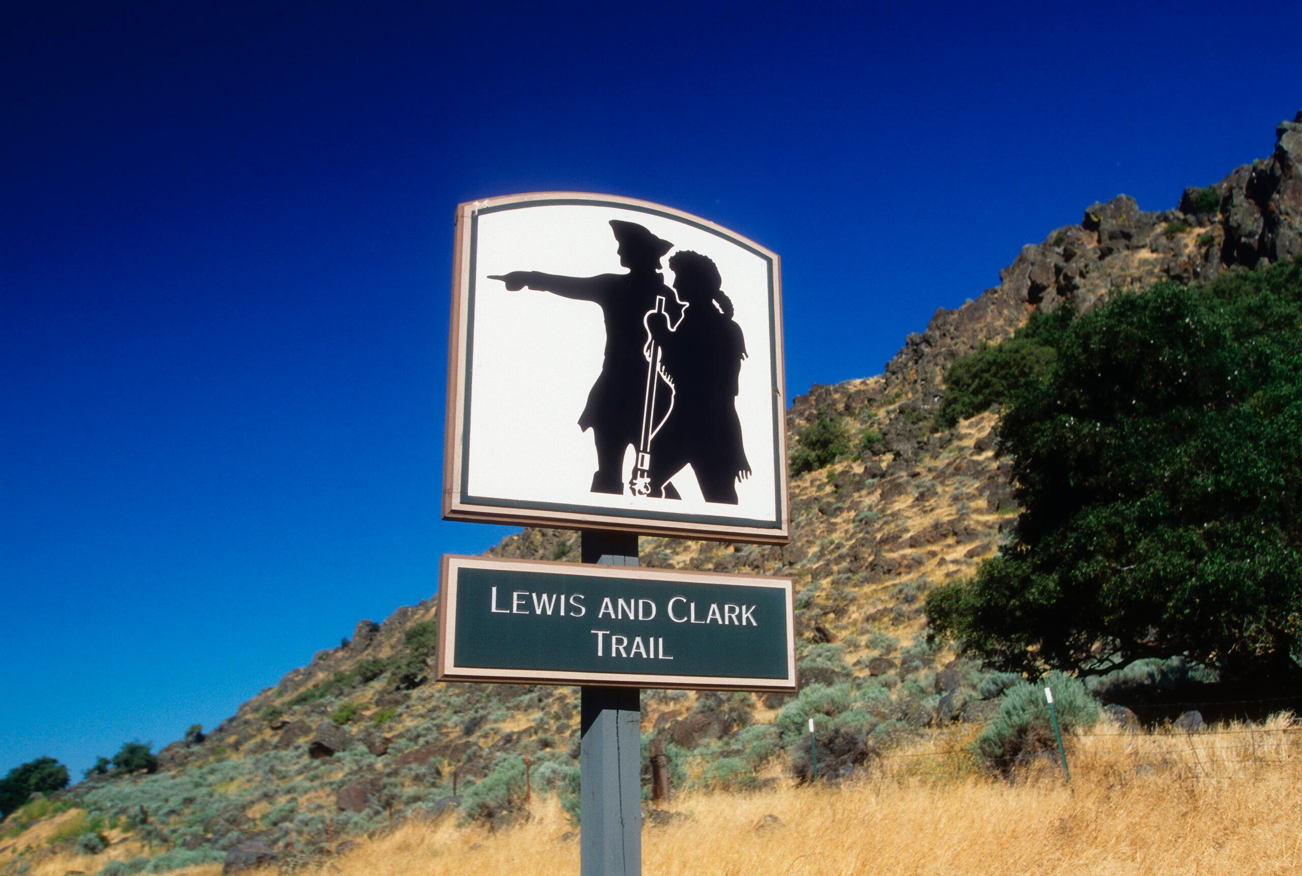
Lewis and Clark Trail - The Ultimate Hiking Guide
Follow in the footsteps of history from Pennsylvania to the Pacific coast.
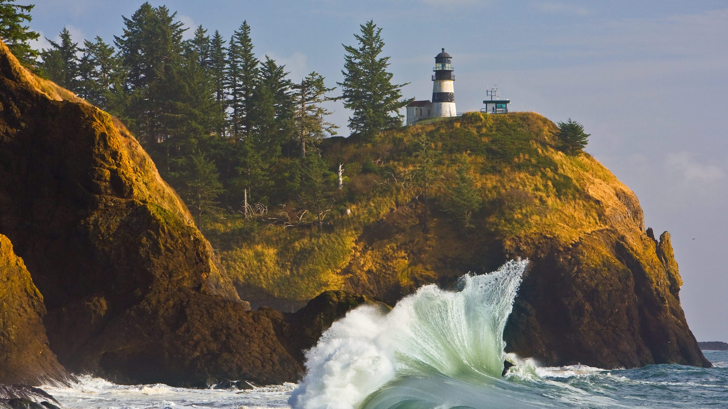
Cape Disappointment Lighthouse (Photo: David_Johnson/iStock via Getty Images)
While the PCT, AT, and CDT cut through the country from north to south, the Lewis and Clark Trail takes a horizontal approach. Following the path of Lewis and Clark’s 1804-1806 expedition and preparatory trips, the trail runs from Pittsburgh to the mouth of the Columbia River in Oregon.
Unlike more traditional long trails, however, you can’t hike the Lewis and Clark Trail end-to-end—not unless you’re ready for a whole lot of road walking. A lot of the route follows busy highways and interstates. Once you get farther west, though, the backpacking, rafting, and day hiking opportunities increase. Read on for the best hikeable sections of this historic path.
The Lewis and Clark Trail Route
The 4,900-mile National Historic Trail follows both the inbound and outbound paths of Lewis and Clark, as well as the preparatory journeys they undertook before heading west. The trail passes through 15 Native reservations (and the historic territories of around 30 tribes) and dozens of historical sites along the way. Most of Lewis and Clark’s expedition was guided by Sacagawea, a Lemhi Shoshone woman whose knowledge of the landscape, plants, and local languages was key to the success of the Corps of Discovery. She was the only woman on the expedition, and at the time was only 16. Despite her critical contributions, she was not paid at all, while her husband, the much older Toussaint Charbonneau, received $500.
The Lewis and Clark Trail starts at Point State Park in Pittsburgh, the headwaters of the Ohio River. It follows the Ohio for several hundred miles, passing cities, national forest, and national recreation areas. After hitting the Rockies, the trail heads up into the alpine, dropping over the passes to the western side of the continent. Here, a new waterway to follow: the Columbia River. The trail follows the Columbia to the sea, where the Lewis and Clark Interpretive Center sits perched on the coast at Cape Disappointment. (Don’t let the name fool you: It’s actually gorgeous.)
ADVERTISEMENT
The Seven Best Hikes on the Lewis and Clark Trail
Though much of the route currently runs on roads, there are hikeable sections. Hike, paddle, and backpack in centuries-old footsteps on these seven hikes and paddles.
| Segment | Trail Name | Location | Mileage | Elevation Gain |
| Hike 1 | Backwater Trail | Ponca State Park, NE | 4 miles | 9 feet |
| Hike 2 | Headwaters Trail | Missouri Headwaters State Park, MT | 1.6 miles | 13 feet |
| Hike 3 | Snake River Trail | Hells Gate State Park, ID | 6.2 miles | 800 feet |
| Hike 4 | North Head Trail | Cape Disappointment State Park, WA | 4 miles | 420 feet |
| Hike 5 | Katy Trail | Katy Trail State Park, MO | 240 miles | 513 feet |
| Hike 6 | Lolo Trail | Montana | 119 miles | 3,000 feet |
| Float 7 | Missouri River Breaks National Monument | Montana | 3 days | n/a |
1. Backwater Trail, Ponca State Park, NE
This 4-mile out-and-back wanders through cottonwood forest, oxbows, and tallgrass prairie in the Missouri River Bottomlands. The 580 acres bordering the river that this trail passes through were donated to the park in 1999 by the Conservation Fund.
2. Headwaters Trail, Missouri Headwaters State Park, MT
Climb to a bluff above the river with views of the water, grasslands, and surrounding mountains on this 1.6-mile hike. A series of interpretive plaques along the way tell about the history of the region, particularly the Lewis and Clark expedition. Unlike many Montana trails, this one can be accessed year-round.
ADVERTISEMENT
3. Snake River Trail, Hells Gate State Park, ID
Located in a river bottom left by Ice Age floods 15,000 years ago and bordered by basalt columns formed by a 14-million-year-old lava flow, this park is home to much older history than Lewis and Clark. Check out the natural history on the 6.2-mile Snake River Loop Trail, which climbs through grassy bluffs to impressive cliffs of basaltic columns. Afterward, head to the Lewis and Clark Interpretive Center to learn about the more recent past.
4. North Head Trail, Cape Disappointment State Park, WA
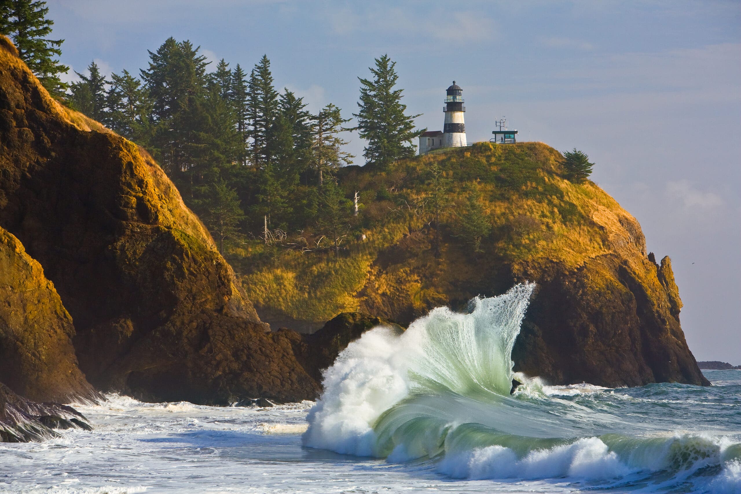
Hike from a lighthouse looking out on the Pacific down through coastal forest to the beach on this 4-mile out-and-back. Much of the trail drops down wooden stairs and boardwalks over the damp forest floor before reaching the gravel-and-sand beach. Not ready to finish your hike at the water? Cross the road to the Mackenzie Head Trail and explore an abandoned World War II gun battery.
5. Katy Trail, Katy Trail State Park, MO
Pick your favorite stretch–or hike or bike it all–on this 240-mile rail trail, the longest in the country. There are 26 trailheads along the path, but the stretch between Cooper County and St. Charles County is officially designated as part of the Lewis and Clark Trail. The 114-mile section has lodging available at several towns along the way, separated by reasonable daily distances. Some, like Defiance and Augusta, have camping available, while other spots are limited to hotels.
ADVERTISEMENT
6. Lolo Trail, MT
Lewis and Clark described this route over the Bitterroot Mountains as the most challenging part of their journey. It took them 11 days on the way out and 15 on the way back. Modern hikers have an easier time of it. The 119-mile primitive road, known as the Lolo Motorway, parallels several different trails and is a pleasant walking route itself. Established campsites along the way take the mystery out of finding a place to sleep. Or, reserve one of a series of historic lookouts and cabins for overnight stays.
7. Float Missouri River Breaks National Monument, MT
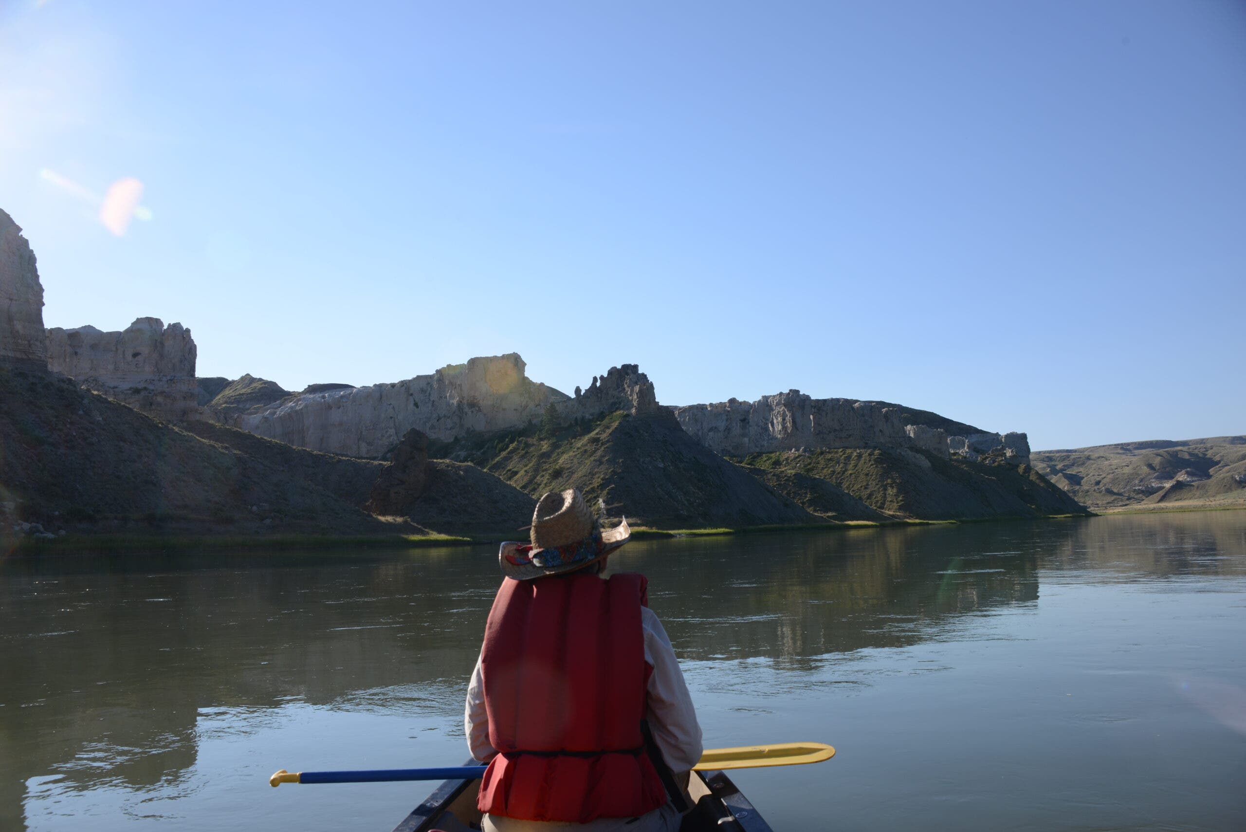
Rent a canoe in Fort Benton for a three-day float to Judith Landing on the wild Missouri. After launching your craft head into the Missouri River Breaks and the White Cliffs region, where pale sandstone formations rise hundreds of feet above the river. Eagle Creek, Hole in the Wall, and Slaughter River are the best waterside campsites along the way accessible to boaters. Missouri River Outfitters will rent you the watercraft and shuttle your car to the takeout site.
Gear for the Lewis and Clark Trail
The Lewis and Clark Trail passes through nearly every ecosystem in the northern US. Good raingear, wicking layers that will accommodate hot days but still keep you warm in the cold, and an insulated jacket for cold nights and mountain traverses are key. If you’re going to take the river route through some of the Dakotas and Montana, bring water shoes and paddling gear, and set up a local rental or transport for your boat.
ADVERTISEMENT
Permits
Very few sections of the Lewis and Clark Trail require a permit, as most of it is in National Forest Land or along urban areas. Check the official trail maps for any land management agencies that may require permits or reservations.
When to Hike the Lewis and Clark Trail
Summer has the best weather and the least snow in the mountain passes, making it the best season to hit the trail. Start just after spring or in early fall for cooler days of walking. July or August provides the best chance of sunny days and the least chance of blizzards.
Where to Stay on the Lewis and Clark Trail
Camping along much of the Lewis and Clark Trail can be hard to find. Most accommodations along the route are hotels of various levels–bed and breakfasts, roadside motels, and guest cottages—until you reach the Dakotas. Pick your accommodation budget and book accordingly, leaving a small cushion for emergency hotel stays in bad weather.