Long Trail (Section 08): Cooley Glen to Birch Glen

Starting from the Cooley Glen shelter, this 15.5-mile chunk of the Long Trail (only accessible by car at the Lincoln and Appalachian Gap midpoints), challenges hikers with rugged terrain but rewards with an epic Green Mountain experience. After a short climb to Mount Grant, take a pause to enjoy southward views across the Breadloaf Wilderness. Pick up a steady descent towards Lincoln Gap; 3.6 miles in, stop for a breather at the Sunset Ledge (which offers views to the west).
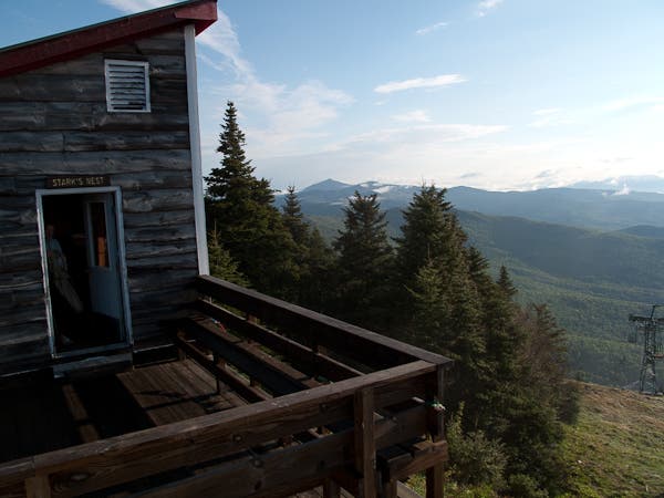
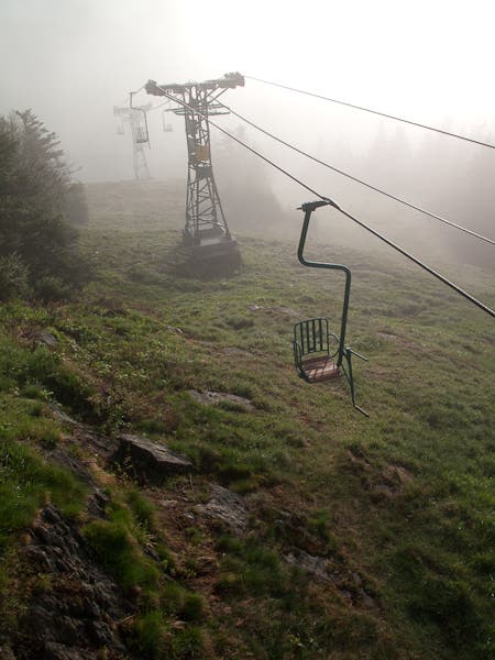
After crossing Lincoln Gap, hunker down for a steep 1.7-mile, 1,700-foot climb to the above-treeline summit of Mount Abraham; the final push to the top requires steep scrambling of rock slab (that can be very slick when wet). Heading north from “Abe,” use care to stay on trail so as to preserve sensitive alpine plants. Tracking along the ridgeline north, the LT skirts classic Vermont ski areas Sugarbush and Mad River Glen. Take a breather at the Stark’s Nest warming hut atop Mad River to enjoy the view (and the restored single chairlift). After a steep descent to Appalachian (“App”) Gap, the LT makes a final push up Molly Stark Mountain before descending to Birch Glen Camp.
Shelters: Cooley Glen, Battell, Glen Ellen, Theron Dean, Birch Glen
-Mapped by Berne Broudy, AuthenticOutdoors.com
MORE LONG TRAIL MAPS
Section 1 | Section 2 | Section 3 | Section 4 | Section 5 | Section 6 | Section 7 | Section 8 | Section 9 | Section 10 | Section 11 | Section 12
Trail Facts
- Distance: 25.0
Waypoints
LNG101
Location: 44.049785, -72.91375
Section 8 starts from the Cooley Glen shelter and begins an immediate .8 mi, 500-foot ascent of Mt. Grant.
LNG102
Location: 44.052002, -72.92583
Mt. Grant: A summit overlook offers views south of the Breadloaf Wilderness. Continue on the LT heading north on the descent down to Lincoln Gap.
LNG103
Location: 44.087924, -72.927611
About a mile before Lincoln Gap, keep an eye out for the Sunset Ledge overlook (which offers broad views to the west).
LNG104
Location: 44.094921, -72.928287
Use caution crossing Lincoln Gap: ahead the LT begins a 1.7-mile, 1,600-foot climb of Mount Abraham.
LNG106
Location: 44.120409, -72.936237
Mount Abraham: Enjoy 360-degree, top-of-the-world views from one of the LT’s best overlooks. A stonewall offers relief from wind if necessary. Continuing across the top of the ridge to Lincoln Peak, use caution to stay on trail in this above-treeline, alpine plant environment.
LNG105
Location: 44.111785, -72.936855
About 750 feet below the Mt. Abraham summit, the LT passes the Battell Shelter. Ahead, the trail begins its approach to “Mt. Abe.” Expect some steep ledge scrambles (tough in wet weather).
LNG107
Location: 44.12709, -72.928705
Arrive at the Lincoln Peak summit above the Sugarbush Ski Resort. The LT continues north along the ridgeline .
LNG108
Location: 44.160188, -72.928859
At the top of Mt. Ellen, the LT pops out onto Suguarbush ski slopes, heads left for 150 feet left and re-enters the woods at an unmarked cairn.
LNG109
Location: 44.179594, -72.930233
Passing the junction with the Jerusalem Trail, the LT continues up the ridgeline towards Stark Mountain. Just ahead the LT meets a junction downhill to the Glen Ellen Lodge.
LNG110
Location: 44.19159, -72.93097
The LT pops out onto Mad River ski slopes, turn lefts, cross under single chair. Here the trail passes Stark’s Nest, a warming hut for skiers where camping is allowed. There is an outhouse, but no easily accessible water, but the hut is often stocked with water by the ski patrol. Continue northwest down a steep descent to the Theron Dean shelter.
LNG111
Location: 44.198441, -72.935509
Here the LT passes the Theron Dean shelter. From here the route picks up a steep descent to Appalachian Gap.
LNG112
Location: 44.211249, -72.931457
The LT crosses VT-17 at Appalachian (App) Gap. The LT continues north just down the road at waypoint 113.
LNG113
Location: 44.210895, -72.930663
The LT re-enters the woods and begins a steep climb up a two-tiered climb up Baby Stark and Molly Stark Mountain. This climb is one of the steepest, stretches on the LT. Ahead, the LT passes a junction with the Overlook Trail.
LNG114
Location: 44.225213, -72.925401
Just past the summit of Molly Stark Mountain, reach Molly Stark’s Balcony, an overlook that offers great views of Camel’s Hump to the north/northeast. From here it’s a short descent to Birch Glen Camp, the end of section 8.
LNG115
Location: 44.23659, -72.930078
Section 8 ends at Birch Glen Camp.
Stark’s Nest
Location: 44.19159, -72.931108
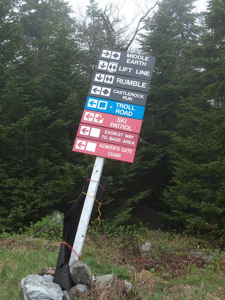
Sugarbush Signs
Location: 44.140919, -72.927461
Ski Trail Trail
Location: 44.141674, -72.927525
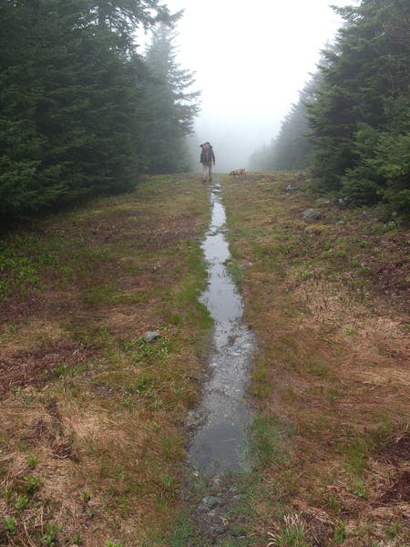
The LT cuts through the upper reaches of Sugarbush
Mad River Glen’s Single Chair
Location: 44.191621, -72.930851
The Realm of the Hump
Location: 44.211215, -72.931339