Published May 13, 2011 11:45AM
Local Hikes: West
Hike these long trails in Washington, Oregon, and California, and climb to a 10,064-foot peak in Angeles National Forest.
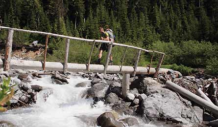
'The Wonderland Trail (David Tate)'
WASHINGTON
Wonderland Trail (Print & Go)
Fryingpan Creek to Box Canyon
Hit the highlights of the 93-mile trail in an easy weekend. This two-day, 15.5-mile route climbs to Panhandle Gap (look for mountain goats), tracks past glacier fields and raging waterfalls, then traverses a ridge overlooking Fryingpan Glacier on Rainer’s eastern flank.
WASHINGTON
Pacific Crest Trail
Pasayten Wilderness
There’s really no such thing as crowds on the PCT, but if you want maximum solitude, hike the northernmost 35 miles. From Harts Pass, the route stays high, riding 6,000-foot ridgelines and crossing broad meadows. Bonus: This stretch of trail sits in the Cascades rain shadow, which means you’ll likely get storm-free views of Mt. Baker and North Cascades National Park.
OREGON
Oregon Coast Trail
Neahkahnie Mountain
It’s easy to add this 1,631-foot peak to your thru-hike. Take a 5.4-mile loop (located just off the OCT) and climb to a summit meadow overlooking the deep blue Pacific. Scramble up the rocky outcrop for the best vantage point, says Salem-based map contributor Echo Hobbs. “You’ll see kitesurfers riding the wind and a vast coastline extending beyond Nehalem Bay.”
CALIFORNIA
John Muir Trail
Tuolumne Meadows to Devils Postpile
Score some of the JMT’s most classic views on this 31-mile section hike that starts less than two hours from Bishop. The three-day point-to-point runs south past shimmering alpine lakes and towering Sierra Nevada peaks to Devils Postpile, where hardened columns of lava pierce the sky. Shutterbugs: At mile 18.5, snap your own version of the scene shown below. (Ansel Adams’s classic photo of Banner Peak and Thousand Island Lake was also shot near here.) Get the best light in early morning and late afternoon.
CALIFORNIA
Pacific Crest Trail
CA 36 to Drakesbad Resort
Hike past steaming geyers and sizzling lakes on a 17.4-mile section in Lassen Volcanic National Park (the most thermally active stretch of the PCT). Near mile 16, look to your left for a glimpse of Boiling Springs Lake, a lime-green pool rimmed with mud pots. Caution: Keep your distance. Steam vents beneath the surface keep the temperature of the water around 125°F.
SEE THIS NOW
MT. BALDY
Angeles National Forest, CA
Payoff Climb to a 10,064-foot peak in the middle of SoCal’s biggest wilderness—less than an hour from metro Los Angeles. On a clear day, the views from Mt. Baldy stretch southwest to Catalina Island, east to the Mojave, and north to the San Andreas rift zone.
Time Most of Baldy’s snow melts by late May, turning 75-foot San Antonio Falls at mile .6 into a torrent. Since LA’s smog worsens in summer, May offers the best chance for clear vistas.
Place Start at Manker Flats Campground ($12/night, fs.usda.gov), and hike a nine-mile lollipop that gains 3,800 feet to Baldy’s summit. Road-walk .9 mile to reach the Baldy Bowl Trail on the left. Return via the knife-edge Devils Backbone Trail to the service road at Baldy Notch. fs.usda.gov