Updated July 15, 2025 07:37PM
Local Hikes: Los Angeles
The best local hikes in LA.
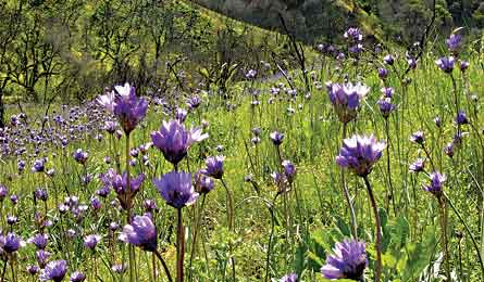
'The Canyon Trail, Placerita Canyon Natural Area. (Community Hiking Club)'
Best Local Hikes Home | California Home
Your Guide
Community Hiking Club (communityhikingclub.org)
Your Hikes
» Towsley-Wiley Canyons Loop, Ed Davis Park “The trails here are the best-kept secret in the L.A. area,” says club director Dianne Erskine-Hellrigel. The 6.2-mile loop winds through Towsley Canyon and switchbacks up a 2,500-foot ridge with unrivaled views of rugged mountains, vibrant lupine, and the Santa Clarita Valley rimmed by the San Gabriels. Drop into Wiley Canyon, then turn left on Canyon View Loop Trail for the 1.5-mile return trip. Miles from city center 30; Trip ID768676
» Canyon and Waterfall Trails, Placerita Canyon Natural Area Connect these two trails for a 4.8-mile (round-trip) hike that meanders along Placerita Creek and passes a natural seep where white oil bubbles from the ground. Roughly 1.6 miles in, turn right into Los Pinetos Canyon. Less than a mile later, stop for a photo-op at the 15-foot waterfall (seasonal) that pours down the rock walls, then backtrack to the trailhead. Miles from city center 31; Trip ID768661
» Bridge to Nowhere, Sheep Mountain Wilderness Trek to a now-defunct, 100-foot-high bridge spanning the East Fork San Gabriel River on this 10-mile out-and-back. From the ranger station, the rough trail drops to the canyon floor where it crisscrosses the river and intermittently follows the remnants of an old road built in the 1930s. Miles from city center 46; Trip ID 248631
» Devil’s Chair, Devil’s Punchbowl Natural Area This seven-mile out-and-back traces a 300-foot-deep canyon flanked by massive sandstone slabs. Turn left at mile 3.3 and scale a narrow rock ridge to Devil’s Chair, a 100-foot-high perch overlooking monolithic rock gardens and the surrounding San Gabriel Mountains. Miles from city center 76; Trip ID756632