Life List: Jökulsárgljúfur, Iceland

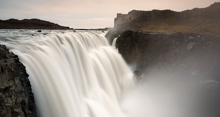
'Glacier-fed Dettifoss, where this hike begins, dumps water 144 feet into the canyon. (Tomas Kaspar)'

Glacier-fed Dettifoss, where this hike begins, dumps water 144 feet into the canyon. (Tomas Kaspar)

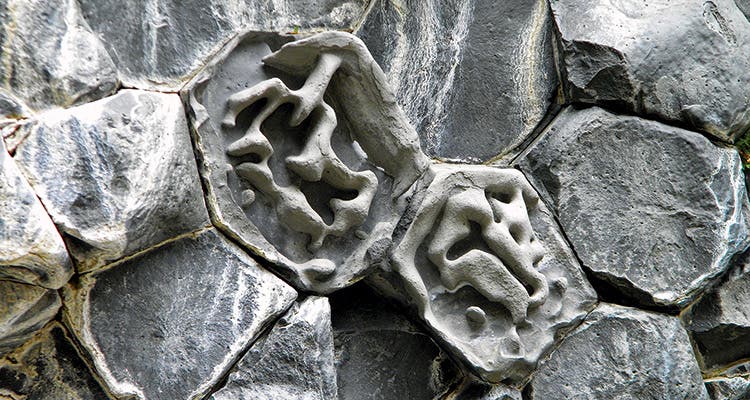
The gorge’s honeycomb basalt formed when the glacial river rapidly cooled magma from a shield volcano eruption 8,000 years ago. (Doug Schnitzspahn)
AFTER A DAY OF WALKING down the canyon of the Jökulsá á Fjöllum river, my 9-year-old daughter Isa is convinced that Iceland’s notorious huldufólk, or “hidden people,” inhabit these steep walls of igneous rock and glacial-melt cascades. She’s most worried about the trolls. If such creatures exist, the gaping, magma-formed cave in front of us—called a kirkjan, meaning “church”—seems like an ideal home.
When the June Arctic rain begins pelting us, the troll church is the only place to escape. Inside, our footsteps echo, and Isa begins to sing, her voice rising over the patter of rain outside the cave. And for maybe the tenth time on this two-day journey, we get that epic, humbling feeling: There’s magic here—maybe not in the form of mythical creatures, but certainly in the visceral power of standing within the raw workings of a still-evolving planet.
A million tourists—many of them hikers—will visit Iceland this year, drawn to the geological secrets of a place that straddles the North American and Eurasian tectonic plates. Most of these folks focus on the southern half of the island, home of the Eyjafjallajökull volcano that burst its top in 2010 and the easy-access, 50-mile, hut-to-hut Laugavegurinn trek.
Looking to escape those crowds, we instead chose this 20-mile trek on the quiet, northeast corner of the island, a seven-hour drive from Reykjavik. The mostly flat path through the narrow Jökulsárgljúfur (yuh-kul-soar-glyu-fur) section of Vatnajökull National Park is easy to navigate, ideal for taking photos and your time—both of which you’ll want to do as you follow the runoff of Europe’s biggest glacier through the canyon’s high-walled, honeycomb basalt corridor.
We began at Dettifoss, the most powerful waterfall in Europe, a Niagara Falls-like torrent that spills from the bare, rocky tundra. By the time we reach the troll cathedral near mile 13, we’ve tented in a grassy, bright green valley, navigated a series of fixed hand ropes across steep rock, passed a cluster of springs that burbled down viridescent tundra, and seen the chaos of whirlpools in the Jökulsá—only encountering a few hikers on our first day.
We don’t find any trolls within the spooky puzzle of lava rock, but my daughter hasn’t given up hope that other legends are true. Toward the end of the day, we emerge from red dirt hills atop the lip of Ásbyrgi, a horseshoe-shaped canyon said to be formed by the hoof of the Norse god Odin’s eight-legged steed Sleipnir. It’s filled with a tangle of white birch trees and hosts an emerald pool. It’s also said to be the capital city of the elves. Isa wonders if we can stay another day to look for them.
DO IT The 20-mile trek takes two days (camping only allowed at Vesturdalur near mile 12 and at the finish at Ásbyrgi). You can do it either direction (shuttle info below). Get there The drive to Dettifoss from Reykjavik takes about seven hours, or you can fly into Iceland’s second biggest city, Akureyri, which is a two-hour drive from Dettifoss. Shuttle info Fjallasýn offers rides depending on road conditions; check booking rates and details (+354 464 3941; info@fjallasyn.is). Season Go in the early season (May and June) when the road between Dettifoss and Ásbyrgi is closed (so only trekkers can access the area). Contactbit.ly/JokulTrek