Updated March 8, 2024 10:59AM
Hike Through Forests, Lakes, and Historic Mansions On The Rubicon Trail
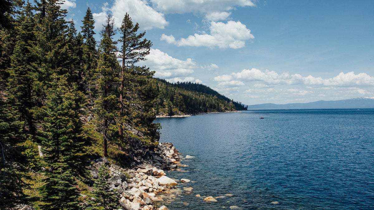
This 10.6-mile out-and-back links thick lodgepole pines, stunning overlooks, and jade-colored waters reflecting the high Sierra.
(Photo: MingzheZhang via Getty Images)
Hike through history and the jade waters around Lake Tahoe on the Rubicon Trail.
How To Hike The Rubicon Trail
There is no trail-specific permit required to hike the Rubicon Trail. On this 10.6-mile trail, you’ll begin with a gradual descent to Emerald Bay and historic Vikingsholm Mansion. Hike down a wide, dirt path as it zigzags through a tall coniferous forest filled with lodgepole, ponderosa, and jeffery pine. From the north end of Vikingsholm pulloff, hike northeast down the Vikingsholm Trail. Then, turn right at 3-way junction and follow the dirt path to Vikingsholm mansion.
Built during the summer of 1929, this rustic, Scandinavian-style mansion, with its sod and shingled roof sits prominently at the edge of Emerald Bay (look to the east, you’ll see the clear, jade-colored water). Spend some time checking out the expert craftsmanship and then continue hiking along the path toward Rubicon Point. The path, a strip of sandy singletrack, follows the shoreline and crosses over bubbling spring-fed brooks while flanked with shiny, rust-covered manzanita bushes.

Soon, you’ll pass through Boat Campground and continue to parallel the bay. From the shoreline, you can see views of Fannett Island and the famous tea house sitting on top. As you hike, cut through an open forest where azalea bushes flank the trail and continue as the trail turns away from the water and back into coniferous forests.
After climbing 150 feet above the water, stop for a breather at Emerald Point—a rocky point where granite boulders are covered in patches of pink and green lichen. This also offers fabulous views of the lake and mountains to the north and east.

As you hike, the trail follows a narrow ledge with open forest dotted with bushes and large rock slabs. Continue on dirt path covered in pine needles. Don’t forget to take the time to look back for views of headlands and coves to the south. On a clear day, it is also possible to see the slopes at Heavenly Resort on the right. Thick brush hangs into the trail as you ascend up several switchbacks away from the lake. You’ll pass through clear cut-forests on your way with peek-a-boo views of the lake through the trees.
ADVERTISEMENT
And then comes the history. Walk down 40 steps cut into the granite ledge leading to the wooden lighthouse. You’ll get to what was once the highest elevation lighthouse in the world. After checking out the digs, ascend the stairs to return to the trail. The path, a dirt-packed, pine needle covered walkway, cuts through open areas interspersed with lodgepole pines. The trail steadily ascends back up to D.L. Bliss State Park, toward Rubicon Point and stunning views of South Lake Tahoe. Snap a pic of these views while spring-fed creeks cascade violently to the lake below. Grab a snack at Rubicon Point, one of the best views of Lake Tahoe, before making a U-turn and returning on the Lighthouse and Rubicon Trail. Take a moment and soak in sweeping views of the Sierra Nevada and crystal-clear, jade-colored water.
Optional: Bring your swimsuit and head down the Calawee Trail to Calawee Cove, where a sandy, quiet beach is the perfect place for a refreshing dip in Lake Tahoe’s frigid waters.
