Published February 5, 2015 06:50AM
La Cloche Silhouette, Ontario
Take an up-and-down tour of Ontario's lake district.
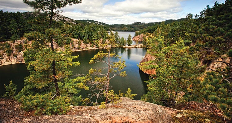
'Overlooking Killarney's lake district. (Michael P. Gadomski)'
The numbers: 49 miles, 6 to 8 days
The hike: French voyageurs named these mountains La Cloche (“the bell”), and the deceptively tough terrain might ring your chimes if you’re not in good shape. Despite no summits over 1,800 feet, this Killarney Provincial Park loop gains almost 8,500 feet as it winds over bare ridges of 2.3 billion-year-old quartzite; park rangers suggest a schedule of only 5 to 8 miles a day. Just as likely to slow the pace: frequent stops to photograph azure lakes, old-growth hemlock forests, and blindingly white cliffs. Going clockwise lets you start on relatively moderate terrain, though you can still expect wet boots and rough footing (including beaver-dam stream crossings). Keep an eye out for moose, black bears, otters, and osprey from the lakeside campsites—target the unique H21 site, a peninsula poking into Three Narrows Lake. From here, it’s all up and down—soak your feet at day’s end at secluded campsites by Little Mountain Lake (H33) and Boundary Lake (H35)—until the Crack, the chasm that exits the mountains. Enjoy views stretching as far as Georgian Bay on Lake Huron.
TRIP PLANNER
ADVERTISEMENT
Trailhead 46.014169, -81.401650; George Lake, Ontario 637, north side of Lake Huron
Red tape Trip plan must be filed and campsites reserved ($12/night plus $13 booking fee; 888-668-7275)
Season mid-May to mid-October