Published September 20, 2013 02:26PM
Joshua Tree National Park: Coxcomb Mountains
This 12.4-mile dayhike or overnighter hits the park's lesser-traveled northeast tip, linking cactus lands to unnamed peaks. Good navigation skills required.
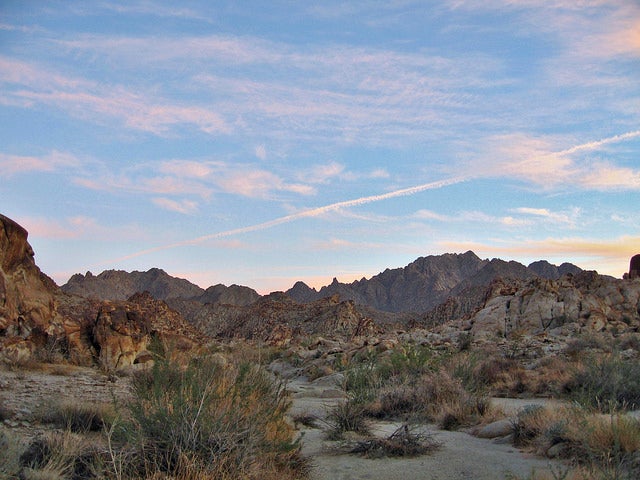
'Coxcomb Mountains (Photo by Joshua Tree National Park)'
Mapped by Peter Rives
Trail Facts
- Distance: 10.0
Waypoints
CMT001
Location: 34.0951347351074, -115.420799255371
Head S from backcountry billboard. Note: Pack at least 100 oz. of water for this day trip, more for an overnight
CMT002
Location: 34.0849685668945, -115.421890258789
Terrain remains relatively flat; jackrabbits bounce through low-lying creosote bushes
CMT003
Location: 34.0711250305176, -115.425399780273
Begin to bear L toward the bone-dry ridgelines of the Coxcombs; see spidery ocotillo and cholla cacti
CMT004
Location: 34.0616493225098, -115.419746398926
Nice spot for camp (self-registered permit required)
CMT005
Location: 34.0525436401367, -115.41088104248
Hike SE, following wide, sandy wash
CMT006
Location: 34.0451507568359, -115.400169372559
Scan canyon walls for tell-all scuffs and gouges from past floods
CMT007
Location: 34.0412902832031, -115.394409179688
Trail fades out, heading SE into small gap; start short but tough lollipop loop
CMT008
Location: 34.0348320007324, -115.386497497559
Turn R, hiking WSW. This unmarked trail fades in and out as it scrambles over boulders (hardest section is rated Class II-III)
CMT009
Location: 34.0351982116699, -115.394813537598
ADVERTISEMENT
Small saddle. Good break spot. Take in sky-high desert views, and the N-to-S-running canyon forming the craggy Inner Basin. Head N down steep gully to close loop
CMT010
Location: 34.0402183532715, -115.395652770996
Don’t miss: General Peorge Patton used this bunker to train troops. Return to WPT 7 and retrace route to car