Joshua Tree's Best Backpacking Route: The California Riding and Hiking Trail

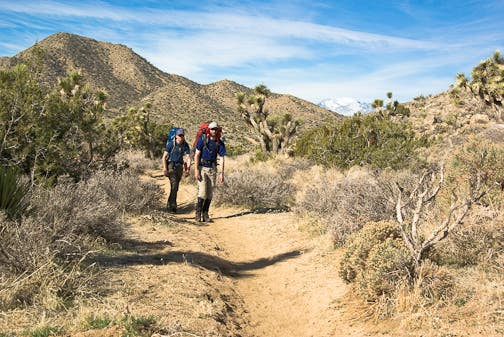
The California Riding and Hiking Trail (CHRT) is the premier backpacking route in Joshua Tree National Park, stringing together lonely cacti and pinyon landscapes with iconic Joshua trees, incredible desert overlooks, and rock formations that defy Newton’s Law. Backpackers can thru-hike this trail in three days or choose from several accessible trailheads for shorter day-hike or overnight options.
Trail Facts
- Distance: 36.6 one way
- Elevation Gain: 3,060 feet
- Difficulty: Challenging
The Hike: California Riding and Hiking Trail
Section 1: Black Rock Canyon Trailhead to Upper Covington Flats Trailhead

The California Riding and Hiking Trail is best thru-hiked from west to east. Start at the Black Rock Canyon trailhead located five miles south of the town of Yucca Valley at the Black Rock Canyon campground. This 7.5-mile section begins by weaving through low scrubland and past several side trails to a wide sandy wash. Next is a 1,000-foot uphill march and the steepest elevation gain of the whole hike. From the highpoint at 5,130 feet, it’s two mostly downhill miles to the Upper Covington Flats trailhead.
Section 2: Upper Covington Flats Trailhead to Keys View Trailhead

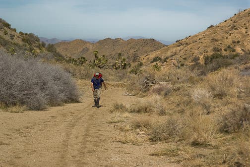
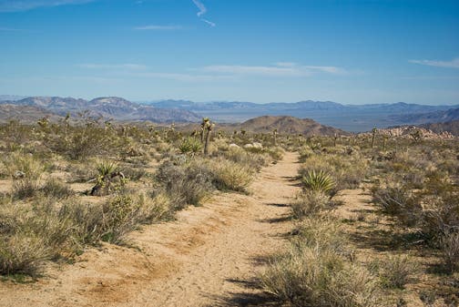
The 10.8-mile section from Upper Covington Flats to Keys View is the longest and most remote section of the CRHT. The trail is often overgrown so wear long pants or the woody and thorny underbrush will cheese grate your legs into a scratchy mess. Trace a desert plateau for .9 mile before descending into a sunburnt valley. The trail crosses several dry washes in Covington Flats and climbs again to a panoramic ridge just below 5,000 feet with views over Juniper Flats. Look north to Quail Mountain, the highest mountain in the park at 5,813 feet. Now, descend into Juniper Flats where you’ll see groves of bushy armed Joshua Trees. Many unique rock formations dot the topography as the trail turns downhill into Lost Horse Valley to Keys View trailhead.
Section 3: Keys View Trailhead to Geology Tour Trailhead

Since it’s near the halfway point, Keys View trailhead is a good place to stash extra water. From the road, head east .8 mile to Ryan Campground. Next, begin a short climb. Near the top, you’ll pass junk left by gold miners, including old building foundations, wagon parts, and a mine shaft just south of Ryan Mountain. The trail quickly climbs again and continues to Geology Tour trailhead to end this 6.5-mile leg.
Section 4: Geology Tour Trailhead to Pinto Basin Road

It’s only 4.4 miles from Geology Tour Road to the next major trailhead on Pinto Basin Road. This is a great option for day-hikers and has little elevation gain. Head east across dry washes and high spots with views into a geological wonder called Jumbled Rocks. The trail flows in and out of various washes so navigate with caution. The last two miles offer spectacular views of Pinto Basin, a parched zone of sunken rocks that connects the Sonoran and Mojave deserts.
Section 5: Pinto Basin Road to North Entrance Trailhead

From Pinto Basin Road the trail swings north and in 1.3 miles passes a side trail on the left to Belle Campground. Stay on the CRHT. You’ll cross a dirt road 1.4 miles later. From here to the trail’s end the path becomes faint in spots, so when in doubt, bear due north. You’ll climb a small hill with views over the town of Twentynine Palms. To finish this 7.3-mile stretch, continue north-northwest to the North Entrance trailhead.
Why You’ll Love the California Riding and Hiking Trail

This 35-plus-miler is filled with beautiful views, historic finds, geologic wonders, and incredible camping. Here’s what you can look forward to along this hike:
The Views
- Little San Bernadinos
- Ryan Mountain
- Quail Mountain—the highest in the park.
- San Bernadinos
- San Gorgonio—Southern California’s highest point.
- Mount San Jacinto
- Juniper Flats
- Joshua Trees (obviously!)
- Twenty-nine Palms Valley
Geologic Wonders
- Jumbled Rocks—think Legoland for rocks.
- Pinto Basin
- Unique rock formations
History
- Gold miner buildings and paraphanelia.
Permits and Logistics
When to Go
Temperatures are ideal from fall through spring, and wildflowers bloom from February to April, depending on elevation.
Water
Drop water caches before you start and carry at least six liters of water per person per day, more if daytime temperatures rise above 85 degrees.
Permits
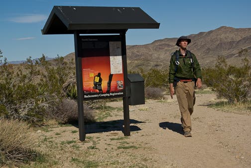
There is no fee for backcountry camping in Joshua Tree. Backpackers are required to park and register at designated backcountry registration boards. Learn more.
The Map: The California Riding and Hiking Trail
–Mapped by Ben Fullerton, fullertonimages.com
