Jackson, WY: Horse Heaven Loop

Thanks to more popular neighbors in the region, the Wyoming Range has open ridgeline miles, trout-filled streams, and pristine campsites—and no crowds. The catch? You have to find the way using unnamed paths that can fade into nothing. Start this three-day, 17-mile loop at the Little Greys trailhead and follow the Little Greys River Trail along a grassy bench for 1.1 miles to the Pickle Pass Trail junction. Go right, continuing .5 mile through an aspen grove.
At 3.5 miles, traverse a 60-foot-wide gully that smells of sulfur from a nearby thermal area. The trail parallels the Little Greys for a mile to a rocky, calf-deep ford of a freestone (i.e. snowmelt-fed) river that may become impassable during June. Boot up, cross a meadow dotted with white mule’s ears flowers (August), and turn north at a trail junction. In .1 mile, fork northeast and begin a 2.5-mile, 1,000-foot ascent that ends in an immense alpine meadow at the headwaters of the Little Greys River. Camp at mile 7.5 near an unnamed pond shaded by subalpine fir and whitebark pine.
Next morning, hike north, crossing 9,000-foot Cliff Creek Pass then the creek itself to enter Horse Heaven Meadows. This remote, several-thousand-acre upland area houses moose, elk, mule deer, and sometimes gray wolves. Crest a 9,100-foot unnamed pass at mile 8.6, hike along the western rim of a 700-foot-deep gorge, then bend west. At 10.4 miles, reach the top of a timbered ridge, and continue 1.6 miles to the night’s camp in a meadow.
On the final morning, hike southwest into a forest of fir, pine, and spruce. At mile 13.1, climb north to a rocky ridge with views over the Wyoming Range to the Tetons, 35 miles north. At Pickle Pass, begin a gradual descent toward the Little Greys River, which courses 1,300 feet below. Reach the Pickle Pass Trail junction in another 1.8 miles and head west to the trailhead.
PERMIT Not required
CONTACT (307) 739-5500; fs.fed.us/r4/btnf
GEAR UP Teton Mountaineering, 170 N. Cache Dr., Jackson. (307) 733-3595; tetonmtn.com
-Mapped by Jason Kauffman


Trail Facts
- Distance: 27.4
Waypoints
GRE001
Location: 43.070827, -110.688213
Leaving the trailhead, follow the trail along a grassy bench above the Little Greys River.
GRE002
Location: 43.070389, -110.667267
Keep right at the Pickle Pass Trail junction.
GRE003
Location: 43.068288, -110.660717
The trail passes through a lovely stand of large aspen trees.
GRE004
Location: 43.065772, -110.64644
Watch for water-loving wildlife as the trail wraps around the north side of a marshy pond.
GRE005
Location: 43.063723, -110.629168
Traverse an eroded gully smelling strongly of sulfur.
GRE006
Location: 43.060342, -110.612938
Ford a calf-deep section of the Little Greys River. Be cautious at this crossing if the river is swollen from early season snowmelt.
GRE007
Location: 43.059867, -110.610931
The trail crosses a large meadow carpeted in the bright white mule’s ear flowers. This is a great spot to take a break and soak in the views of higher peaks to the north.
GRE008
Location: 43.059533, -110.60568
Take the sharp turn left at the trail junction.
GRE009
Location: 43.06102, -110.605963
Begin a 2.5-mile, 1,000-foot ascent that ultimately ends in an immense alpine meadow at the headwaters of the Little Greys River. Watch for elk, deer and other local wildlife foraging in the open meadows on both sides of the climb.
GRE010
Location: 43.066441, -110.60144
Carefully negotiate around the large boulder and log-filled blowout. The trail resumes on the other side.
GRE011
Location: 43.08223, -110.597505
Watch for a nice break spot in the small cluster of trees on the right side of the trail.
GRE012
Location: 43.091969, -110.593361
Day 1 camp. Remove your pack and find a nice place to pitch your tent near one of the small, unnamed lakes to the right and left of the trail.
GRE013
Location: 43.093868, -110.591968
Look to the right for the massive rock slide coming off a shoulder of 10,862-foot Hoback Peak.
GRE014
Location: 43.09603, -110.595956
Cross 9,000-foot Cliff Creek Pass. Beyond are the rolling, bright green uplands of Horse Heaven Meadows. Keep an eye peeled for grey wolves, moose, elk and other native fauna that inhabit these high-elevation lands.
GRE015
Location: 43.098805, -110.596979
Cross Cliff Creek, now just a mere trickle near the headwaters. Parallel the creek northwest towards the distant saddle as the trail becomes faint in places.
GRE016
Location: 43.104932, -110.599912
Cross an unnamed ridgetop saddle and leave Horse Heaven Meadows.
GRE017
Location: 43.111377, -110.597842
A short detour off the main trail takes you to a scenic vantage point high above a lush green gorge full of wildlife. For folks attempting this loop in two days, this makes an excellent campsite.
GRE018
Location: 43.115934, -110.605943
Cross a small tributary stream set in a sea of rolling, bright green meadows. The author spotted numerous wildlife along this stretch, including a pair of heavy-antlered mule deer bucks. Angle northwest up the slope to the next ridge as the trail becomes faint.
GRE019
Location: 43.117897, -110.608228
Regain the trail again as it makes a sharp change in direction to the southwest. In about a quarter mile watch for the faint trail across the wide basin that angles up the steep slope to a timbered ridge.
GRE020
Location: 43.113544, -110.614005
Crest the timbered ridge as the trail once again becomes easy to follow. For the next couple miles the trail stays high with wide views in all directions.
GRE021
Location: 43.092662, -110.614381
Day two campsite. Pitch your tent on the left side of the trail in the old outfitter campsite under the trees. Look for water in the wet meadows to the right side of the trail.
GRE022
Location: 43.082884, -110.628397
Turn sharply where the faint trail bends right at a junction and climbs steeply to the open, rocky ridge at mile. For the next mile watch in openings in the trees for views of the rugged Teton Range, some 35 miles to the north.
GRE023
Location: 43.086935, -110.644192
Cross Pickle Pass. Immediately begin a steady, 1,300-foot descent to the Little Greys River.
GRE024
Location: 43.077491, -110.656761
Take a short detour to the rocky vantage point, with excellent views of the Little Greys River below. From here, continue to a reunion with the Pickle Pass Trail junction. From there, return to the trailhead.
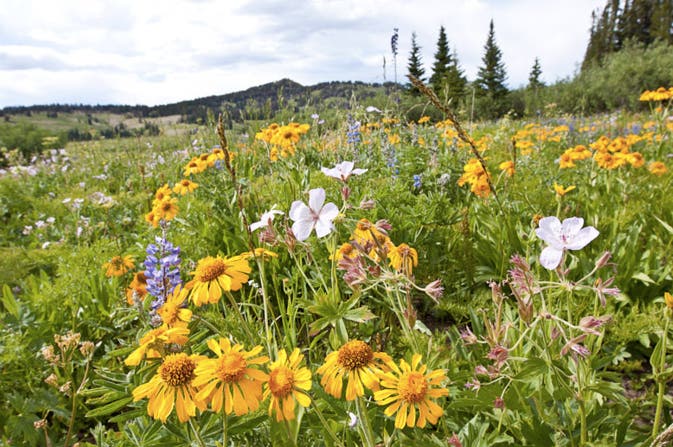
Flower-filled meadow
Location: 43.086097, -110.5937
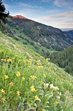
Lush green gorge
Location: 43.107531, -110.598979
Steep flower-covered slopes drop to an unnamed creek in a remote portion of the wildlife-rich Wyoming Range.
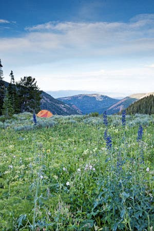
Wyoming Range campsite
Location: 43.11133, -110.598367
Hikers can expect crowd-free campsites when backpacking in the Wyoming Range.
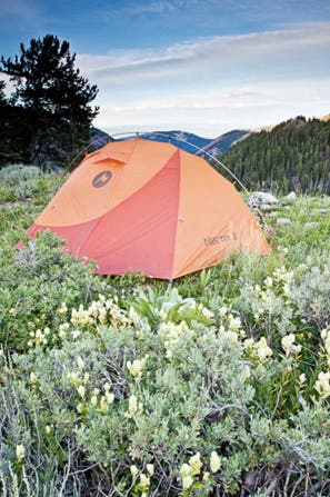
Camp with a view
Location: 43.111377, -110.59767