Updated December 4, 2024 03:00AM
Hike the Living Desert in Ironwood National Monument, Arizona
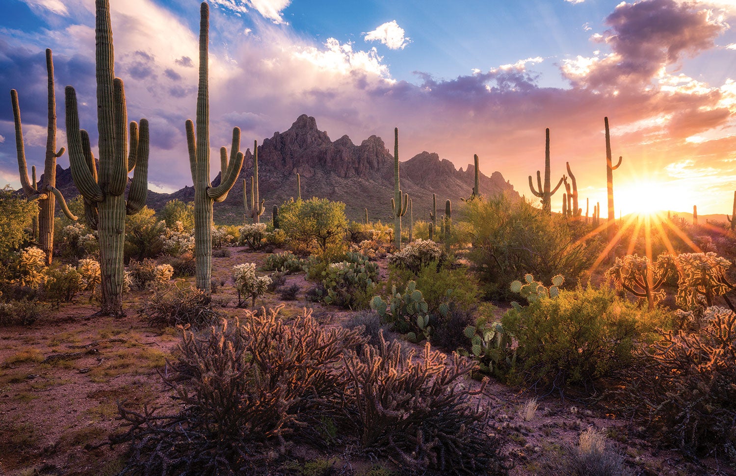
The Ironwood Forest is a true redemption story. Home to arroyos, plains, foothills, and mountains, the monument’s coarse and well-aerated soil allows roots to dig deep. The result: The world’s densest stands of ironwoods, low-growing shrubby trees that enrich the earth, enable the Ironwood Forest’s species diversity, and burst with purple-pink flowers in late spring.
'Gannon McGhee'
The Insider
The uncharted territory of the Ironwood Forest drew Gary Borax from mile one. A decade ago, he started exploring the monument and hasn’t stopped. Borax quickly learned the lay of the land, even though there weren’t any hikers’ maps. In the late 2000s, he went ahead and made the maps himself. He also volunteers with Friends of the Ironwood Forest, cleaning up garbage, restoring ecosystems, and leading group hikes to raise awareness.
Warm Up
Jumping right into the good stuff is easy in the Ironwood—just drive up to the base of any mountain range to find drainages, forests of shrubs and wildflowers, limestone cliffs, and desert views for miles. But Waterman Peak, a jaunt of just over a mile, is special in its own right. As a rare desert limestone uplift, it’s prime real estate for the endangered Nichol’s Turk’s head cactus, a round blue-green barrel that occurs in only three small populations in Arizona and Mexico. Waterman also claims the easternmost territory of the elephant tree, which lines the mountainside with red-hued branches.
ADVERTISEMENT
Follow an abandoned mining road halfway up the mountain’s east face, then bear right for a steep bushwhack to the 3,773-foot summit, passing decrepit timber structures from the old mines and succulent gardens sprouting through limestone cracks. Reach 360-degree views at the top, where bighorn sheep have flourished since the monument’s protection in 2000. The vertical cliffs of the Silver Bell Mountains rise above the defunct mines to the north, the pyramid-shaped Coyote Mountains squat to the south, while rough desert scrub and groves of saguaro fill the spaces in between.
Tower of Flowers
Survey the jewel of the monument—the craggy knobs of Ragged Top—from top to bottom with a basecamp overnight. Day one: Summit 3,907-foot Ragged Top, where volcanic soil hosts a Garden of Eden: 410 types of plants–69 percent of the monument’s flora–sink roots into this aerie. It’s only 1.3 miles to the top, but give yourself 6 or 7 hours to get there and back–—class 3 and 4 scrambling makes the journey sporty and you’ll want to stop and stare at both the views and the flora.
From the drive-up group campsite at the base of the mountain, climb 200 feet to Wolcott Saddle among saguaros and foothill palo verde. Continue west to a second saddle, then take a sharp right to scramble up a narrow chute. Ascend the scree slopes of the 22 million-year-old mountain to its summit.
ADVERTISEMENT
Next day, start the same way, but this time bear south off the first saddle and make a wide loop around Wolcott Peak, circling it in about 3.6 miles. Trek through the ups and downs of quintessential Sonoran Desert: patches of hibiscus and purple allionia, creosote bushes, and spring-flowering saguaros protruding from dense stands of ironwood trees, which sprouts its own delicate pink flowers in May and June.
On flat plains where javelinas forage for agave and prickly pear, look down to spot desert tortoises or iguanas among the scrubs, then look to the peak above to spy curious bighorn sheep. “They’ll come out and say hi,” Borax says. Bring plenty of water—there are no springs here.
Down Low
The best way to get up close and personal with the desert is a short, intense bushwhack through the veins of ancient rivers, where low shrubs and ironwoods a dozen feet tall grow thick. Head for the south side of Ragged Top and wander through dense patches of mesquite and blue palo verde near its base. But be warned: “The desert’s a hard place to live,” Borax says. “Even the plants had to evolve thorns to survive.” So take your time, and try not to get too scratched up.
Up High
You can’t appreciate the full sweep of the Ironwood Forest without visiting its tallest mountains and taking it all in. Silver Bell Peak is the tallest in the monument at 4,199 feet—and it’s only a 4.2-mile hike there and back. Ascend nearly 2,000 steady feet from the parking lot (marked by an old windmill) through arroyos lined with green stone and dense stands of ironwoods and foothill palo verde. The vegetation thins to low-growing jojoba bushes as you hike the increasingly steep slope. Keep an eye out for bighorn sheep on the upper saddle, where a rainwater guzzler is maintained for them (BYO drinking water). From the solitary summit, the scrub-dotted Avra Valley stretches out to the east and Ragged Top’s molar-like formations protrude to the north.
ADVERTISEMENT
Cool Off
After a long day in the sun and dry desert heat, head down to Avra Valley to the classic bar and grill Circle S Saloon. Try a specialty cocktail (like the Sexy Gator) or coffee drink (perhaps a Hot Chocolate Turtle?) and satisfy your hiker appetite. “They’ve got good hamburgers,” Borax says—and on Mondays, you can build your own. Other specials throughout the week include Wino Wednesdays and Taco Sunday.
Trip Planner
Season October to May for more moderate temperatures and weather (but most peaks are under voluntary closure during bighorn sheep lambing season from January to April) Permit None