Published January 25, 2008 11:21AM
How to Thru-Hike L.A. County
Thru-hike L.A. County? It can be done with Southern California's Backbone Trail.
'Photo courtesy Bryon Moore'
Call the producers:
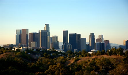
Right in the heart of Los Angeles, a few miles north of Malibu’s famous coastline, is the 68-mile Backbone Trail, a temperate chaparral paradise bordering the Hollywood hills. A 20-year work-in-progress (64 miles have been completed, with a finish date of “any day now”), the Backbone entails a handful of logistical challenges. But if you’re good with a map and like back-to-back 10-hour treks, you’re practically guaranteed to be the first person on the block to thru-hike L.A. County. Do it in four days, or slice it into a handful of spectacular dayhikes just miles from Universal Studios.
The Route
The Backbone traces rolling hillsides and oak woodlands with ocean views before crossing 3,111-foot Sandstone Peak, the high point of the 153,075-acre Santa Monica National Recreation Area. The trail system, 30 percent of which travels fire roads, starts at Point Mugu State Park and winds through Malibu Creek and Topanga State Parks before terminating at Will Rogers State Historic Park.
Do It
If you’re going the distance, plan to hike 13 to 25 miles per day for four days. From the Ray Miller trailhead it’s 16 miles to Circle X Ranch, where a state-run campground is one mile south on Canyon View Trail. Day 2 is the crux: 25 miles from Circle X to Malibu Creek. But well-maintained trails let you hike three to four mph across rocky ridges and lush valleys that smell like the sea. Leave the trail for two short asphalt detours (at Little Sycamore Canyon Road and Encinal Canyon Road totaling 3.5 miles. On day three, trek 14 miles to Musch Campground in Topanga Canyon. It’s 12 miles to the trail’s end, near Sunset Boulevard.
Season
Head out in fall or winter (highs in the 60s and 70s) and skip summer’s triple-digit valley afternoons.
Camping
It’s the most logistically challenging aspect of a Backbone thru-hike. Circle X Ranch ($2, 805-370-2301) is a group campsite, but park officials will let you stay on a weekday, depending on space. Malibu Creek State Park, at mile 41, has 62 reservation-only sites ($25; 800-444-7275), and 8-site Musch Campground, at mile 55, caters specifically to weary backpackers ($3, first-come/first-served). Download details at the SMMNRA site (see contact below).
Water
There’s only one natural year-round water source: Malibu Creek. But campgrounds have water and restrooms.
Access
Roads intersect the Backbone at more than 10 different spots, and there’s bus service at Sunset Blvd. (metro.net)
Best Dayhike
For a sweet slice of ridge-top hiking, tackle the 12-mile stretch between Kanan Dume Road and Tapia Park on Malibu Canyon Road.
Best Overnight
From Will Rogers State Historic Park (11), hike 12 miles to Musch Campground on winding switchbacks. Sleep under starry skies (yes, you can actually see them on a clear night), and arrange for a ride at the Trippet Ranch parking lot (12), another mile up the Backbone.
Maps and Guide Tom Harrison Maps: Point Mugu, Malibu Creek, Zuma-Trancas, and Topanga ($9 each; tomharrisonmaps.com)
Contact Santa Monica Mountains National Recreation Area Visitor Center: (805) 370-2301; nps.gov/samo