Published November 20, 2019 10:36PM
Explore Otherworldly Tree Tunnels on Big Frog Mountain, Tennessee
Hike a rhododendron forest on this 19.1-mile loop.
'US Forest Service'
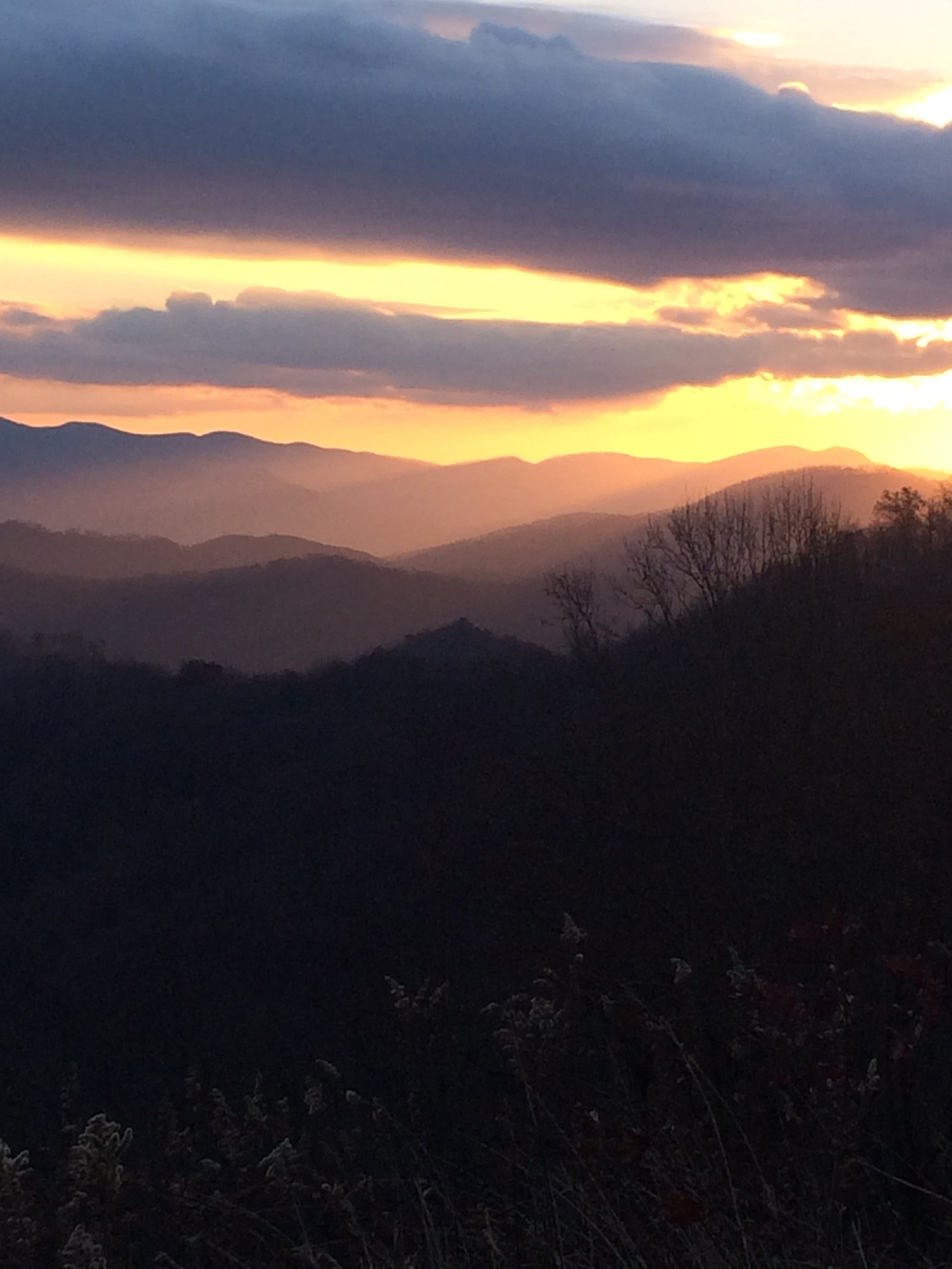
After a night of wild, howling winds surging through the treetops above my campsite, I wake with the dawn. The rain that drummed on my hammock all night has turned to sheets of ice with the approaching cold front; A thick, freezing fog has developed here at the top of Big Frog Mountain, coating pine needles, leaves, and spider webs in sparkling frost. I break camp in the chill and start on the next leg of the hike, a series of rhododendron tunnels. The eerie, hunching trees loom phantom-like over me through the swirling mist.
It’s a far cry from the golden-warm sunlight I enjoyed yesterday, as I traversed the mountain side and wove in and out of ravines, watching wandering clouds that paint the rolling landscape with rich shadows. Today, in the fog, I’m descending into the greenery of the Rough Creek valley—with a few more views of the hills, if the clouds burn off—and then back to my car. But no matter how far away I go, my heart will remain up here in the wilderness, where it belongs.
Turn-by-turn from the Big Frog Trailhead on Forest Road 221
(1) Follow the Big Frog Trail 2.4 miles to Low Gap, then turn west at the three-way intersection onto the Grassy Gap Trail.
(2) Hike the Grassy Gap Trail for 5.2 miles. At mile 2.8 there is an unmarked intersection with the Big Creek Trail—go straight.
(3) Continue on the Grassy Gap Trail to the T intersection with the Wolf Ridge Trail and turn left.
(4) Hike the Wolf Ridge Trail for 0.7 mile, then turn left onto Hemp Top Trail at mile 8.3.
(5) Follow Hemp Top Trail 1.9 miles to the campsite at the summit of Big Frog Mountain.
(6) In the morning, continue on Hemp Top Trail 0.5 mile, past the spring to the right 0.15 mile in, and turn left onto Licklog Ridge Trail at mile 10.7.
(7) Follow Licklog Ridge Trail for 3.8 miles and turn left onto Rough Creek Trail at mile 14.5.
(8) 2.1 miles after the turn Rough Creek Trail intersects the West Fork Trail. Look for a trail sign post missing its sign that marks the Rough Creek Trail turning sharply west away from the creek as a narrow single-track trail, and follow that.
(9) At mile 17.6 reach a T-intersection with the Big Frog Trail. Turn right and follow Big Frog 1.5 miles back to where you started.
ADVERTISEMENT
Campsite: Big Frog
At over 4,000 feet, Big Frog is the first real peak east of Oklahoma. Camp right on top of the mountain in one of three large sites interspersed between hardy oaks and hickory at mile 10.2. While the views from the campsites are limited to forest and low shrubs, the frequent breeze through the trees will lull you to sleep at night. During the winter it’s quite common for a fog to roll in and coat every twig and blade of grass with rime frost; you just might wake up in a crystalline ice palace.
Explore
Find the best views on the trail during day 1 at the intersection of the Grassy Gap and Wolf Ridge trails. Explore northward on Wolf Ridge for additional views of the Tennessee Valley to the west before returning to the route. On day 2, about half a mile along the Big Frog Trail from your campsite, explore a section of trail commonly referred to as the “enchanted forest”. Large rhododendrons hang over the trail here, creating fantastic tunnels.
Wilderness
The 8,000-plus acre Big Frog Wilderness was designated a Wilderness Area in 1984. When combined with the adjacent 37,000-plus acre Cohutta Wilderness in northwestern Georgia, Big Frog makes up the largest contiguous federally designated Wilderness Area east of the Mississippi.
ADVERTISEMENT
Play it Safe
While trails here are generally well maintained, they are not well-marked outside signage at some major trail crossings. Take your map and compass or GPS to be sure you’re heading in the right direction and that you don’t miss a turn. Pay special attention at the intersection of Rough Creek Trail and West Fork Trail, as many people follow the creek and miss the turn. And while there is signage at the four way intersection at Low Gap, it does not identify the Grassy Gap Trail.
DO IT Distance 19.1 miles (loop) Time 2 days Difficulty 2 of 5 Trailhead 35.0543, -84.5015, off Forest Road 221 Season Winter or early spring, before the foliage grows in, have the best views. Permit No permit or reservation