Published May 24, 2017 01:07AM
The Insider's Guide to Katahdin Woods and Waters National Monument
Get to know Maine's brand new national monument with a little help from an insider.
'Little Outdoor Giants'
We welcomed the Northeast’s most pristine watershed to the national park system last August with itchy feet. Now go see what the fuss is about. Hint: old-growth forests, craggy peaks, hidden waterfalls, and A-list wildlife.
The insider
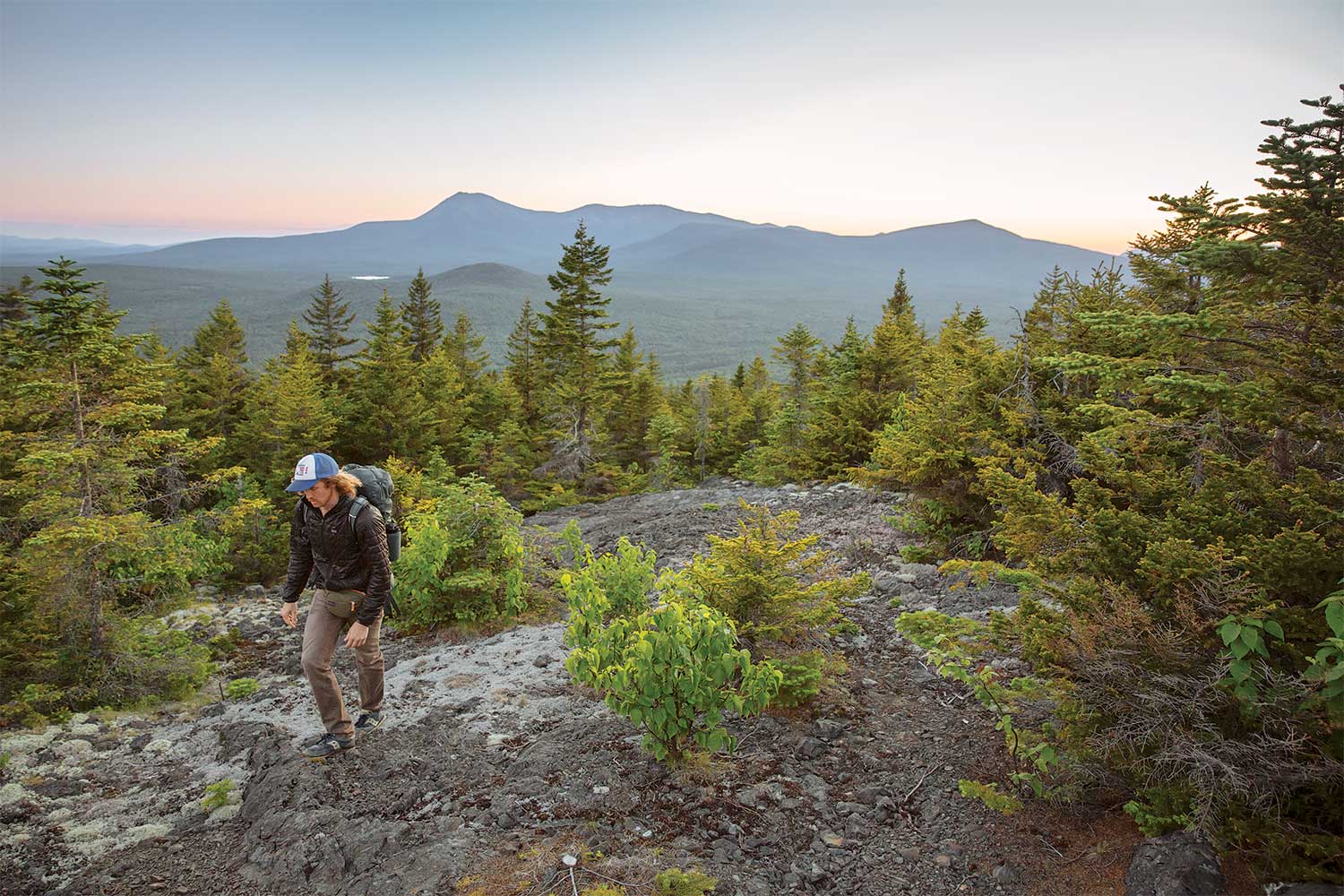
What is now a national monument was until last fall Lucas St. Clair’s backyard.
“I spent my childhood canoeing, hunting, and fishing here,” says the lifelong Mainer. His mother, Burt’s Bee’s founder Roxanne Quimby, donated it to the federal government last year. In 2011, St. Clair took responsibility for the campaign to turn it into a park and spent his days showing it to congresspeople, National Park Service reps, school groups, and more. In the process, he’s hiked, skied, and biked every inch of the park’s 150 miles of trail “and then some.”
Cascade hike
Waterfalls are a major part of Katahdin Woods and Waters, and according to St. Clair, the best is Orin Falls on the remote Wassataquoik (“wass-ata-cook”) Stream. Take the only trail from Loop Road (between mile markers 15 and 16) and follow it 3 miles to the series of small drops and pools. Scout an established campsite along the riverbank because you’ll want to linger: “I’ve walked a long way up and down that river,” St. Clair says. “It’s a spiritual place.”
ADVERTISEMENT
Multisport
You could simply hike 1,942-foot Deasey Mountain—the monument’s tallest peak—via the Katahdin Lake Trail and you wouldn’t regret it, with its adventurous ford of the Wassataquoik and a trek through glacially carved hillsides. But you’d be missing out on a quintessential Maine multisport journey: “You should always start a hike in a canoe,” St. Clair says. Put in at Lunksoos Camp and paddle 2 miles upstream on the East Branch of the calm Penobscot to the Big Seboeis campsite. Stash your boat and hike 4 miles on Old Telos Tote Road (which turns into the International Appalachian Trail) through a silver-maple floodplain and old-growth hemlocks to the bald summit. See forested Lunksoos Mountain (2.6 miles out and back from here), the ragged Traveller Range, and, of course, the Katahdin massif. Head back the same way.
Thru-hike
Locals know the Appalachian Trail doesn’t end at the Knife Edge. It keeps going 138 miles to Canada, bisecting Katahdin Woods and Waters. St. Clair calls the 27-mile section of the International Appalachian Trail (IAT) through the monument a classic: Start on the Loop Road and hike it north, taking the Katahdin Lake Trail (IAT) across the Wassataquoik and up Deasey. Drop down to the Lunksoos Lean-to at mile 12.9 before continuing 4.5 miles to Old Telos Tote Road, which parallels the East Branch. Still on the IAT, pick a campsite near a waterfall: 20-foot Grand Pitch (mile 23.4) or 15-foot Haskell Rock (mile 24.9). Next day, close out the hike at Haskell Gate.
Fauna
Black bears are a common sight when raspberries are ripe (July and August), but it’s the moose that people come to Maine to see. According to St. Clair, you can find them just about anywhere. Even the 16-mile Loop Road is a hot spot for the ungulates: “They’re so big, they can’t plow through the dense forests,” he says.
ADVERTISEMENT
Trip planner
Season Year-round; expect snow October to April, but the roads and trails are skiable PERMIT None