Published June 18, 2018 07:02PM
The Local's Guide to Hiking Alaska's Chugach National Forest
As a gateway to the Chugach National Forest, a trip to Cordova is a primer in hiking southern Alaska
'Bernard Marschner'
Hidden along the ragged coastline where the glaciated Chugach Mountains rise out of Prince William Sound, a tiny fishing village called Cordova serves as the gateway to the 5.4-million-acre national forest. It’s easy to miss, but here’s what isn’t: a backcountry paradise of snowy alpine summits and dripping rainforest lowlands perfect for any first-timer to the wildest state. Best part? It’s all minutes from town—but cut off from the outside world.
The Insider
Cordova has a tendency to take hold of people who stop by for a visit, which is how Dana Smyke ended up there. After showing up on a fishing boat more than 30 years ago, he stopped casting nets and started building trails for the Forest Service. He has since explored the whole area on foot and by ski.
Best View
Ease into Alaska’s headier terrain on Smyke’s “after work” jaunt up Heney Ridge to its bird’s-eye vantage over the liquid labyrinth of Prince William Sound. From the 1,850-foot high point, the teeth of the Chugach Mountains dominate the north, the blue finger of Orca Inlet stretches out to the west, and the steely Copper River Delta—the source of the area’s salmon fishing industry—spools out to the south. Take the Heney Ridge Trail 3.7 miles from Hartney Bay to get there; you’ll pass old-growth spruce before climbing into the alpine, where midsummer wildflowers like pink woolly lousewort flourish.
Easy Overnight
In this part of Alaska, getting there is the hard part. But the hiking? “Anyone can do it,” Smyke says. See for yourself on the 12-mile Power Creek Loop, a forest-to-sky circuit in the Chugach range. From the Power Creek trailhead, head north up Surprise Valley—where hanging glaciers decorate the slopes—into Power Creek Basin. At mile 3, veer west onto the Alice Smith Intertie route, which climbs a ridge littered with salmonberries (fruiting in July) and views of Prince William Sound. Stop over at the small, 8-by-12-foot shelter (sleeps four; first-come, first-serve) near mile 6 before descending the Crater Lake Trail to circle back to Power Creek Road.
ADVERTISEMENT
Migration Route
Beginning in mid-spring, 5 million shorebirds make a pit stop in Cordova’s tidal flats. The best place to spot them? Smyke recommends hiking along the .7-mile-long shore of Hartney Bay, where plovers, snipes, and sandpipers gather. (Hit it at high tide when the birds are closer to the shore.) To savor a top-down view of the delta, tackle the 5.8-mile Sheridan Mountain Trail to a 2,280-foot overlook. (Bonus: Mountain goats and black bears loiter here in summer.)
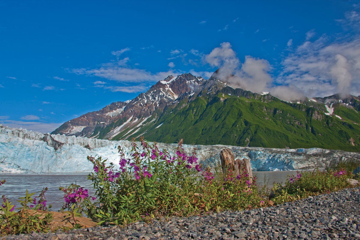
Glacier View
Hikers need to get a bit creative to see Childs Glacier, a 12-mile-long juggernaut of ice that’s unreachable by road. Book a short airboat ride ($200) to the Childs Glacier Interpretive Site, a picnic area in the splash zone of calving ice. From there, follow user trails past the glacier’s northern flank to a rocky moraine, creating a 2.2-mile out-and-back. (Pack crampons and head up the nontechnical ice.)
Trip Planner
Get there Cordova is only accessible by boat or plane; flights from Anchorage arrive every day. Season May to October Permit None