Published October 18, 2018 06:23PM
Hike New York's Homegrown Long Path
Step off the subway and into a wilderness sparkling with lacy waterfalls and craggy summits—all thanks to the Long Path, a 358-mile work in progress stretching from 175th Street to John Boyd Thacher State Park upstate and linking the Hudson Highlands, Shawangunks, and Catskills. The trail is inching its way to the Adirondacks (72 miles to go), but that’s no reason to delay a visit (or five) to its top-tier bits, all aflame with the fall palette this month.
'Steven Aaron Photography'
The Insider
On a weekend trip in 2004, Andy Garrison discovered the Long Path when his 9-year-old son wondered what the “LP” icons all over their map meant. Captivated by the idea of a long-distance trip right in their own backyard, the pair hiked the whole thing over the next two years. Since then, Garrison has become a self-made Long Trail expert, volunteering thousands of hours with the New York-New Jersey Trail Conference to maintain, acquire land for, and promote his hometown thru-hike.
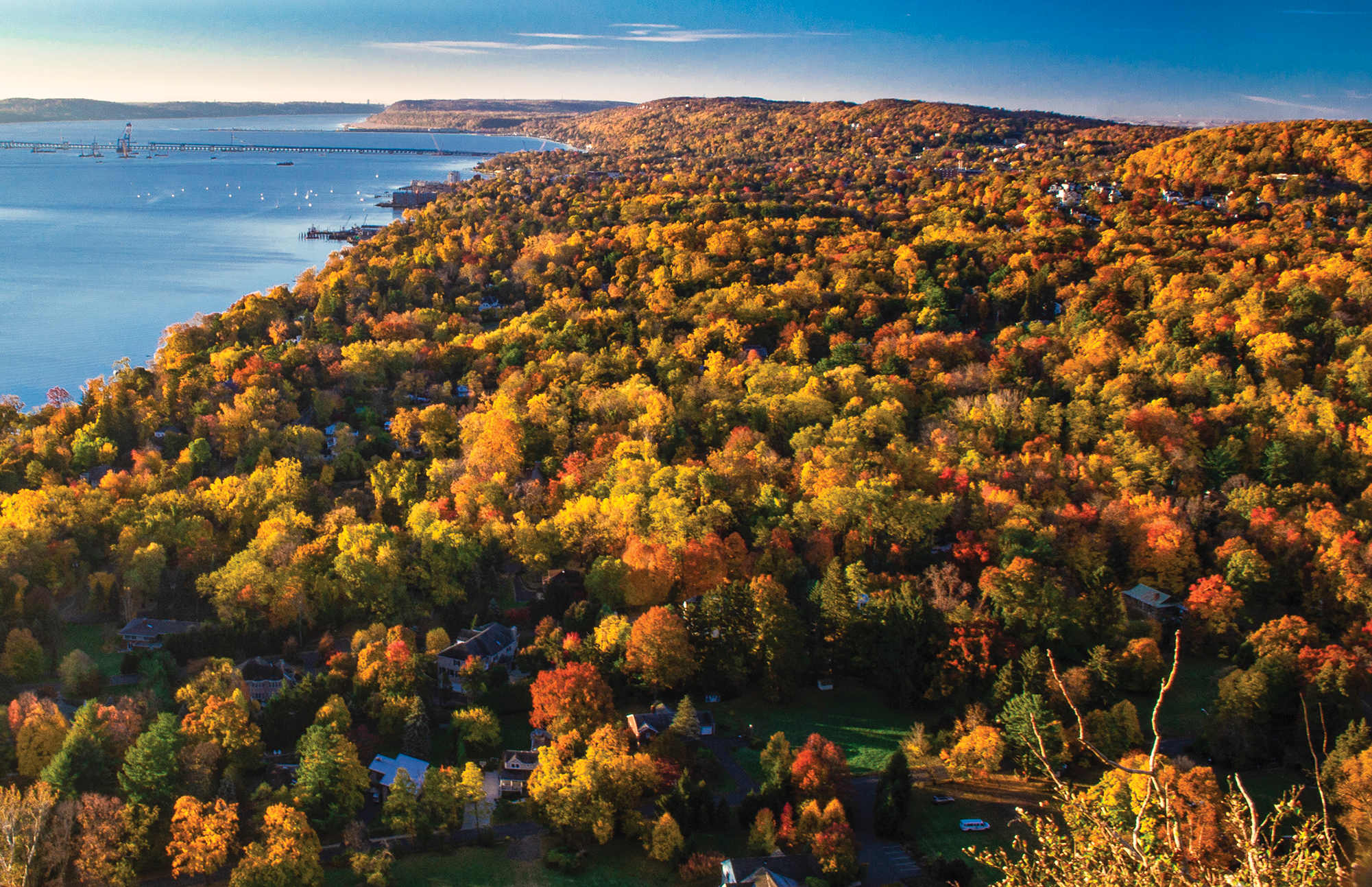
Bird’s-eye dayhike
Garrison favors the northern Shawangunks for the far-reaching views: “It’s so different from everything else in the area,” he says. “It has deformed pitch pines, scrub oak, and berry bushes—but doesn’t, for the most part, have tall trees.” This 8.3-mile loop treats you to an aerial perspective over the Hudson Highlands, Catskills, southern ’Gunks, and the lofty outcroppings of Gertrude’s Nose and Castle Point, plus a 187-foot waterfall and a series of explorable caverns called the Ice Caves. From the Sam’s Point Preserve lot, the trail passes spurs to the caves en route to an overlook above Verkeerder Kill Falls. Turn northwest and hike to High Point, then swing south on High Point Carriage Road to close the loop.
Peakbagger’s choice
This four-day, 36-mile shuttle hike is the one that kicked off Garrison’s love affair with the Long Path. A rollicking sine wave of a trek that tags six Catskills summits (including the range’s high point), the trip offers vistas so big, you just might fall for it yourself. From Upper Cherrytown Road in Ulster County, hike to 30-foot Vernooy Falls, then stump up and over Bangle Hill to tent at Sundown Primitive Campsite at mile 9.7. Day two roller coasters over 3,843-foot Peekamoose Mountain and Table Mountain to campsites in the floodplain of the East Branch of Neversink Creek. The third day traces a ridge of the Burroughs Range to 4,180-foot Slide Mountain, then bobs up and down between cols and Cornell and Wittenberg Mountains. Land at a campsite near the seasonal stream .9 mile past the East Branch-Phoenicia Trail junction before closing with 9 miles over three more peaks (Cross, Pleasant, and Romer) to the town of Phoenicia.
ADVERTISEMENT
Stretch of solitude
This 7.4-mile section near the Long Path’s northern terminus is all about the little things—quiet red pine and spruce forests, miniature waterfalls and ponds, remnants of 1800s-era homesteads and cemeteries. Start at West Kill Road and head into the Eminence State Forest, tracing old stone walls to Rossman Hill Lean-to at mile 5.9. Day two, pass Looking Glass Pond and the cascades in its outlet on your way to Sawyer Hollow Road.
Urban hike
With a southern endpoint at a New York subway station, the Long Path is citified by design—but even its densest areas hide natural beauty, like the stretch between the Hudson River and New Jersey’s Palisades Parkway. From the George Washington Bridge north, the trail follows the Palisades escarpment, a blocky, 600-foot basaltic cliff wall where the views are both wild (swamps, hardwood forests, the Hudson) and civilized (NYC, the Met Cloisters monastery, old stone homesteads). Garrison’s top section runs 13.9 miles up from the bridge, tracing the cliffs most of the way.
Can’t-miss trail town
Phoenicia (population 309) is the kind of place where the hardware store sells hiking boots and quaint inns offer a chance for a hot shower and a genteel return to civilization. Garrison hits up Brio’s Pizzeria for his posthike celebrations: “After a week in the woods, I go for the 1-pound hamburger.”
ADVERTISEMENT
Trip Planner
Season May to October at higher elevations, year-round at lower ones Permit None Shuttle Cabs are available across the Long Path. Pre-arrange a pickup.