Hike the Four C Trail in Texas

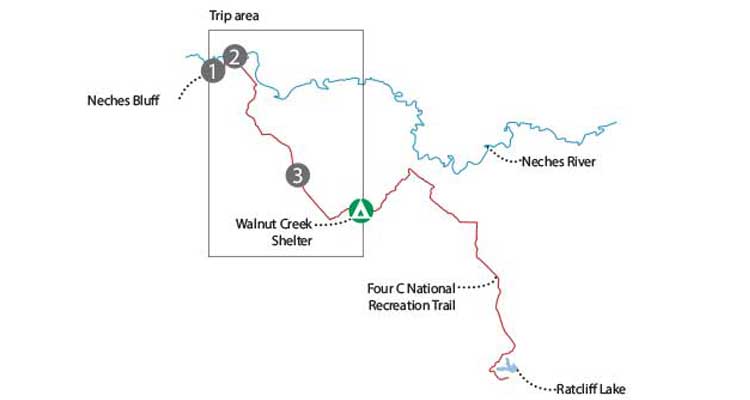
'Map by Becky Kivlovitz'

Map by Becky Kivlovitz

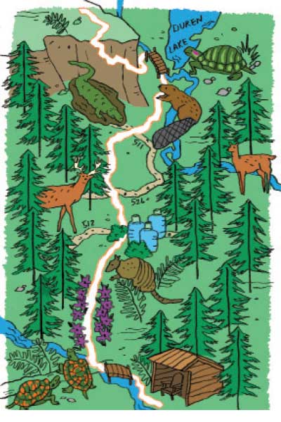
Illustration by Vicki Chu
T
he sun dances through the 100-foot-tall pines, shining on pockets of purple, 4-foot-tall American beautyberry like a spotlight. Pine needles cushion my steps and a cool breeze hums through the quiet bottomland woods. I’ll pass through sloughs and upland forests before nightfall. In Texas, wilderness like this isn’t typically available for quick getaways—which is why I feel like a crook. I’m strolling through this wooded cathedral on the Four C National Recreation Trail, which spans 20 miles in the Davy Crockett National Forest, only a few hours from Dallas, Austin, and Houston. I’m headed for a backcountry shelter near mile 9, then I’ll turn around in the morning—and be home for dinner.
Turn-By-Turn
From the Neches Bluff Overlook:
- Head east on the Four C Trail, tracing the sandy bluff .5 mile before descending to the Neches River at mile 1.5.
- Continue 5.5 miles south on the main path to Pond Camp (cross the forest road at miles 2.5, 4, and 5.1.)
- Follow the trail south through a stretch of purple wildflowers (blooming late summer) to the Walnut Creek Shelter at mile 9.2.
- Retrace your steps to the overlook.
Campsite
Walnut Creek Shelter (mile 9.2)
Leave the tent at home and bed down in this lean-to beside shaded Walnut Creek. This wooden hut (first-come, first-serve) sleeps up to 10 and provides luxe accommodations: fire pit, grill, and log benches. There are also established sites at this campground for those who prefer to tent.
Water
There is no potable water around this trail (it’s laced with chemicals, likely from mineral extraction or pipeline construction), so pack what you need (we recommend a gallon per person per day) or cache at the forest road crossings: Write your name and the date on the stash and leave it near the trail/road intersections; FS 512 at mile 5.1 is the last junction before camp.
Animal House
Scan for armadillos hiding in the underbrush and white-tailed deer grazing in the virgin forests. Check the pond banks for box and red-eared slider turtles. Beavers and alligators swim in the marshes.
Do It
Trailhead 31.567073, -95.162909; 26 miles northeast of Crockett off FS 511-A. Gear up Spring Creek Pro Shop in Crockett; (936) 544-5444Season Wait out summer temps (in the upper 90s), but beat hunting season (November to February) with a fall trip. March through May bring blooms and temperate weather. Permits None Custom-centered map bit.ly/BPmap4C ($15) Contact(936) 655-2299; bit.ly/DavyNFTrip datawww.trimbleoutdoors.com/ViewTrip/2676075
Trip Stats
Distance: 18.4 miles; Time: 2 days; Difficulty: 1.5 out of 5 stars.