Published May 20, 2019 06:06AM
Hike Like a Local in San Francisco's Golden Gate National Recreation Area
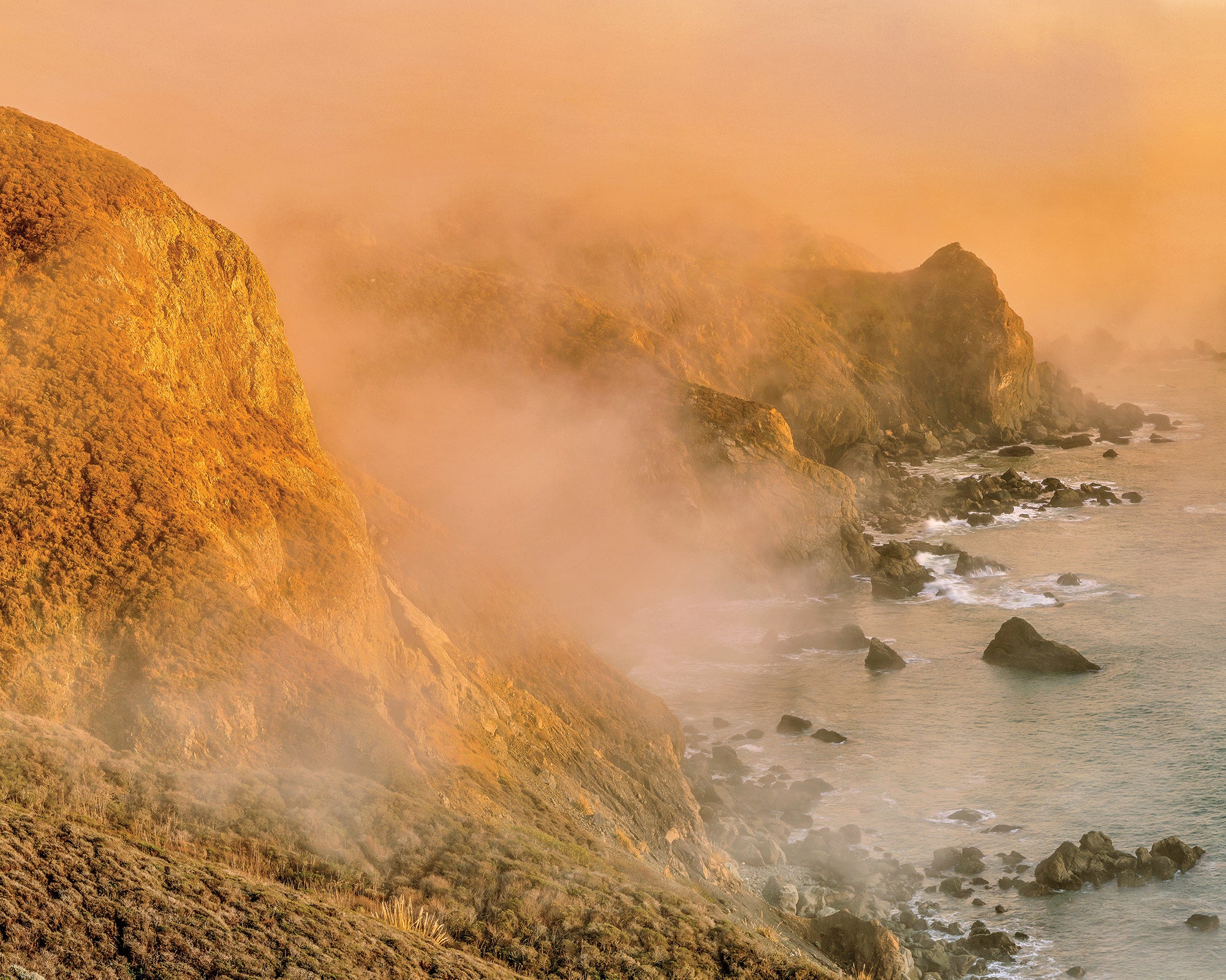
See butterflies, redwoods, whales, and some of the most beautiful coastline any major metro area has to offer.
'Ed Callaert'
Forget sourdough and Silicon Valley: Greater San Francisco’s most valuable treasure is its 80,000-acre necklace of wildflower-spotted hills, miles-long beaches, and oceanside bluffs. Stretching from Tomales Bay in the north to the redwood groves southwest of the Bay—with the Golden Gate Bridge smack in the middle—the chain of public land offers everything from quick lunchtime treks to campsites so quiet you’ll forget you could be back in a booming metropolis in time for a breakfast of $12 avocado toast.
The Insider
Paul Myers spends his days shooting photos and video in Golden Gate’s most beautiful corners as the digital content producer for the park’s nonprofit partner, Golden Gate National Parks Conservancy (GGNPC). And he’s certainly put in the scouting legwork: The born-and-raised Bay Area local has spent four decades exploring the park’s 250-plus trails.
Lunch Hike
Golden Gate’s Presidio, an old military base-turned-park at the southern end of the bridge, hosts San Francisco’s best hidden trails, says Myers. His pick for a midday leg-stretcher begins at Baker Beach, a white-sand expanse with crashing waves and big views of the Golden Gate Bridge. Take the California Coastal Trail a short jog north to the .7-mile Batteries to Bluffs Trail, then wind along the bluffs. “Watch pelicans go by and see whales (humpbacks, grays, and killers) when they’re migrating in early spring and fall,” Myers says. Rejoin the California Coastal Trail and continue north to Fort Point, an 1850s-era post at the base of the bridge, then retrace your steps for a 3-mile trip.
Big Day
With nearly 3,200 feet of elevation gain, this 13-mile loop was Myers’s go-to when training for the High Sierra Route. Rewards for the sweat: a glimpse of ecosystems ranging from coastal cliffs to oak forests, views of the Farallon Islands, and a stretch meandering through the redwoods at Muir Woods. Kick it off from Stinson Beach on the Dipsea Trail, then cross into Mt. Tamalpais State Park and trace fern-lined Webb Creek on the Steep Ravine Trail to the Pantoll Campground, where vistas range northwest to Point Reyes National Seashore. Drop into another canyon shaded by old-growth redwoods on the Stapelveldt and Ben Johnson Trails to Muir Woods—Myers considers this the back door into the arboreal cathedral because it conveniently skirts the new parking and shuttle reservation system. The return leg’s stiff, 1,700-foot climb in 2.4 miles on the Bootjack Trail ditches the crowds for good: You’ll hug Redwood Creek, then connect to the Matt Davis Trail via the short Alpine Trail and descend another 4 miles back to Stinson Beach.
ADVERTISEMENT
Quick Overnight
The three tent sites at Hawk Camp, perched on a rise overlooking the wrinkly topography of Gerbode Valley and the mouth of San Francisco Bay, feel a lot more remote than they really are. “It’s isolated, but the trailhead is 30 minutes from the city,” Myers says. And the moderate, 3.2-mile approach means you can start hiking in late afternoon and still catch a killer sunset from the grassy hilltop. Myers’s favorite way in: From the Tennessee Valley trailhead, take the Old Springs Trail through eucalyptus trees to the Miwok Trail. Hike .9 mile, then link the Bobcat and Hawk Camp Trails to reach the free backcountry sites, just shy of 800 feet elevation. Pack in your water.
Butterfly Hike
Milagra Ridge is one of the few places to reliably spot the endangered Mission blue butterfly, thanks to the GGNPC’s work restoring the silver lupine flower, one of the insect’s host plants. And now is the perfect time to go looking for the periwinkle, quarter-size bugs, as the adult blues are out and fluttering from March to June. Scan for them on the lupines along the Milagra Ridge Trail on a 2-mile out-and-back to the overlook west of Battery 244—and don’t forget to look up for vistas of the Pacific, Mori Point, and Mt. Tamalpais.
Redwood Solitude
Psst: Muir Woods isn’t the only place in Golden Gate to see redwoods. Down at the southern tip of the park complex, a little-known grove of the giants awaits at Phleger Estate. True, it’s a mix of old- and second-growth trees, so the redwoods don’t reach the same lofty heights as their more famous neighbors up north. “But there could be 4,000 people a day at Muir Woods,” Myers says. “Here, you might see five.” Access the secret stash via San Mateo County’s Huddart Park, linking the Miramontes, Raymundo, and Mt. Redondo Trails for a 5-mile lasso-loop that tracks steeply through a forest of redwoods and wood sorrel.
ADVERTISEMENT
Trip Planner
Season Year-round Permit Required for overnighting (prices vary; call (415) 331-1540)