Updated July 8, 2025 09:41AM
Hike Like a Local in Phoenix
This desert kingdom claims some of the most diverse terrain of any urban center in the country. Explore redrock canyons, cacti-studded wildernesses, and subalpine mesas bristling with Douglas firs—all within striking distance for a day outing.
'Photo by Scott Jones'
Garden Valley Loop, Superstition Wilderness
Miles 5.1 (loop) Drive from town 1 hour
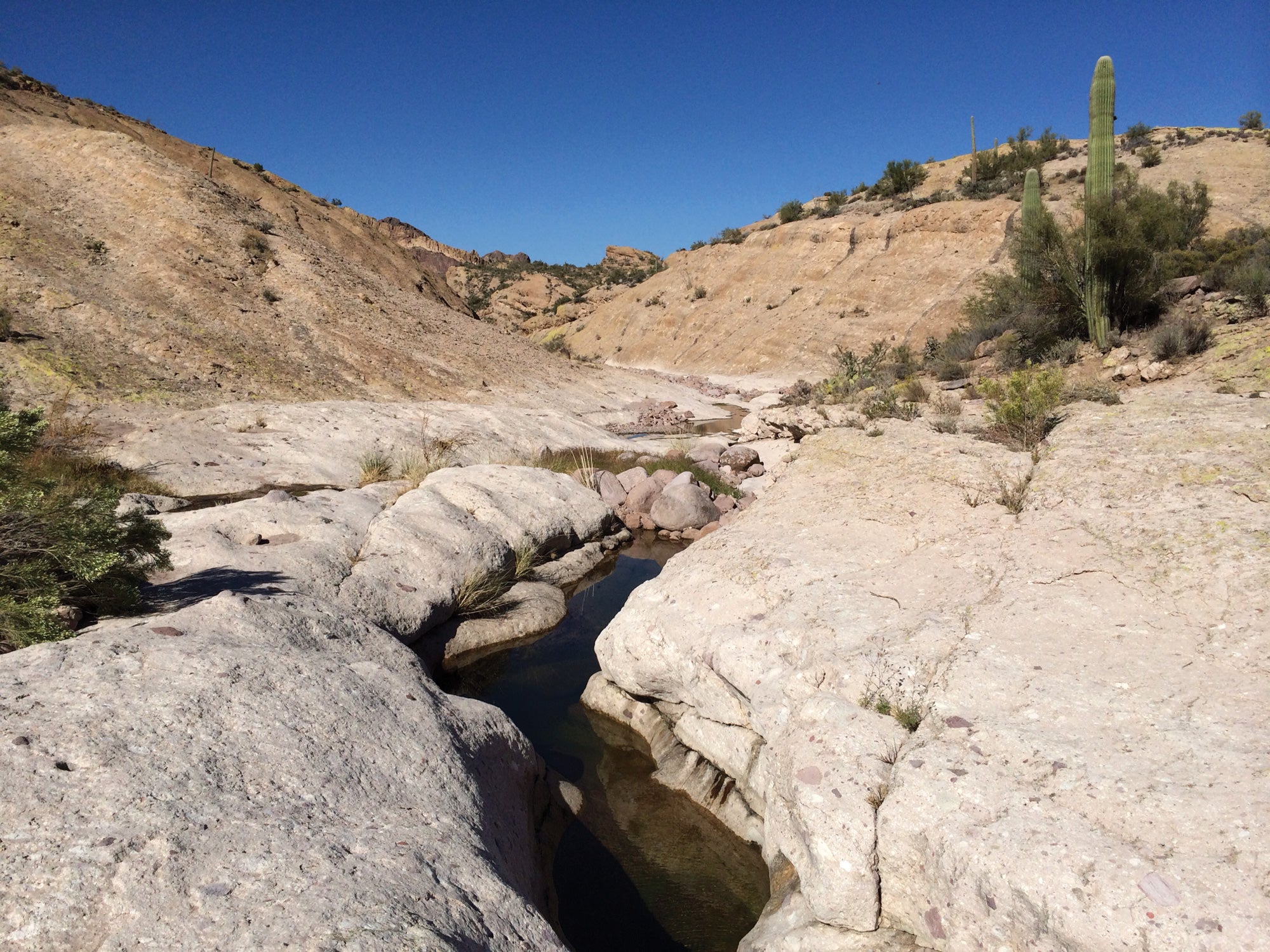
The closest wilderness with legit wow factor? That’s easily the beloved Superstitions, a rugged mountain range that boasts the best of the eastern Sonoran Desert: cactus forests and rock citadels. Bring some basic routefinding chops and set out on the Second Water Trail to enter the sagebrush- and saguaro-covered landscape. Once in Garden Valley, pass through a chain fruit cholla forest, where the branches curlicue like a pipe-cleaner art project. Continue downhill into canyons where multicolored lichens cover the walls like camouflage to reach Hackberry Spring (and a campsite). See views of Four Peaks and Weavers Needle on the loop back. Trailhead First Water Info

West Clear Creek, West Clear Creek Wilderness
Miles 25.1 (point to point) Drive from town 2 hours 10 minutes
Ready for refreshment? When most Phoenix-area trails bake in the summer, this one beckons hikers to bring their bathing suits. The path along West Clear Creek doesn’t just offer a chance at a dip: It demands it again and again. Start by descending into a wide canyon and flash in and out of narrower slots until the first swim arrives in a pool framed by white box sandstone (mile 10). Continue in and out of the water, passing several small waterfalls and hanging gardens to reach the terminus at Bullpen Ranch. Not a swimmer? Treat it as a 19-mile out-and-back, with camping allowed in the sandy canyon bottoms. Note: Watch the forecast in summer monsoon season. Flash floods can fill the canyon in a hurry. Trailheads West Clear Creek and Bullpen Ranch Info
ADVERTISEMENT
Barnhardt Trail, Mazatzal Wilderness
Miles 12.1 miles (out and back) Drive from town 1 hour 45 minutes
When the Superstitions get to feeling too busy, keep heading north for a hike that climbs past a seasonal waterfall as it ascends from chaparral desert to ridgetop. As you gain elevation, the views transition from scrublands to pinion and ponderosa pines to oaks. A tiered waterfall cascades trailside at mile 2.5 (flowing in spring). Continue up, climbing past ledges and taking in views down to the desert floor until you reach the ridge and the intersection with the Arizona Trail after 1,800 feet of total elevation gain. If you brought an overnight kit, head south on the AZT a bit more than a mile to reach Chilson Camp (first come, first serve). Note: This trail is exposed to that hot sun, and water is unreliable; it’s best between October and April. Trailhead Barnhardt Info

Where to Buy Gear in Phoenix: Arizona Hiking Shack
Where to Eat Near Phoenix
Find the tribe in Gilbert at Arizona Wilderness Brewing Co.
Don’t Forget: Keep safe from the blazing sun with some combination of sunscreen, hat, sunglasses, bandana and a UPF-rated long sleeve shirt.

Our Scout: Scott Jones