Updated July 8, 2025 02:14PM
Hidden Montana: Beaverhead Range
Rugged, scenic, and lightly traveled, the Beaverheads rise above Big Hole Valley's broad meadows as a skyline full of 10,000 foot summits with alpine lakes pooling at their feet. Outside of Montana, this place would be on every hiker's tick list, but here it fades into obscurity behind Glacier and the northern Bitterroots that loom above Missoula. Explore them shoreline to summit on these two hikes.
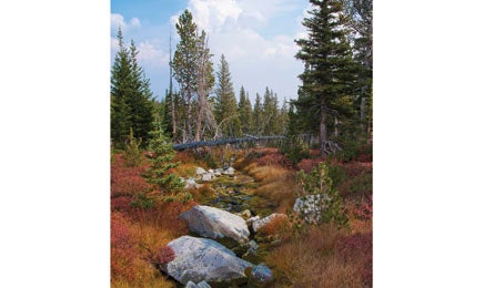
'Timberline park lands near Homer Youngs (Steve Howe)'
Heart Lake and Homer Youngs Peak
The secret Idyllic elk meadows and an imposing summit lie just a few miles from a little-used trailhead.
Maybe the reason so few people know about the upland beauty here is the ordinary approach. But a few miles into this 12.2-mile (round-trip) overnight trek, the scenery begins: tranquil ponds, rolling meadows, and a treeline view of the vast, open ridgelines of Homer Youngs Peak. Let most people be fooled; you’ll share this spot with elk and black bears instead. Start where Trail 187 leaves the Upper Miners Lake Road (the second unsigned two-track that climbs north after Miners Lake Campground). At mile 1.9, trace the brook upstream along a faint trail (402) for 1.4 miles to reed-filled Kelly Lake, set in a subalpine cirque surrounded by gray cliffs. Round the lake to the south and climb another 1.4 miles up the Kelly Creek drainage as evergreens shrink and views grow, making toward a saddle due east of Heart Lake. The entire timberline region here offers scenic camping, accessible water, and enough evidence of black bears to make food canisters a good idea. To add a summit view to your trip, go off-trail atop the rocky ridgeline at mile 4.8. After 1.3 miles and 1,200 vertical feet of class 2 talus, you’ll earn a view across the wrinkled topography of the Continental Divide. If water is more your scene, descend a steep boulder slope to Heart Lake. Trailhead 121 miles southwest of Butte; 45.308164, -113.603904Map Beaverhead-Deerlodge USFS Visitor Map Central West (CW) Region; bit.ly/HomerYoungsContact Beaverhead-Deerlodge NF; (406) 689-3243; fs.usda.gov/bdnf
Ajax Lake and Ajax peak
The secret A long dirt-road approach to the trailhead dissuades most hikers from attempting this magnificent summit, but they don’t know about the five-star car camping en route.
Slope-side boulder fields and an old wildfire scar make this whole 6.7-mile (round-trip) route open and scenic—from the ruins of a 19th-century silver mine to infinity views at the summit after an easy-to-navigate scramble. Drive in on 25 miles of dirt roads (with camping) and park at the base of a steep climb (just after a hairpin right turn). Hike up the now-4WD road 1.9 miles to broad, deep Ajax Lake (with good fishing for lake trout and cutthroat) and a rundown miner’s cabin on the far shore. Trace the shoreline north on a fisherman’s trail. Turn west where a talus fall reaches the water, and hike up naked scree to a lonely, old-growth pine that sits in the bowl beneath the Ajax/point 9,522 saddle. Keep climbing west 780 vertical feet to gain the ridgeline. Turn north and climb 500 feet of class 2 talus, then boulder-hop to the roof-gable summit, with vistas north and south along the spine of the Beaverheads. Strong hikers can descend back to the saddle and follow cairns south along the class 2 ridge to bag point 10,042 as well. Trailhead 68 miles northwest of Dillon; 45.351303, -113.695633Map & Contact Same as above