10 Threatened Hiking Trails That Need Your Help

'Photo by Whit Richardson'
Grand Galleries
Lower Butler Wash
Bears Ears National Monument, Utah
When former President Barack Obama established the 1.4-million-acre Bears Ears National Monument on December 28, 2016, he secured protections for several hundred thousand cultural and archaeological sites that had suffered from looting, grave robbing, and energy development. Since 2013, state and federal managers had flagged more than 100,000 acres along the monument’s eastern edge near Bluff, Utah, for potential oil and gas leases. Monument status effectively put those plans on hold.
Fast-forward a year: President Donald Trump’s executive order to roll back Bears Ears up to 85 percent of its former size exposes many sites to renewed drilling threats. In March, the BLM plans to auction off leases in the Canyon Country District, which includes the former Bears Ears. And new wells have been permitted on BLM land 2 miles north of Bluff, near the old monument boundary.
Native American tribes, state attorneys general, and groups such as the Wilderness Society have all promised to challenge Trump’s action in court (see page 26). You can show where your allegiance lies on the trail. Head into the southern corner of the reduced monument—in what was tentatively called “Shash Jaa National Monument” at press time—to see the Procession Panel, a 1,500-year-old petroglyph that depicts 179 human forms marching to a central circle. From the unmarked trailhead on Lower Butler Wash Road, follow the unsigned trail southwest. Cross Butler Wash and another sandy drainage before climbing slickrock slabs, where cairns mark the route. Descend into a canyon slicing into Comb Ridge and hike west to Procession Panel, 1.4 miles from the trailhead. Puzzle at the 15-foot-long assembly of sheep, serpents, deer, and people (some wearing elaborate headdresses) before retracing your steps.
Trailhead Procession Panel (37.3511, -109.6288) Season September to May Permit None Contact

Wet-’n’-Wild
Birch Lake
Boundary Waters Canoe Area, Minnesota
Crowds aren’t always a bad thing. Boundary Waters is one of the country’s most visited wildernesses, and since the area’s currently locked in a debate pitting mining against conservation, the swollen ranks of hikers and paddlers have never been more welcome.
In 2016, Chilean company Antofagasta petitioned the BLM to renew a mining lease in the Superior National Forest adjacent to Boundary Waters Canoe Area, hoping to start up a sulfide-ore copper mine in the same watershed as the wilderness area. Mining has long been a part of Minnesota’s economy, but this kind of copper extraction would release sulfuric acid—the same corrosive stuff used in batteries—into the drinking water of moose, endangered Canada lynx, and blue-spotted salamanders found throughout the Boundary Waters. Now, the BLM and U.S. Forest Service are conducting an environmental analysis of a proposed 20-year-long mining moratorium, but Minnesota congressional members are trying to block it. The public comment period has ended, but it’s never too late to show your support.
With 1 million acres of wilderness and more than 1,200 miles of canoe routes, Boundary Waters has plenty of glacially carved lakes and forested basins to go around. See what the hype is about by staging a paddle through Birch Lake, a long stretch of silver nestled amid a spruce forest pocked with aspens. Put in near Kramer Bay, and camp at any number of lake islands. When you return, consider calling local representatives and telling them why the place is worth keeping pristine for the next 20 years—and beyond.
Trailhead Birch Lake Boat Access (47.7355, -91.9423) Season June to October Permit Required; reserve six months in advance (starting at $16 per person). Contact
Multisport Mania
Archer’s Fork Loop
Wayne National Forest, Ohio
If history’s doomed to repeat itself, then Ohio’s only national forest might be destined to serve as a stage. The 240,000-acre tract of rolling Appalachian foothills was almost completely stripped of trees by the end of the mining and logging boom in the 1800s. It took a full-scale replanting effort by the CCC in the 1930s to create the forest as we know it today, which is home to more than 158 bird species, including wood ducks, great blue herons, and cedar waxwings. The restoration triumph is a hot spot for hiking, mountain biking, hunting, and paddling—but new fracking technology threatens to replay the forest’s past.
The BLM has set aside 40,000 acres for potential drilling, a move that could pollute millions of gallons of water and would result in deforestation for roads and drilling pads. The good news? As of press time, only 2,000 acres have been leased and no operations have broken ground yet, so there’s still time to urge BLM and Forest Service officials to take back the land. See what all the fuss is about on the 9.5-mile Archer’s Fork Loop, which passes the sandstone Great Cave and the 51-foot-long Irish Run Natural Bridge (which you can walk across). Here, it’s easy to see Ohio’s real riches are all in plain view.
Trailhead Ludlow Catholic Cemetery (39.5240, -81.1810) Season Year-round Permit None Contact
Terra Incognita
Appalachian Trail
Northeast Somerset, Maine
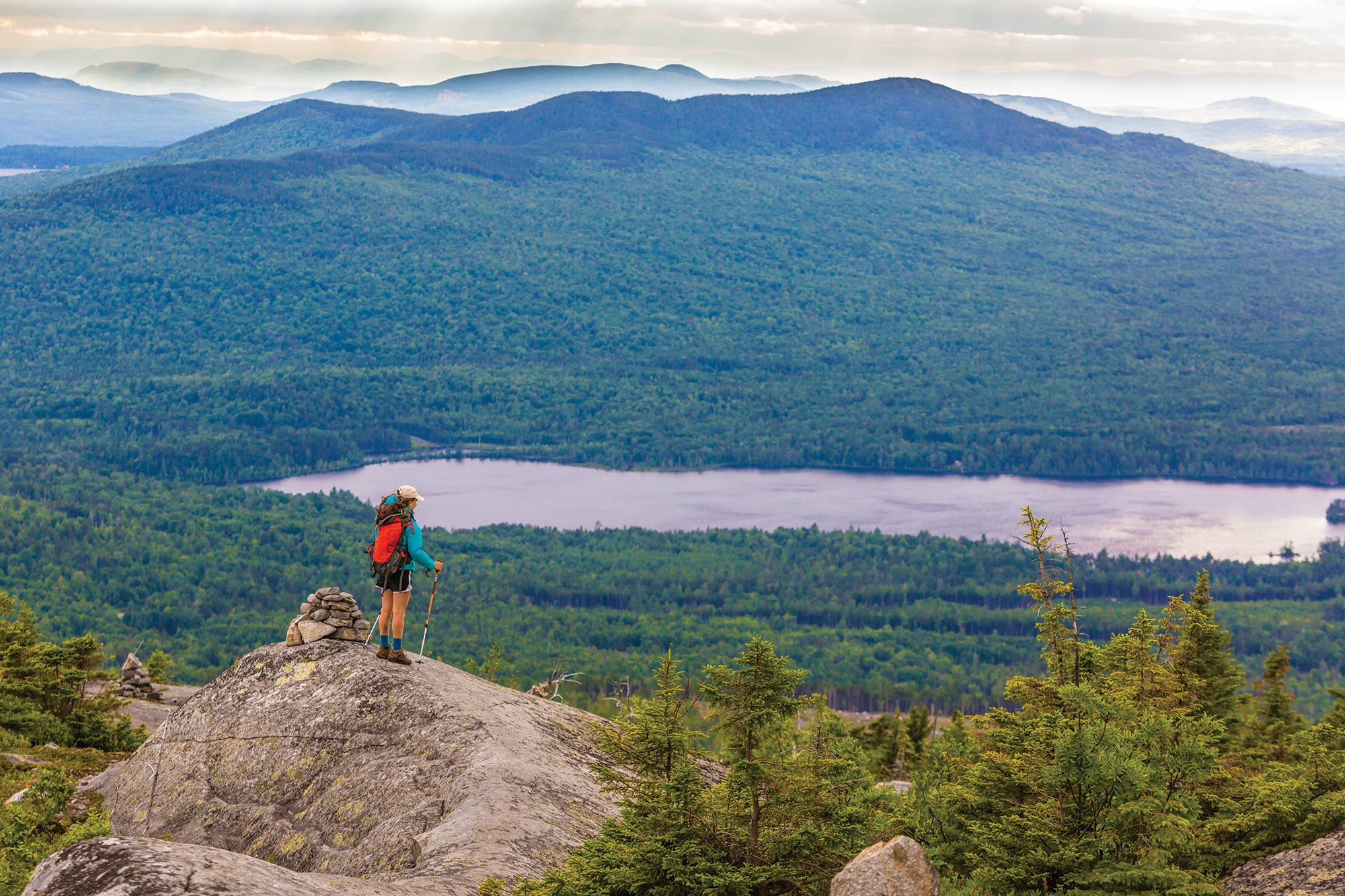
The Bald Mountain Pond area offers a glimpse into what Maine’s forests were like more than a century ago. Conifers and fingers of rock surround its pristine, glacier-hewn shoreline, where AT thru-hikers bunk at a lean-to hidden in the pines on the north end. Arctic char—a species that once thrived in most of Maine’s lakes—still swims here, and the endangered Canada lynx roams the woods. That’s why the National Park Trust and the Trust for Public Land are campaigning to buy roughly 1,500 acres of land around the pond from a private timber company. The purchase would preserve a parcel of never-logged, old-growth forest and provide public access to previously off-limits Ossie Pond and its population of wild brookies.
Most lakes this big long ago attracted scores of cottages and towns, but Bald Mountain Pond is still, surprisingly, scarcely touched—and impressively grand. Discover what makes it worth preserving by launching a canoe from the informal ramp on the lakes’s southern edge. Paddle 2 miles north beneath the shadow of Bald Mountain’s lumpy ridge, which stands more than 1,500 feet above the water. Take out at the Moxie Bald Lean-to (near 45.2707, -69.7453), which sits just back of the water in a miniature bay on the lake’s northwest end. Claim space for your sleeping bag, then head out on foot: Hike 2 miles southbound on the Appalachian Trail to 2,630-foot Moxie Bald for a feast of blueberries (fruiting in August) and views over Moxie, Baker, Austin, and Bald Mountain Ponds. Tack on the .8-mile (one way) side trip to North Peak for views of Katahdin’s gray ramparts (looking northeast) and the Bigelow Range (west) before returning to Bald Mountain Pond for the loons’ evening serenade.
Trailhead Bald Mountain Pond Boat Launch (45.2422, -69.7311) Season May to November Permit None Contact
California Dreamin’
Pacific Crest Trail
Shasta-Trinity National Forest, California
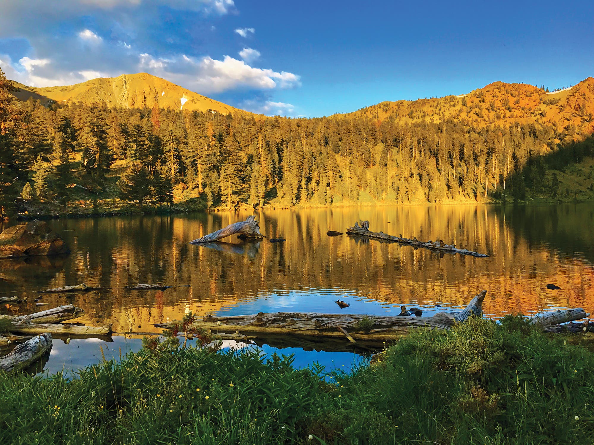
In northern California, the PCT hugs high, rugged ridgelines with birds’-eye views over evergreen-rimmed lakes—owned by the Michigan-California Timber Company. Thankfully, the company ceded the scenery in September 2017, selling off land and easements that surround 17 miles of the Pacific Crest Trail to the Forest Service, Pacific Crest Trail Association, and the Trust for Public Land. The deal also protects four river systems (including salmon and steelhead habitats in the Trinity and Klamath River basins) and opens public access to 10 lakes.
To witness why the area is worth the expense of time, money, and effort, venture into Shasta-Trinity country. There, the 10-mile Sisson-Callahan Trail, a route that links Lake Siskiyou to 8,020-foot Deadfall Summit, looks to become the next great vein for staging loops and multiday trips. (At press time, the Forest Service did not have a timeline for when construction on side trails might begin—but there’s no better way to show support than by hiking the main drag.) Easy option: Hike 20 miles out and back to camp at the Deadfall Lakes, beneath the jags of bronze-colored Mt. Eddy. The trip is entirely on trail and follows the Sisson-Callahan the whole way. Adventurer’s option: Keep going. Continue north on the PCT, crossing a string of high-alpine meadows beneath Trinity Divide, before looping counterclockwise below the Scott Mountains to camp at Bull Lake (one of the 10 tarns that this purchase brought into public ownership) near mile 23. Next day, follow a mix of faint user paths and forest roads east along Bull and Bear Creeks to reconnect with the Sisson-Callahan Trail and close the 40-mile lollipop-loop.
Trailhead Sisson-Callahan at North Fork Sacramento River (41.2859, -122.3859) Season July to October Permit None Contact
Home Sweet Home
Pinhoti Trail
Weogufka State Forest, Alabama
Not only are local nonprofits buying up private land to reroute the Pinhoti’s road walks onto wilderness trails, but they also want to extend the Appalachian Trail to where the Pinhoti crosses Flagg Mountain, the southernmost 1,000-foot peak in the Appalachian Range. It’s bigger than Georgia’s Springer Mountain, where throngs of hikers (and their tent cities) have overrun the southern terminus of the AT. Advocates say Flagg’s size and CCC cabins, which could be adapted for hikers, will relieve overuse at the current AT starting point. Long trail legend and former AT record holder Jennifer Pharr Davis is on board: In March, she’ll thru-hike Alabama’s 170-mile portion of the Pinhoti Trail to raise awareness for the underrated route, which ducks through quiet, leafy corridors, fords small creeks, and passes rocky overlooks above the rolling green hills.
You can follow in her footsteps. Hikers (and their tourism dollars) can do a lot to persuade local residents to support proposed Pinhoti Trail improvements by demonstrating the economic benefits that come from welcoming walkers. From the Flagg Mountain summit, hike a 4-mile lollipop-loop on new trail: Follow yellow then white blazes to historic CCC cabins, then make a steep, .3-mile climb for views of Alabama’s rounded summits. Retrace your steps on the return, and turn it into an overnight if you’d like; dispersed camping is allowed. Tip: Time it for mid-October when the slopes explode with crimson and yellow.
Trailhead Flagg Mountain (32.9729, -86.3487) Season Year-round Permit None Contact
Summit Season
Spraddle Creek Trail
White River National Forest, Colorado
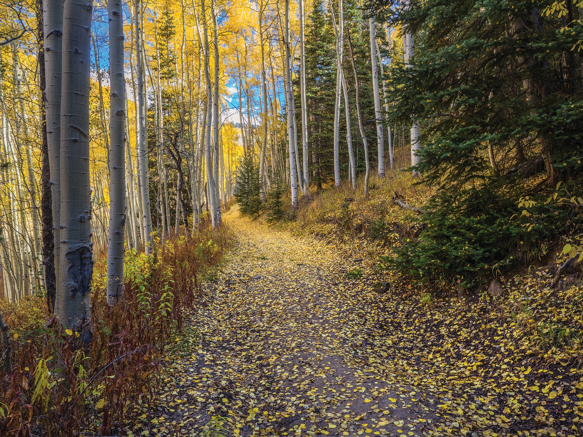
The 7,377 acres surrounding Spraddle Creek occupy a busy part of one of the busiest national forests in America. There, just outside Vail, recreation and development pressure is so intense that Conservation Colorado is campaigning to add this zone to the adjacent Eagles Nest Wilderness. If Spraddle Creek’s designation is upgraded and given wilderness area protection, its swath of boggy moose habitat and high-alpine meadows can’t become the next great condo complex or zipline course. Instead, it would remain a roadless, largely trailless tract of Colorado high country (much like the nearby Gore Range), the wildness of which belies its proximity to vacationland.
To visit, head out from the trailhead at Spraddle Creek Road and trek 4 miles up FS 737 (a former 4WD route). The aspens are on the brink of overtaking the doubletrack, creating a quaint tunnel that deposits you at a ridgetop meadow. There, spy the teeth of the 14,000-foot Sawatch Range behind Vail Ski Resort.
Trailhead Spraddle Creek Road #737 closure gate (39.6438, -106.3634) Season June to October Permit None Contact
Writing On the Wall
Fremont Village Trail
Nine Mile Canyon, Utah
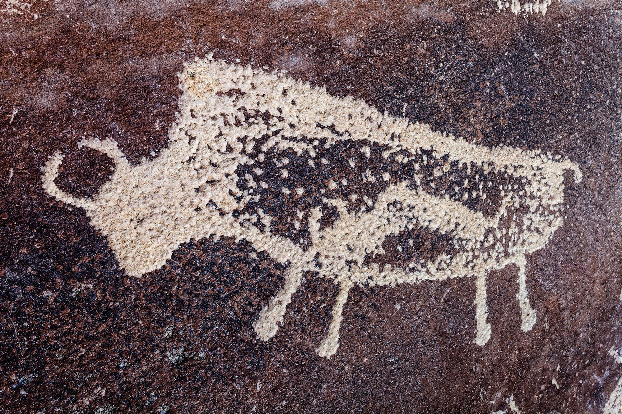
The development of oil reserves in the plateau surrounding Nine Mile Canyon, started in 2000, nearly spelled disaster for 60-plus prehistoric rock art sites, which were getting coated in the dust kicked up by heavy truck traffic. But energy companies paved the canyon road, and now, it’s heavy visitation that threatens these gems: As more people enjoy easier access to the 10,000 petroglyphs and pictographs, vandalism is on the rise. In May 2014, two hikers defaced the famous “Pregnant Buffalo” site, etching their initials into the panel.
But hikers can also be a force for good. Other visitors at the Pregnant Buffalo site witnessed the vandalism and noted the couple’s license plate number, which led to the perpetrators’ eventual prosecution. The episode proved that increased visitation at Nine Mile Canyon and other archaeology hot spots (like Bears Ears National Monument, page 36) can actually protect ancient artifacts. Hopefully, people will show more respect if they know hikers are watching.
Visit Nine Mile Canyon, which contains more Fremont petroglyphs and pictographs than any other location in the Lower 48, and hike the Fremont Village Trail. Starting near the split of Nine Mile Canyon and Cottonwood Canyon Roads, the .5-mile out-and-back ascends a sagebrush-dotted hillside to a bench 200 feet above Nine Mile Canyon’s floor. Pass a ring of stones marking an unexcavated pithouse, admire the red handprints that the Fremont people stamped on a large boulder some 1,000 years ago, and peer into caves where they made basic dwellings.
Trailhead Fremont Village (39.7832, -110.1343) Season Year-round Permit None Contact
Western Frontier
High Trails
Dillon, Montana
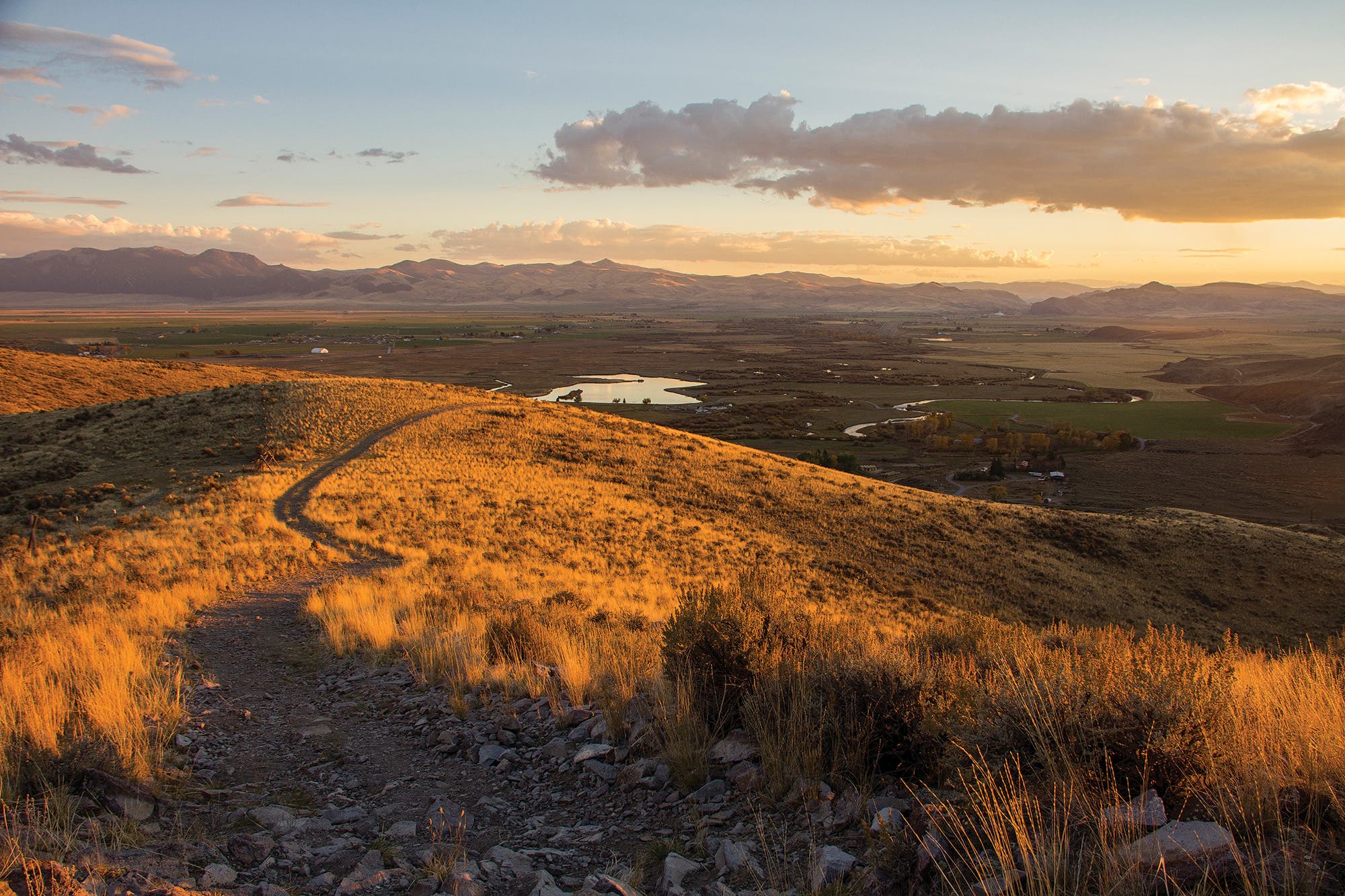
When the BLM sold off 1,100 acres to a private buyer in the 1980s, residents of Dillon, Montana (population 4,257), lost access to their local hiking, biking, and equestrian trails—which subsequently required a half-hour commute to reach the goods. The Beaverhead Trails Coalition negotiated with the new owner, who agreed to sell—if the BTC could come up with the money. So far, the BTC has raised more than $430,000 in donations to purchase 781 acres, which eliminates the car time. Construction on new trails has already begun, but the group needs $130,000 more for the final 327-acre parcel, which offers an even remoter feel along the trail system’s western edge. Donate and then visit to show your support—and help remove the KEEP OUT signs still posted there.
The High Trails network currently consists of 3 total miles of hiking paths that climb the 300- and 400-foot bluffs along the broad Beaverhead River and roller coaster across treeless prairie. From the parking area on 10 Mile Road, follow the Dillon Town Overlook Trail for .8 mile, gaining 400 feet on the approach to the hillside’s landmark “M,” an homage to local University of Montana Western. Then continue north on marked trails nearly a mile farther, rolling across the grassy ridgeline to savor views west to the Pioneer Mountains bordering Idaho. Head south to complete the 3.5-mile loop.
Trailhead Dillon Town Overlook (45.2179, -112.6751) Season Year-round Permit None Contact
Canyon Country
Sound of Silence Trail
Dinosaur National Monument, Utah/Colorado
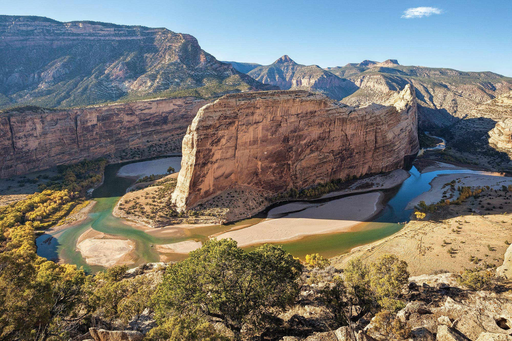
At press time, energy companies were vying to claim several BLM leases that the agency had offered adjacent to Dinosaur National Monument. While the Colorado side of the park has a comprehensive plan to suggest guidelines on where such development can and cannot happen, the Utah side doesn’t. That leaves roughly one-third of the park on the ropes. If developed, the wells would be visible from the Quarry Visitor Center (on the Utah side) and the 3.2-mile Sound of Silence Trail, which is so-named because its interpretive panels encourage visitors to use all their senses to savor the region’s lack of development. Hike these sandy washes and slickrock knobs to make the statement that hikers want to
hear desert winds, not pump jacks.
Trailhead Sound of Silence (40.4372, -109.2760) Season March to November Permit None Contact