Head to the High Country

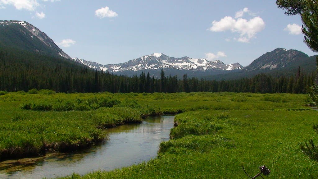
'\"Berry Meadow\" by Forest Service - Northern Region is licensed under CC BY 2.0'
Black Angel Trail, White Mountain National Forest, NH

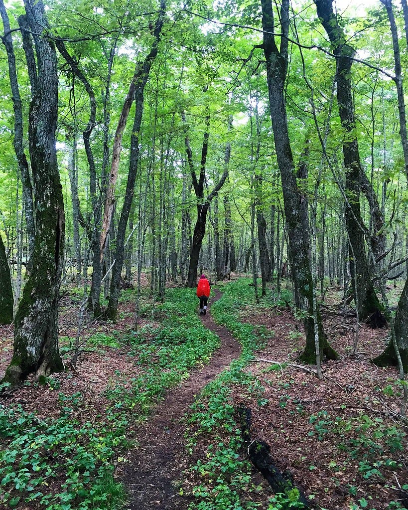
The Black Angel Trail is the embodiment of what hiking is all about: isolation and solitude in nature’s undomesticated playground. The Black Angel Trail is best tackled as part of a 16.9-mile figure-eight loop from the Wild River Campground. Climb to Carter Dome in the Carter-Moriah Range, where you can look out on Mt. Washington and down over the Wild River Wilderness. Drop off the ridge into a veritable no man’s land and descent 3,100 feet through birch glades to loop back towards the trailhead.
Permit none Contact White Mountain National Forest
Larry Garland and Courtney Holden
Baker Gulch to Bowen Gulch, Never Summer Wilderness, CO

This 19-mile loop two hours northwest of Denver delivers national park caliber scenery—clutches of 13,000-foot peaks amid trout-laden alpine lakes—with a dose of wilderness-grade solitude. From the Bowen-Baker trailhead, set off through a mile of Rocky Mountain National Park forest before crossing into the 21,090-acre Never Summer Wilderness. Camp at Parika Lake, then head onto the Continental Divide for views of the Never Summer Range before dropping into Bowen Gulch.
Permit $20 entrance fee for RMNP Contact Never Summer Wilderness
Beaverhead Range, Beaverhead-Deerlodge National Forest, MT

Maybe the reason so few people know about the upland beauty here is the ordinary approach. But a few miles into this 12.2-mile (round-trip) overnight trek, the scenery begins: tranquil ponds, rolling meadows, and a treeline view of the vast, open ridgelines of Homer Youngs Peak. Let most people be fooled; you’ll share this spot with elk and black bears instead. Start where Trail 187 leaves the Upper Miners Lake Road (the second unsigned two-track that climbs north after Miners Lake Campground). At mile 1.9, trace the brook upstream along a faint trail (402) for 1.4 miles to reed-filled Kelly Lake, set in a subalpine cirque surrounded by gray cliffs. Round the lake to the south and climb another 1.4 miles up the Kelly Creek drainage as evergreens shrink and views grow, making toward a saddle due east of Heart Lake. The entire timberline region here offers scenic camping, accessible water, and enough evidence of black bears to make food canisters a good idea. To add a summit view to your trip, go off-trail atop the rocky ridgeline at mile 4.8. After 1.3 miles and 1,200 vertical feet of class 2 talus, you’ll earn a view across the wrinkled topography of the Continental Divide. If water is more your scene, descend a steep boulder slope to Heart Lake.
Permit none Contact Beaverhead-Deerlodge National Forest
Steve Howe
Rito del Padre-Chimayosos Loop, Pecos Wilderness, NM

Though it starts on a well-trodden path, this gorgeous mountain trek around Cerrito del Padre to the base of Chimayosos Peak fades into a short route-finding challenge for adventurous backpackers.
Head northeast from the Iron Gate Trailhead and climb to Hamilton Mesa. Descend to the Pecos River, passing Beatty’s Cabin, and cross the river at mile 5.8. From here, continue north to follow the sometimes swampy trail along the Rito del Padre. On the east side of Cerrito del Padre, tackle a stiff climb out of the drainage at mile 8.3 and continue uphill through conifers on Trail 25; there’s a good campsite when the trail crosses the Rito again at mile 9.25.
The next day, continue north to the foot of Chimayosos Peak on drier trail. Take in views of the 13,000-foot Truchas Peaks as you traverse the treeline west at the base before cutting south on Trail 257 at mile 12.25. Trail 246 fades on the western flanks of Cerrito del Padre before meeting the start of the loop; don’t attempt this unless you have good route-finding skills and a sense of adventure. Camp 2 is on the far side of this stretch at mile 16.
Permit none Contact Santa Fe National Forest
Death Canyon Loop, Grand Teton National Park, WY

Want the secret to finding classic Tetons scenery crammed with craggy peaks, wildflowers, and mountain lakes—but not the crowds? Drive south nine miles from the easily accessed trails circling Cascade and Paintbrush Canyons to this less-traveled, 28.2-mile lasso loop. Start at the Death Canyon trailhead and hike west. The first mile climbs gently through conifers to a 7,202-foot perch overlooking the deep blues of Phelps Lake.
Descend the next mile to the mouth of Death Canyon, where black bears gorge on juicy huckleberries in late summer, and continue west into the canyon on switchbacks that gain more than 1,100 feet in a two-mile stretch to a small patrol cabin. Scan the sheer granite walls for rock climbers scaling some of the park’s most renowned multi-pitch climbs. Continue 5 miles to the head of the canyon, then head into the alpine and your second camp in Alaska Basin before looping back to the trailhead on day 3.
Permit backcountry permit required ($35 first-come, first-serve, $45 reservation) Contact Grand Teton National Park
Elizabeth Lake, Yosemite National Park, CA

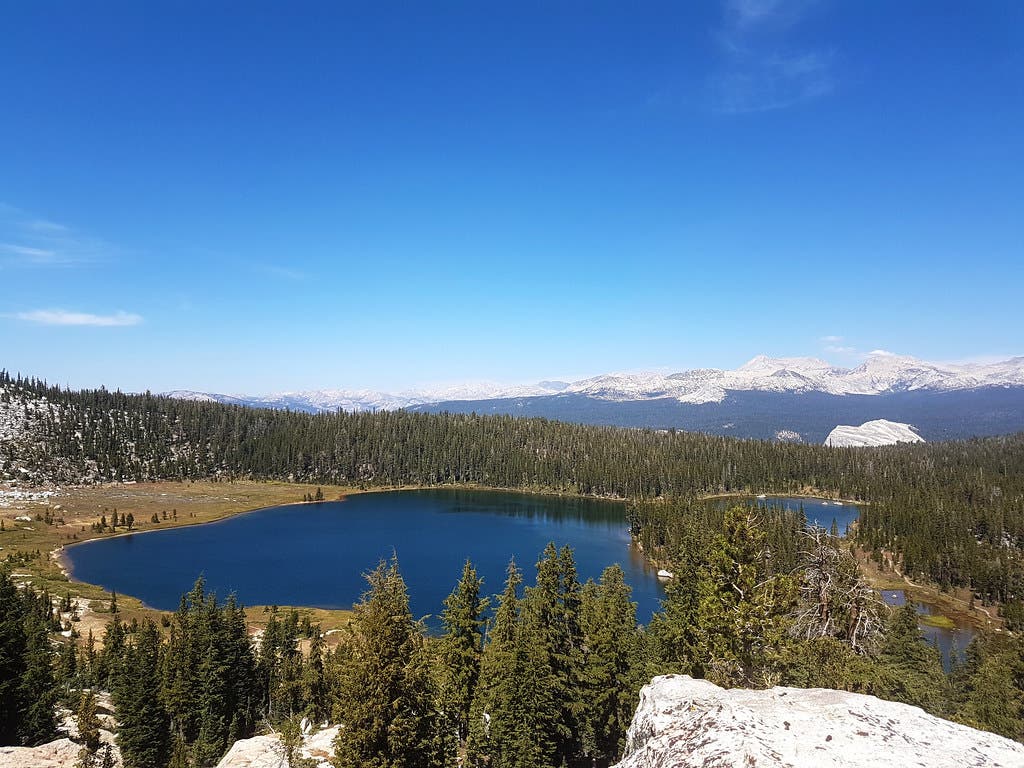
Gain front-row access to the hulking Cathedral Range from the shores of pristine Elizabeth Lake on this jaunt through the conifer-blanketed hillsides south of Tioga Road.The trail begins climbing uphill at a gentle grade, weaving through a deep, boulder-dotted forest of lodgepole pine and mountain hemlock. As the forest thins out, the trail breaks into a lush green meadow divided by the babbling, rock-dotted Unicorn Creek, which funnels water from Elizabeth Lake into the dense lodgepole kingdom below. Just before reaching Elizabeth’s grass-tufted eastern shore, the trail crosses a junction featuring a series of social trails: the right fork offers the quickest access to the lake. Several broad granite slabs, perfect for sunbathing, are plunked into the clear, shallow water just off Elizabeth’s eastern shore. After satisfying your appetite for exploration, use the route you came in on to return to the trailhead.
Permit required ($5 plus $5 per person) Contact Yosemite National Park
Skyline Divide, Mt. Baker-Snoqualmie National Forest, WA

With 2,500 feet of elevation gain in 4.5 miles, the climb to the Divide isn’t the easiest, but the views are well worth it. This 6,000-foot ridge is an extension of Mt. Baker, with views straight to the glaciated volcano and nearby Mt. Shuksan. The deep Cascadian snowpack melts out faster on the exposed ridge than other local hikes, making it a popular midsummer destination, but the hikers thin out quickly when the sun sets. Pitch your tent in one of several established sites just off the ridgeline and settle in for a spectacular sunset show.
Permit none Contact Mt. Baker-Snoqualmie National Forest
Kristin Smith
Greenstone Ridge Trail, Isle Royale National Park, MI

The 43-mile Greenstone Ridge Trail follows the spine of Isle Royale, the largest in a 450-island archipelago comprising the national park of the same name in northern Lake Superior. Accessible only by ferry or seaplane, it offers Alaska-like solitude in the Lower 48 and a certain badge of honor for Midwesterners—the satisfaction that comes with traversing one of the region’s remotest trails. It winds over basalt layers that rise and fall like accordion folds and through thigh-high ferns, rolling up and over thousand-foot mountains. The high point is the open summit of 1,200-foot Mt. Siskiwit, overlooking Isle Royale’s undulating pine woods and the steely waters of Lake Superior. It’s the transition point of the hike; after, on Isle Royale’s leeward side, it seems like a different trail. Firs twisted and dwarfed by the island’s punishing winds yield to stands of towering birch and sugar maple, and the fern-lined trail morphs into a ribbon of scree snaking through hip-high grasses and purple asters.
Permit required (free) Contact Isle Royale National Park
Amy S. Eckert