Updated April 11, 2024 05:13PM
Castle Rock Hike, Kansas
Explore a rocky labyrinth and towering sandstone spires on this easy 2.3-miler around an eroded ancient sea bed in central Kansas.

Looking northeast to Castle Rock, the area's namesake feature.
Castle Rock is one of Kansas’ most interesting geological features. Millions of years of erosion carved the dramatic bluffs, spires, and pinnacles of this stepped, 100-foot contour along the Smoky Valley Scenic Highway. This short loop is packed with bird’s-eye views from ridgelines, and arches, tunnels, and eroded gullies to explore. The area’s namesake, Castle Rock, is a 70-foot-high sandstone bluff that marks the northern end of the loop.
Trail Facts
- Distance: 2.8
- Elevation: 82 feet
- Difficulty: Easy
- Permit: No
The Route
This short hike takes you up, over, and through rocky bluffs until you reach the 70-foot Castle Rock.
-Mapped by Kristy Holland
ADVERTISEMENT
The Start of the Castle Rock Loop to the Main Bluff’s Tunnels

The best place to start is at the Castle Rock overlook where you get a great view of the area and its formations from above. You can also skip the viewpoint and begin your hike at the base of the formations. Pick your path by following already-worn trails.
Main Bluff’s Tunnels to Spire Overlook

The mapped route above begins about halfway to Castle Rock’s main formation and provides easy access to the area’s most interesting rocky sections. Pick your way under arches and through rocky tunnels while following well-worn trails to the top of the ridge.
The Spire Overlook to the Fin

Peek over the rocky edges at the towering sand and limestone cliffs below. Note that it’s more difficult to work your way back down to the bottom of the cliffs from here, so trace the singletrack along the ridge heading south.
ADVERTISEMENT
The cliffs shorten at Castle Rock’s southern end and this route dips toward the road. Follow this route to explore lone pillars on the road’s south side, or turn north to trace the bottom of the cliffs. Follow the road toward the parking lot, but tuck back into the rocky wonderland at the towering 40-pillar near the first car turn-around.
The Fin to Castle Rock

As you continue north toward Castle Rock, there’s an impressive fin. Climb the crumbling little hills on your right and traverse an open field. Since Castle Rock is on private property, you’ll find an old fence that crisscrosses the area en route to Castle Rock’s namesake (and most dramatic) formation. Before you arrive at the 70-foot tower, bear left to check out the rounded gray mounds west of the spire. Then make your way to Castle Rock.
Castle Rock Back to the Parking Area
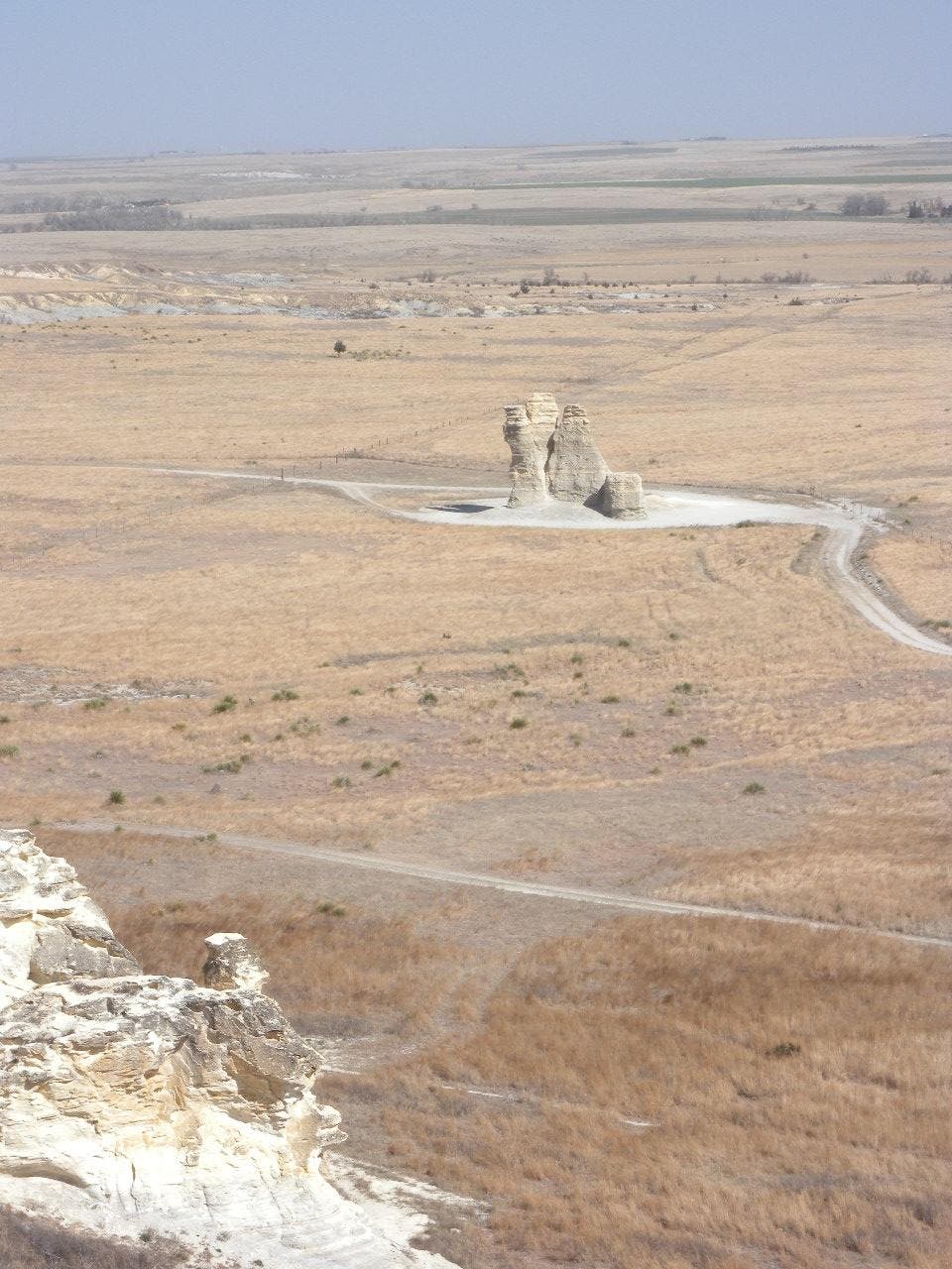
At the loop’s northernmost point, you’ll arrive at Castle Rock, an impressive rock formation made of sandstone, shale, and chalk. These towering pinnacles are still being shaped by erosion. The tower crumbles occasionally with two notable sections collapsing in 1998 and 2001. After taking an up-close look, follow the road or the singletrack on its east side to the parking area.
Additional Photos


