Great Smoky Mountains National Park: Charlies Bunion Loop

A mere footnote in the geologic record, Charlies Bunion may lack the fame other Smoky Mountain hikes. But stand on this weatherworn promontory and peer past the dizzying 1,000-foot dropoffs to a quintessential Smokies skyline, and there’s no doubt: This is a destination worth getting up early for.
In fact, a predawn alarm isn’t a bad idea, since you’ll be bagging the standout summit in the most visited U.S. national park. There’s a reason the softshell-clad masses trek through an evergreen tunnel along the spine of the Appalachians: A jaw-dropping panorama stretches from Mt. LeConte eastward to the jagged peaks of the Sawteeth Range. A 1925 wildfire that incinerated the slopes of this 5,565-foot knob is responsible for the exceptional view—and the peculiar name. Noted outdoorsman Horace Kephart named the bulbous peak in 1929 after observing its resemblance to his hiking companion’s inflamed big toe.
TIPS TO DO IT RIGHT
* Spring brings the thru-hikers, and summer and fall bring everyone else. Visit the Bunion in winter, and you’ll enjoy even better views through the leaf-bare trees, plus likely avoid a bottleneck at the outcrop. A bonus: The low humidity and cool, dense air help confine that famous Smoky Mountain fog to the valleys.
* Take a short detour from the Appalachian Trail onto the Boulevard Trail, 2.7 miles from the Newfound Gap trailhead, to reach The Jumpoff, an overlook with a great view of the Bunion.
-Text by Thomas Wilmes. Mapped by Tim Johnson
PLAN IT
MAP
- Trails llustrated Clingmans Dome/Cataloochee/Great Smoky Mountains NP ($10, natgeomaps.com)
- View a map of the park at the Great Smoky Mountains National Park website.
- Order the USGS topo quads listed above at store.usgs.gov.
- Order a custom map of this route at MyTopo.com.
GUIDEBOOK Hiking Trails of the Smokies ($21, smokiesstore.org) details all 150 maintained trails within the park.
PERMITS Required when camping at a backcountry campsite or shelter (free, reserve up to one month before your trip and pick up in person). Backcountry reservation office: (865) 436-1231, nps.gov/grsm/planyourvisit/backcountry-camping.htm
CONDITIONS Check weather at Gatlinburg, TN (37738) Weather
SEASON The park is open year-round, and our trail scouts have hiked this route in every season. Check for road, trail, and camping closures at nps.gov/grsm/planyourvisit/temproadclose.htm. Curious about fall foliage? Check nps.gov/grsm/planyourvisit/fallcolor.htm.
PARK INFO Great Smoky Mountains National Park, (865) 436-1200; nps.gov/grsm
SMOKIES TRIP PLANNERnps.gov/grsm/planyourvisit/trip-planner.htm
GAS
Shell Super Mart
376 Parkway
Gatlinburg, TN 37738
(865) 430-2161
Texaco
799 Tsali Blvd.
Cherokee, NC 28719
(828) 497-4539
GEAR
Nantahala Outdoor Center
13077 Highway 19 W
Bryson City, NC 28713
(888) 905-7238
Blackrock Outdoor Co.
570 West Main St.
Sylva, NC
(828) 631-4453
Mast General Store
63 N. Main St.
Waynesville, NC 28786
(828) 452-2101
Smoky Mountain Outfitters
469 Brookside Village Way
Gatlinburg, TN
(865) 430-2267
GROCERIES
Food City
1219 East Parkway
Gatlinburg, TN 37738
(865) 430-3116
Bearland General Store
305 Historic Nature Trail
Gatlinburg, TN
(865) 436-4565
Bradley’s Grocery
1699 Paint Town Rd.
Cherokee, NC 28719
(828) 497-9132
RESTAURANTS
Smoky Mountain Brewery
1004 Parkway # 501
Gatlinburg, TN 37738
Best Italian Cafe & Pizzeria
968 Parkway # 9
Gatlinburg, TN 37738
(865) 430-4090
Granny’s Kitchen
1098 Paint Town Rd.
Cherokee, NC 28719
(828) 497-5010
Peter’s Pancakes and Waffles
1384 Tsali Blvd.
Cherokee, NC
(828) 497-5116
Trail Facts
- Distance: 20.6
Waypoints
CBL001
Location: 35.610933, -83.425219
Hike northeast from Newfound Gap.
CBL002
Location: 35.621109, -83.403801
Turn R @ T onto Sweat Heifer Creek Trail
CBL003
Location: 35.61367, -83.386253
Trail cuts to NE @ old logging landing; continue descent to creekbed
CBL004
Location: 35.618881, -83.380814
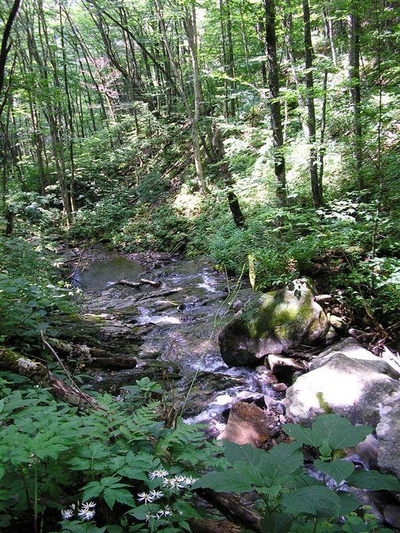
Cross Sweat Heifer Creek, a sun-dappled stream with rippling cascades and a swimming hole
CBL005
Location: 35.610229, -83.368683
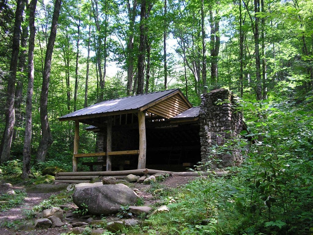
Pass Kephart Prong Shelter, a large stone hut tucked into a glade. Turn L @ T; follow Grassy Branch Trail to N
CBL006
Location: 35.626019, -83.35759
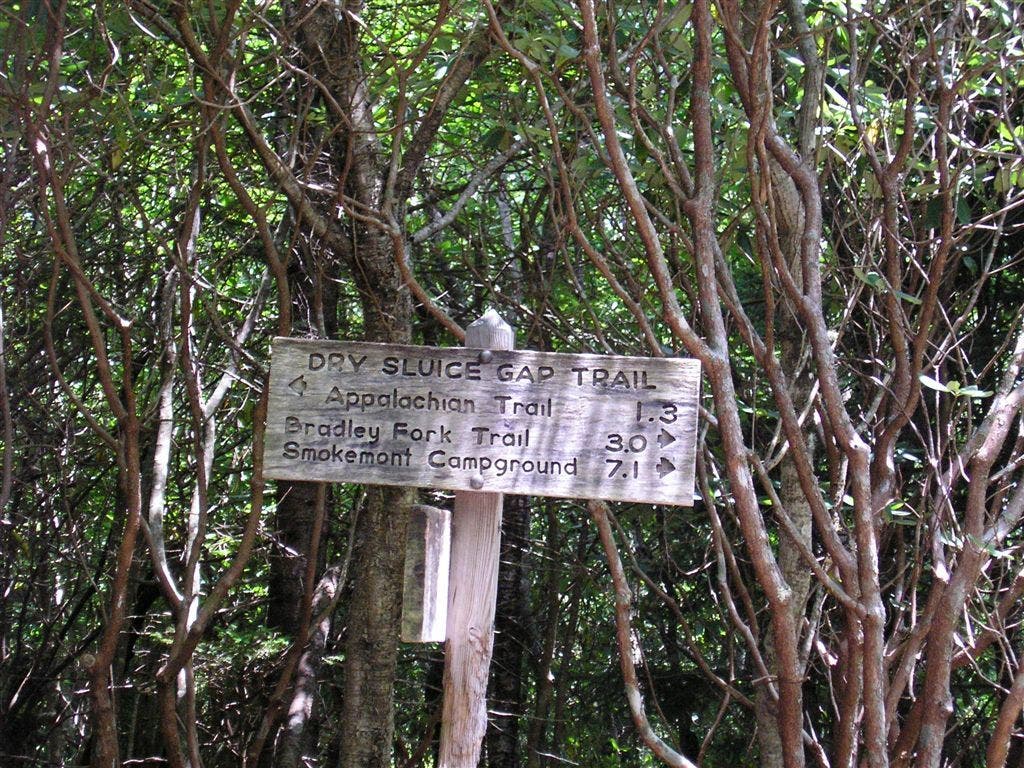
Turn L @ T for steady ascent up Dry Sluice Gap Trail
CBL007
Location: 35.63813, -83.369133
Turn L @ T onto Appalachian Trail
CBL008
Location: 35.638405, -83.372253
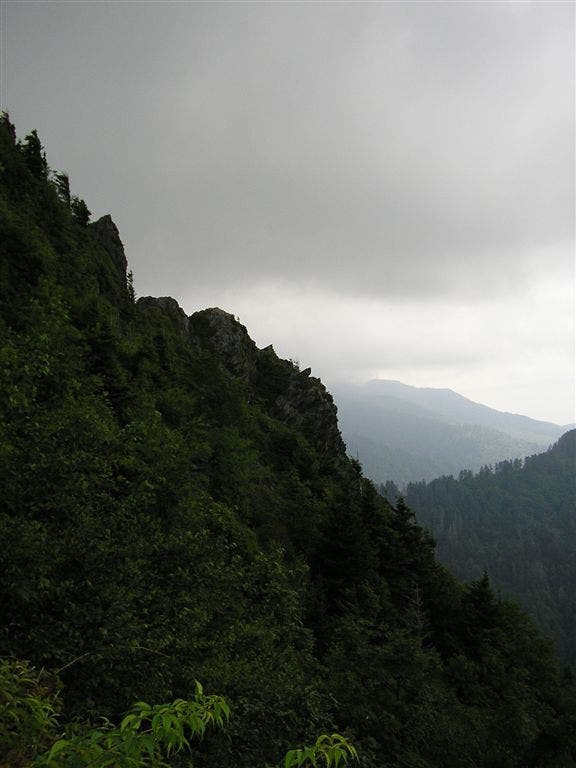
Traverse S edge of Charlies Bunion, a bare, rocky bluff with 1,000-ft. drop-offs to N
CBL009
Location: 35.637497, -83.376785
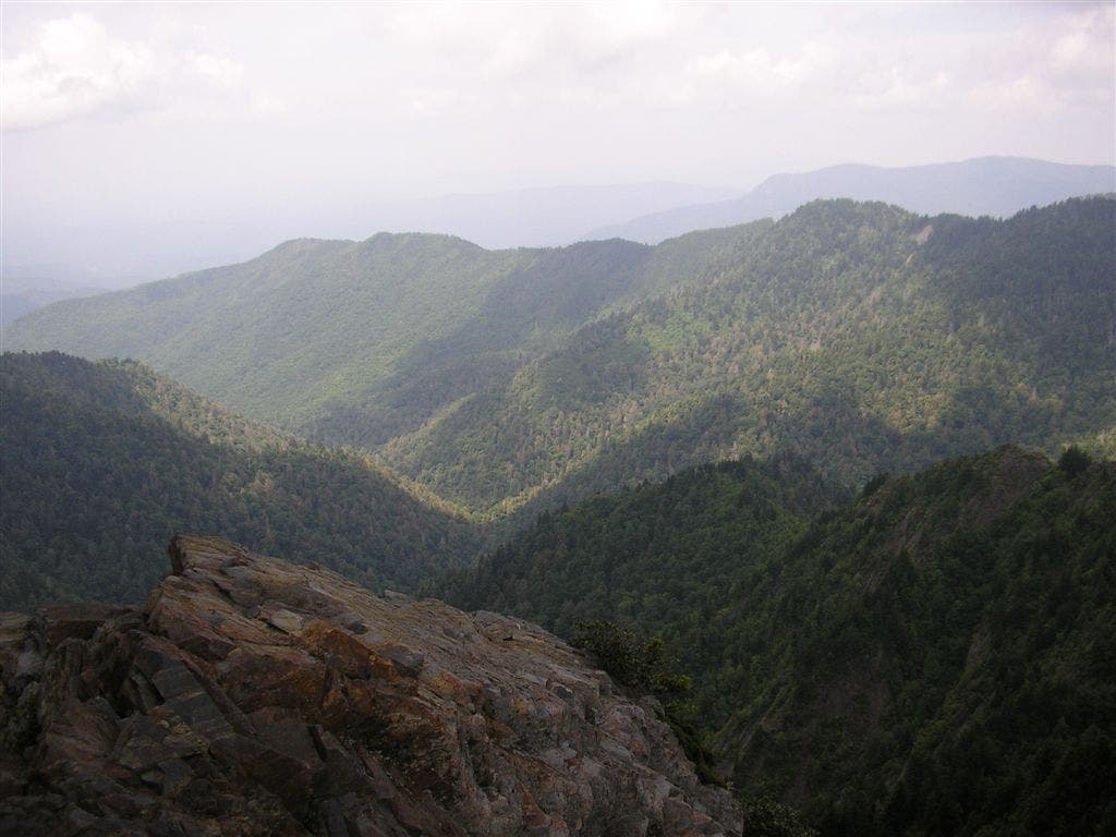
Rock outcrop provides views of layered Smoky Mountain ridgelines; traverse ridgecrest to SW
CBL010
Location: 35.630009, -83.386368
Pass Icewater Spring Shelter (one of the finest on the AT; sleeps 12 and has a privy)
CBL011
Location: 35.62838, -83.390671
Stay straight on AT @ 3-way with Boulevard Trail. Follow NC/TN state line for SW descent on lush ridgeline back to WPT 2. Return to car.
Kephart Prong Shelter
Location: 35.610226, -83.368378
The Kephart Prong Shelter is a large stone hut tucked into a glade. Look for non-native Norway Spruce along this trail, planted by Champion Fibre Company in pre-park days. ©Tim Johnson
Dry Sluice Gap Trail
Location: 35.62603, -83.357263
Trails are typically well-signed in the park. ©Tim Johnson
View from Bunion
Location: 35.638395, -83.372047
The view from Charlies Bunion. The outcrop was originally cleared by a fire in 1925. ©Tim Johnson
Smokies vista
Location: 35.637501, -83.376698
Outcrop provides views of layered Smoky Mountain ridgelines ©Tim Johnson
Sweat Heifer Creek
Location: 35.619282, -83.380867
Cross Sweat Heifer Creek in a forest of Eastern Hemlock, Yellow Birch, and Rosebay Rhododendron; Watch for Rattlesnake Plantain, a member of the orchid family named for its distinctively veined evergreen basal leaves. ©Tim Johnson