Grand Canyon National Park: North Kaibab Trail to Bright Angel Canyon

Hike south from the North Kaibab Trailhead. Ahead, descend the North Rim on a steep and snaking dirt path. The San Francisco Peaks rise dramatically to the south behind the flat-topped canyon. Switchback descent continues. Walk through the Supai Tunnel, a 20-foot-long hole in the rock wall. Potable water (seasonal) and restrooms are available here. Cross a bridge over Roaring Springs. To the north, you may be able to spot the Supai Tunnel and the North Rim. Turn around for the last views of the North Rim, then continue straight @ 3-way junction to enter Bright Angel Canyon. Optional: Turn left @ 3-way junction onto the 0.5-mile spur trail to Roaring Springs for views of water pouring out of the cliff wall and cascading down to Bright Angel Creek.
-Mapped by Trung Q. Le
PLAN IT
GUIDEBOOK AND MAP Hiking Grand Canyon National Park, 3rd Edition , Ron Adkison and Ben Adkison ($19, falcon.com). Trails Illustrated Grand Canyon ($12, natgeomaps .com). Plan other trips in the park using BACKPACKER’s Grand Canyon National Park page.
CUSTOM TOPO MAPS Download tracks and waypoints, print or order custom topos, from the map tools menu on the web version of the trip report.
SEASON March to May and October to November. From June to September, inner canyon temps from are often above 100°F. Start early to beat the midday heat. Also, don’t forget it is much easier to descend into the canyon than climb back up. Expect to spend at least double the time climbing than descending
KEY GEAR Wide-brim hat and six liters of water storage.
PERMITS $10 per permit, plus $5/person per night. Apply (nps.gov/grca/planyourvisit/backcountry-permit.htm) on the first of the month four months prior to your hike date (e.g., June 1 for a hike beginning in Nov.) and fax it to (928) 638-2125
CONTACT Backcountry Information Office: (928) 638-7875 (from 1 to 5 p.m., Monday to Thursday), nps.gov/grca
STOCK UP Canyon Village Marketplace, South Rim. (928) 638-2262 http://www.nps.gov/grca/index.htm
FREE TRIP PLANNERS Get news on vacation deals and lodging at mygrandcanyonpark.com
10 Summer Hiking Essentials
Water – Plain and some with electrolyte replacement.
Food – especially salty foods. Eat twice as much as normal.
First Aid Kit – bandaids, ace wrap, antiseptic, moleskin, etc.
Map – while many trails are well-marked, maps are helpful tools.
Pack – to carry the essentials.
Flashlight/Spare Batteries – allows you to hike out during the cool of the evening.
Spray Bottle – fill with water for your own personal air conditioning system.
Hat/Sunscreen – to keep the sun off you and protect your skin.
Whistle and/or Signal Mirror – for emergency use.
Waterproof Clothing – poncho or jacket; especially usefull during monsoon season (mid-July to early September).
The North Rim: Mid-May to Mid-October
North Rim Lodging and camping along with all other visitor services and facilities are only open from mid-May to mid-October. Reservations are strongly recommended. Additional facilities are available in the surrounding Kaibab National Forest, the Kaibab Lodge area, and Jacob Lake.
Trail Facts
- Distance: 13.1
Waypoints
BAC001
Location: 36.216938, -112.056679
Hike south from the North Kaibab Trailhead. Ahead, descend the North Rim on a steep and snaking dirt path.
BAC002
Location: 36.215412, -112.053085
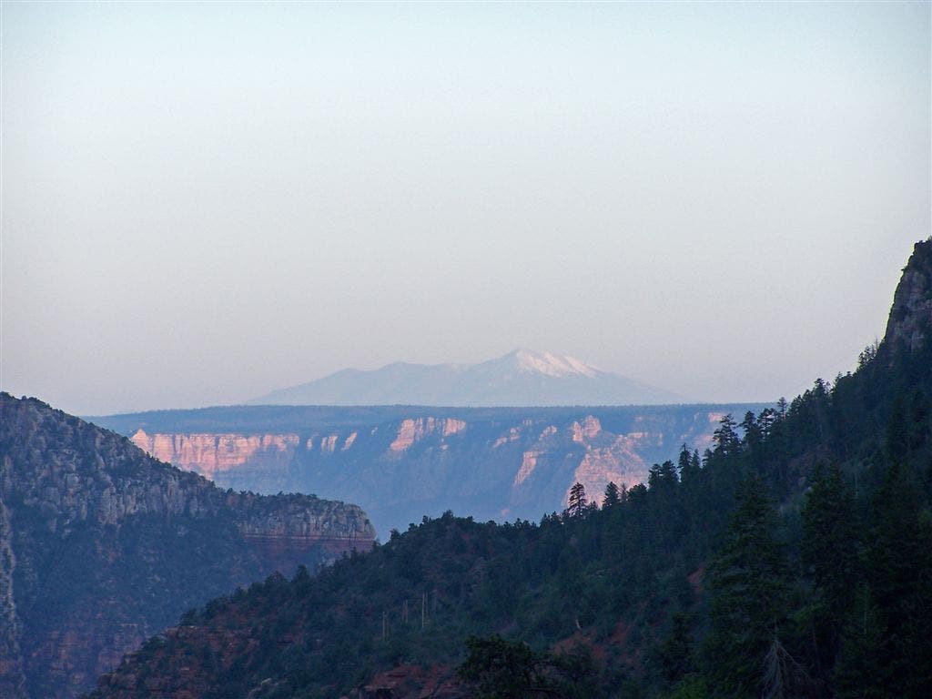
The San Francisco Peaks rise dramatically to the south behind the flat-topped canyon. Switchback descent continues.
BAC003
Location: 36.21122, -112.049423
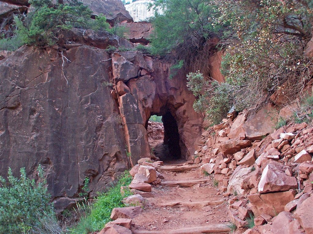
Walk through the Supai Tunnel, a 20-foot-long hole in the rock wall. Potable water (seasonal) and restrooms are available here.
BAC004
Location: 36.207188, -112.046577
Cross a bridge over Roaring Springs. To the north, you may be able to spot the Supai Tunnel and the North Rim.
BAC005
Location: 36.19257, -112.033928
Turn around for the last views of the North Rim, then continue straight @ 3-way junction to enter Bright Angel Canyon. Optional: Turn left @ 3-way junction onto the 0.5-mile spur trail to Roaring Springs for views of water pouring out of the cliff wall and cascading down to Bright Angel Creek.
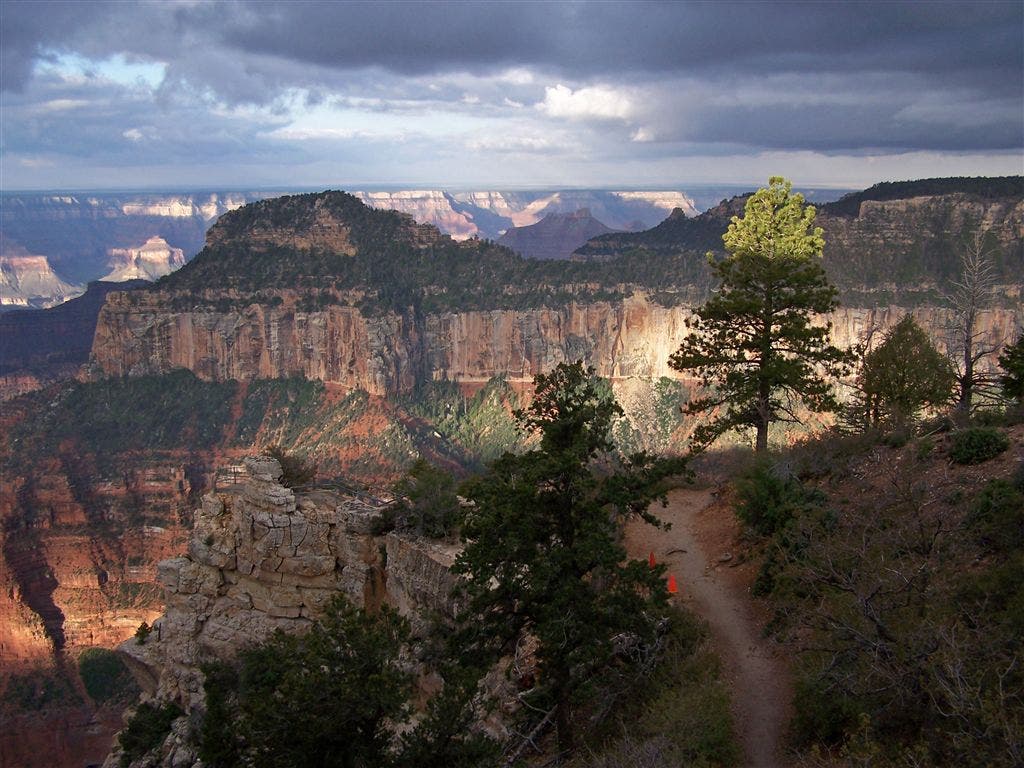
North Rim Views.jpeg
Location: 36.216904, -112.056763
Looking south from the North Rim. © Trung Q. Le
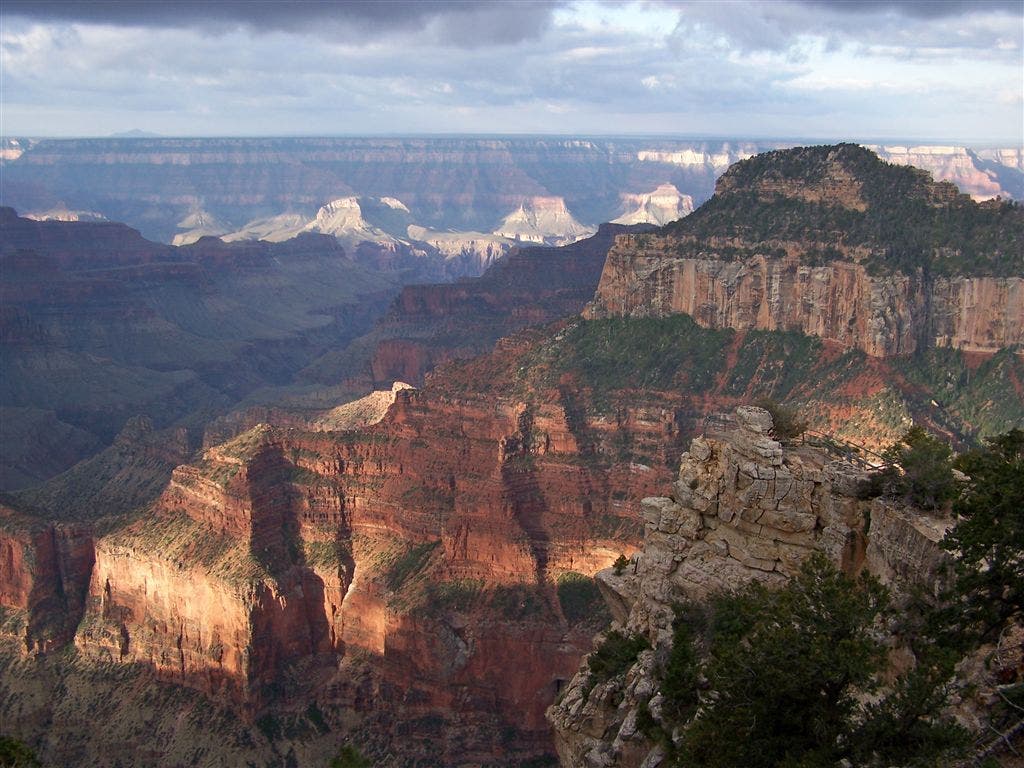
Views from the North Rim.jpeg
Location: 36.216043, -112.056599
Looking south from the North Rim. © Trung Q. Le
Supai Tunnel.jpeg
Location: 36.211208, -112.049394
© Trung Q. Le
San Francisco Peaks.jpeg
Location: 36.211247, -112.049083
Roaring Springs Canyon.jpeg
Location: 36.202369, -112.043847
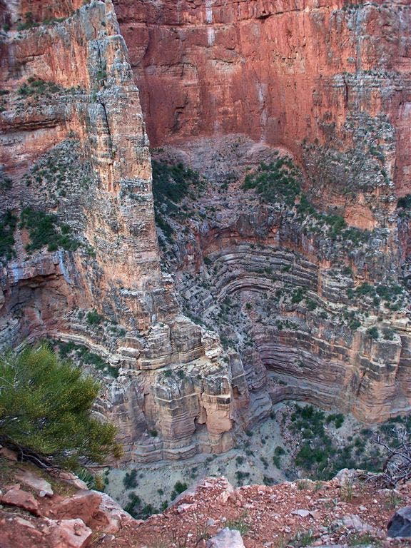
Look for the various layers that make up the canyon wall. © Trung Q. Le