Backpack Grand Canyon National Park

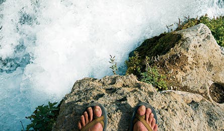
'Above Thunder River's Headwaters (Greg Von Doersten)'

Above Thunder River’s Headwaters (Greg Von Doersten)

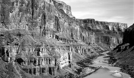
The Colorado River Winding Through the GC (Michael Clark)

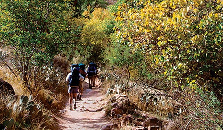
Indian Canyon (Elias Butler)

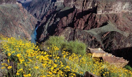
Photo by Ed Callaert
The Grand Canyon is not merely unique among American parks. It’s unlike any place else on the planet, wild or not. The numbers–one mile deep, up to 20 miles wide, 277 miles long, and packed with 2 billion years of geologic history–barely scratch the surface. But what’s truly amazing is that barely six percent of the 4-plus million annual visitors actually leave the roadside overlooks, leaving 95 percent of the park to hikers. The only other visitors, on mules or on rafts, rarely leave their restricted corridors. On foot, you’ll encounter all of the Grand Canyon’s gifts, from cliff-dancing bighorn sheep to hidden springs, and unmatched sunsets to awesome solitude.
Entrance Strategy
Getting there From Phoenix, the Grand Canyon’s south rim is a 230-mile, four-hour drive on I-17 N and then US 89 NW. From Las Vegas, it’s a 276-mile, four-and-a-half hour drive via US 93 and I-40. The turn-off to the South Bass trailhead is located just south of the park entrance gates, which means you avoid the most crowded entrance station.
Season In this extremely dry country, the best time to hike is late spring when water is most plentiful. Late fall is good too, but check with park rangers on water availability. Triple-digit temperatures make our suggested route hazardous in summer.
Best frontcountry campground The 70 spacious sites in Ten X Campground (in Kaibab National Forest) sit in a secluded ponderosa pine and oak forest just four miles south of the park entrance on US 180. They’re $8 cheaper and less crowded than any campground in the park. Contact: (928) 635-8200; fs.fed.us/r3/kai. Note: When Ten X is closed (November to April), hit Mather Campground inside the park (877-444-6777; recreation.gov).
Pre-trip breakfast If you’re starting in Flagstaff–or leaving Phoenix at dawn–pick up a sinfully smooth Mars Hill mocha and a tasty egg burrito at Late for the Train in Flagstaff (928-773-0308). In the park, your best option for a quick, cheap breakfast is Maswik Cafeteria, in Maswik Lodge at the west end of Grand Canyon Village. Note: The town of Tusayan, just south of the park entrance, offers little restaurant fare beyond standard fast food franchises.
Gear Shop Peace Surplus (928-779-4521; peacesurplus.com), in Flagstaff, rents trekking poles for $3 per pair, per day. There’s no full-service gear store in the park or Tusayan, but you can buy fuel and basic groceries at the Grand Canyon Village store.
Permits Avoid the tourist-oriented South Rim Visitor Center, near Yavapai Point, and go straight to the hiker-specific Backcountry Information Center (928-638-7875) in Grand Canyon Village. There you can get required permits ($10, plus $5 per person per day), maps, info on trail conditions, and backpacking advice. Apply for your permit up to four months in advance (a must during popular spring and fall hiking months) online at nps.gov/grca/planyourvisit/backcountry-permit.htm.
The Trip
Treasure Hunting: Discover the Canyon’s best-kept secrets on this 50-mile hike down the secluded West Tonto Trail.
Life gets pared down quickly on the West Tonto. Even on milder spring days on this arid shelf, your world is reduced to walking and water. Or, more specifically, walking to get to water. For five days, that is what you do. It’s all you do. And it will be the best five days of your life.
The trek that Grand Canyon regulars call “the jewels” descends the South Bass Trail for four miles through brush-choked Bass Canyon to the Tonto Plateau, an exposed and undulating balcony perched 2,000 feet above the Colorado River. Rather than continuing down Bass to the rapids, you’ll hang a right on the West Tonto. Here, the people are few and water is sparse–yet conveniently spaced a day’s walk apart in side canyons all named after precious gems: Ruby, Turquoise, Sapphire, and Agate.
The bumpy 25-mile dirt road to South Bass trailhead weeds out many would-be hikers. (That, and the mandatory car shuttle to Hermits Rest trailhead, at the end of your hike.) And since most of this trek is a lateral ramble across the Grand Canyon’s panoramic mezzanine level, it is not sought out by goal-oriented endurance hikers who stick to more difficult and crowded rim-to-river trails. Heading east from the South Bass junction, the barely discernable West Tonto Trail winds through a sun-baked, low-lying obstacle course of blackbrush and prickly pear cactus. The canyon falls away to your left, dropping thousands of feet straight down into a tight corridor of black schist and green river. Across the gorge, an archipelago of pastel-colored buttes and temples rise from an ocean of space stretching some 20 miles to the canyon’s North Rim. Within two miles from the junction, you’ll reach the twisting folds of Serpentine Canyon, your first night’s camp. If you’re lucky, the tiny seep at the canyon’s bottom will be running, producing a trickle of the cold, sweet water that emerges from an ancient aquifer. (Depending on seasonal precipitation, Serpentine can be dry. Be prepared to dry camp your first night, carrying six to eight liters per person.)
Your second day, it’s another six achingly beautiful miles on the Tonto to Ruby Canyon, the next water source. As you circumnavigate the deep drainage from the Tonto’s high perch, you’ll spot the glint of water. Near the head of the canyon, the trail meets a sandy streambed and a series of shallow, clear pools that are fed by a bubbling spring. Mission accomplished. Guzzle up.
On day three, continue connecting the dots, hiking six miles from Ruby to Turquoise Canyon and another water-blessed camp. Between the jewels, take in the space and solitude, venturing to the lip of the plateau to look down at the Colorado. Day four brings Sapphire and Agate–each a lush oasis. After 14 long miles, you’ll reach flowing Boucher Creek. Camp here, next to what seems like an obscene amount of water. On your fifth and final day, you’ll climb 10 steep miles out of the canyon on the Boucher and Hermit Trails to Hermits Rest trailhead, where your car is parked. (Note: Reliable water on this route can usually be found in Ruby and Turquoise Canyons and Boucher Creek. Depending on seasonal precipitation, water may also be found in Serpentine, Sapphire, and Agate Canyons. A high-clearance, 4WD vehicle is required.) Plan B: the east tonto trail Although the 30-mile East Tonto Trail is not as remote as the West Tonto, it still has the far-as-the-eye-can-see, 360-degree vantages atop the Tonto Plateau. It is also significantly less crowded than the popular corridor trails like the South Kaibab and Bright Angel. Hike down the south rim’s brutally steep and rocky New Hance Trail to the river and camp on the beach near Hance Rapid, then ascend scree-filled slopes of the Colorado River gorge, turning west on the East Tonto Trail toward Hance Creek and hulking Horseshoe Mesa. You can climb up the east side of this red monolith via the Page Springs Trail or continue on the East Tonto to Cottonwood Creek. Have lunch on the mesa and soak in the panoramic view; if you’re not claustrophobic, take a peek inside Cave of the Domes near the Cottonwood Trail junction. From Horseshoe Mesa, it’s three steep miles to the south rim via the Grandview Trail.
Exit Strategy
Clean up Built in 1905 and perched on the edge of the rim in Grand Canyon Village, the El Tovar Hotel is both a national historic landmark and a great place to take a bubble bath in a clawfoot tub. Rates for a queen size room start at $196 per night, and it’s a worthy indulgence. Make reservations well in advance. grandcanyonlodges.com
Pig out Savor canyon views and wild game like buffalo carpaccio at El Tovar’s dining room, the park’s most upscale restaurant (reservations: 928-638-2631). For a more casual meal–like baby back ribs drizzled in prickly pear barbeque sauce–plus local microbrews like Apache Trout Stout, go the Arizona Room at Bright Angel Lodge in Grand Canyon Village (no reservations required).
Best dayhike: Tanner Trail to Cardenas Butte
You won’t run into any street-shoe, just-off-the-tour-bus dayhikers on this little-traveled trail located on the far eastern end of the park’s south rim. From the Tanner trailhead at Lipan Point (two miles west of the Desert View entrance), it’s seven quad- and-calf burning miles (roundtrip) to the top of the Redwall just below Cardenas Butte. Once there, feast your eyes on unobstructed views of the eastern Grand Canyon, Marble Canyon, and the Colorado River. There is no water on this hike, so pack plenty.
Try something new Mountain bike the north rim (18 miles one- way) along the edge on the Rainbow Rim Trail, located west of the park in Kaibab National Forest. The singletrack leads to five panoramic overlooks with sweeping views of Powell Plateau and the western Grand Canyon. Car camp at Fire or Fence Points, just 100 feet from canyon’s edge. No permits are required for these primitive sites. Contact: (928-635-8200; fs.fed.us/r3/kai/recreation/trails/nkrd_rainbow_rim.edu/nfsnc)
Go Deeper Than the Rest
Do your homework Rangers are wary of hikers who ask for ideas on routes. In the ranger’s mind, it shows inexperience (i.e. potential rescue), and they’ll direct you to the cattle paths: Bright Angel, South Kaibab, Hermit. Know your options and ask for a specific route.
Hike in winter December to February is better than midsummer for hikers: dark red canyons dusted in white, peaceful trails (permits are no problem), and T-shirt weather at river level. Pack in-step crampons for the first mile of trail below the rim.
You’re a Tourist, Now Act Like One
Cool off in the air- conditioned Grand Canyon IMAX theater in Tusayan. In classic IMAX fashion, the 30-minute “Grand Canyon: Discovery and Adventure” film gives you condor’s-eye views of the Big Ditch. Swoop off the rim and sail over the place you just hiked. Located in the National Geographic Visitor Center. Tickets $13; open daily 8:30 a.m. to 8:30 p.m. (928) 638-2468; explore-the-canyon.com
The Stats
Acres 1.2 million
Miles of trail 588
Website nps.gov/grca
Phone (928) 638-8777
2007 visitation 4.5 million (total), 282,663 (backcountry)