Glacier Peak Wilderness: Spider Meadow to Spider Glacier

Let Type A hikers have their monster mileage. If you’re more Type B–long lunch breaks, photo detours, early campsites–this 14.2-mile out-and-back is for you. The path meanders through lush, knee-high grasses and avalanche lilies and passes countless dreamy tent sites as it gains just 1,700 feet to the foot of a glacier. Late July has the best blooms.
From the Phelps Creek trailhead, 2.5 hours east of Seattle, follow an old roadbed lined with salmonberry bushes (and dive-bombing hummingbirds), northeast. You’ll pass the Carne Mountain Trail in .2 mile and enter the Glacier Peak Wilderness 2.3 miles later. The landscape quickly transitions from a rocky, fading roadbed to a dirt singletrack punching into the heart of a colorful, flower-filled meadow. About one mile later, rock-hop across Leroy Creek’s rushing waters (drop your pack and head upstream 100 yards off-trail to see a hidden multi-tiered falls).
Dry out in the next two miles, climbing steadily through pine forests and intermittent flower gardens. At mile 5.2 you’ll reach the first of several idyllic campsites at the edge of wide, U-shaped Spider Meadow, at the foot of 7,646-foot Red Mountain. It’s one mile across the meadow to a couple more campsites.
From here, the route ascends to higher meadows and crosses Phelps Creek. Bear left at the next Y-junction and scan for the last (and best) campsite on the route. It’s sheltered from wind, near water, and has a bald eagle’s view of sprawling Spider Meadow and craggy Seven Fingered Jack in the distance.
Set up camp, then climb sharply to 7,100-foot Spider Gap. Just .6 mile beyond is the foot of Spider Glacier. A creek flows from its base and cascades here at your feet. Return the way you came, an all-downhill amble back to the trailhead.
Permit: A Northwest Forest Pass is required year-round ($5/day, $30/year). (800) 270-7504, naturenw.org
Gear up: Der Sportsmann has maps, fuel, gear, and expert local knowledge. 837 Front St., Leavenworth, WA; (509) 548-5623; dersportsmann.com
-Mapped by Alan Bauer, Alan Bauer Photography

Trail Facts
- Distance: 23.0
Waypoints
SDR001
Location: 48.082558, -120.835022
Hike north past signposts and wilderness registration kiosks on old roadbed that travels above Phelps Creek. Depending on the season, trailside salmonberry plants may buzz with hummingbird flybys.
SDR002
Location: 48.084522, -120.833008
Continue straight @ 3-way junction with Carne Mountain Trail, which veers to the right. Walk northeast through forest on wide, rocky trail; listen to the sounds of Phelps Creek below.
SDR003
Location: 48.115444, -120.837082
Head north into the Glacier Peak Wilderness; landscape immediate transitions from rocky, overgrown roadbed to lush meadows filled with wildflowers.
SDR004
Location: 48.12637, -120.840332
Rock hop across Leroy Creek, whose rushing waters flow into Phelps Creek (prepare for wet feet if hiking early in the season). Next, continue heading northwest past a boot path on right that hikers use to access Leroy Basin and Seven Fingered Jack.
SDR005
Location: 48.149246, -120.857063
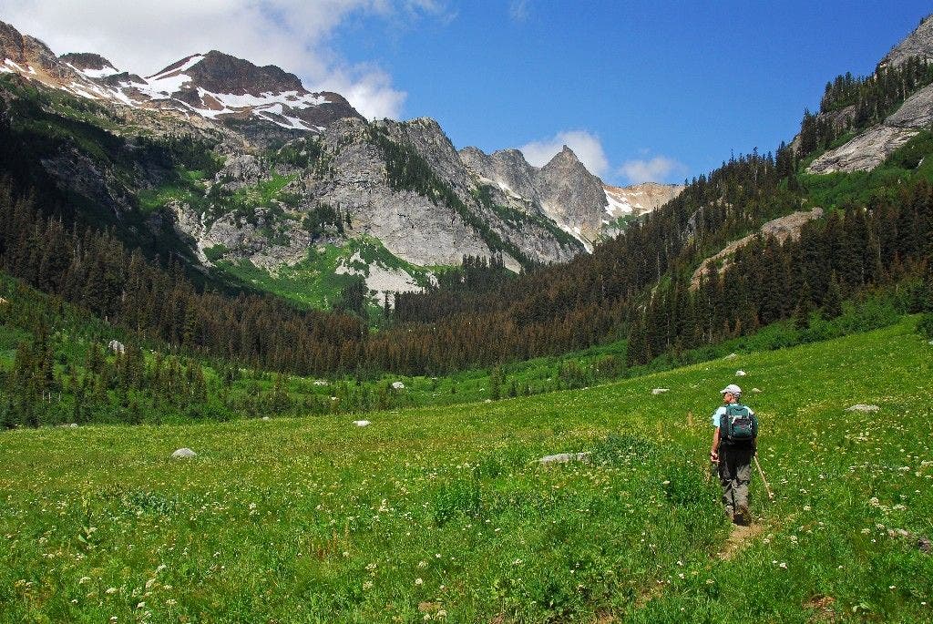
Pass numerous campsites (these sites fill up quickly during the summer). Next, leave the forest and walk across Spider Meadow, a verdant mountain meadow rimmed by rugged peaks; seasonal wildflowers speckle the ground.
SDR006
Location: 48.156021, -120.863945
The trail begins to climb to higher meadows and passes intermittent stands of alpine fir-look for warblers, mountain bluebirds, and western tanagers.
SDR007
Location: 48.159416, -120.868599
Leave the upper Spider Meadow and cross Phelps Creek’s cold, rushing waters. Although this creek is not wide, it can be fast and deep in early season. Ahead, continue north through forest beginning to get serious and steep. Look for blooming bear grass along this stretch.
SDR008
Location: 48.161991, -120.869896
Bear left @ marked Y-junction. Next, tackle a very steep climb that leads to views above Spider Meadow. The trail on the right climbs another mile into Phelps Basin for more meadows and flowers along Phelps Creek.
SDR009
Location: 48.161057, -120.877045
Drop your packs and take a minute to enjoy this vantage point: the entire Phelps Creek Valley and Spider Meadow are rimmed by Seven Fingered Jack and other peaks in the Entiat and Chiwawa mountains. A creek flows down from Spider Glacier and cascades over a waterfall at your feet.
SDR010
Location: 48.161964, -120.879723
Wander around Spider Glacier (this is the main route to Spider Gap for many hikers). Look for marmots that live around the rocks near the creek and near the toe of the glacier. Follow the same route back to the trailhead.
Grassy Meadow
Location: 48.148258, -120.856216
A hiker walks across verdant meadows southeast of Red Mountain.