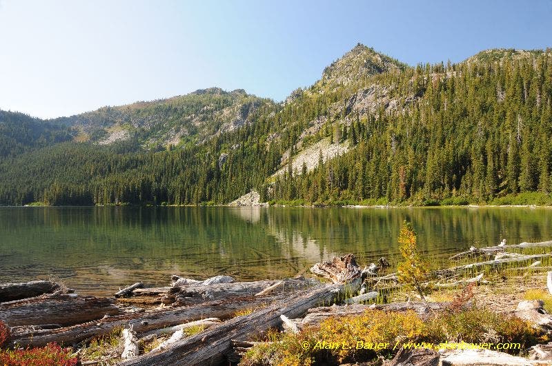
Glacier Peak Wilderness: Schaefer Lake

Nestled in the eastern reaches of Washington’s toothy Glacier Peaks Wilderness, Schaefer Lake offers a veritable buffet of backcountry delights: solitude, stream crossings, vibrant vegetation and stunning views. From the trailhead, descend through old-growth cedar and fir as you wind your way toward the powerful Chiwawa River. If you’re feeling adventurous, try negotiating the river’s precarious log jam crossing. When water levels are low in late summer, hikers can cross the river about 100 feet downstream.
Continue up at a steady incline while taking in the seasonal wildflowers and teases of the pristine Chiwawa River Valley below. Cross two more streams—one wet, one bridged—as you bear down for the most strenuous part of the trek: a steep, mile-long stretch ending at the Glacier Peak Wilderness boundary. Once at the lake—now just a few up-and-down pitches away—head to its grassy eastern shore to check out the abundance of plant life, including seasonal blueberry bushes.
Though the trail is generally well marked, don’t be surprised to encounter a few windblown trees blocking the path, especially if it’s been awhile since the trail crew’s last visit. Hikers wary of crossing the unpredictable log jam should wait until late August and September when the levels of the Chiwawa River are lowest.
-Mapped by Alan Bauer, Alan Bauer Photography

Trail Facts
- Distance: 13.7
Waypoints
SCH001
Location: 47.952696, -120.772449
Head west from the parking area and slowly descend toward the river. Old-growth cedar and fir flank the trail.
SCH002
Location: 47.952307, -120.776759
The Chiwawa River intersects the trail; carefully maneuver across the log jam crossing. If you prefer to ford the river, walk downstream about 100 feet to the shallow gravel bar. Caution: This section of river may be impassable in early spring due to snowmelt. Do not try to ford the river if water levels are too high.
SCH003
Location: 47.952394, -120.785617
The trail steepens and reveals glimpses across the Chiwawa River Valley; seasonal wildflowers speckle the ground.
SCH004
Location: 47.95652, -120.797804
In early summer, prepare to get your feet wet at this creek crossing (moss-coated rocks line the creek). Continue heading northwest across the mountainside.
SCH005
Location: 47.962274, -120.806973
Rest your legs at this viewpoint that overlooks the Chiwawa River Valley and the massive peaks of the upper valley. Ahead, the trail rounds to the west toward Schaefer Creek.
SCH006
Location: 47.960835, -120.812578
Traverse a slick, rocky area covered with moss. This area resembles a wetland due to the water that seeps out of the rocky cliffs. Hike past gigantic old-growth western red cedars, a rare sight in this dry forest.
SCH007
Location: 47.959553, -120.818533
Cross a bridge over the roaring waters of Schaefer Creek. Look for blooming monkey flower and American dippers that zip up and down the creek. Next: Prepare for a very steep (and dusty) mile of hiking to the lake basin.
SCH008
Location: 47.961451, -120.8303
The steepest part of the climb is over as you enter the Glacier Peak Wilderness and pass a picturesque spot along the creek.
SCH009
Location: 47.962865, -120.834591
Pass a glassy, reed-filled pond in a large, flat area below the outlet of Schaefer Lake. There are a few more ups and downs before you reach the lake.
SCH010
Location: 47.963064, -120.838457
Schaefer Lake: This 5,131-foot lake sits at the foot of a small cirque. (In the fall, the surrounding larch trees create vibrant reflections in the water.) If you have time, follow the boot path around the north shore to a slew of boot paths/game trails that climb to the ridgetop and grand views up the Napeequa River Valley. Follow the same route back to the trailhead.
Schaefer Lake
Location: 47.9630456, -120.8382368
©Alan Bauer