Glacier Peak Wilderness: Mount David

This challenging, 13.5-mile summit trek combines a thrilling, ridgetop walk with dizzying views of the Glacier Peak Wilderness. From the trailhead, cross the White River on a steel bridge, then turn left onto Panther Creek Trail. After a mile warm-up on flat land, begin a stiff, 3-mile ascent (gaining 3,000 feet) through a mixed forest of fir and pines. Look for woodpeckers, thrushes, and brown creepers in the upper reaches of the forest.
Crest the ridgetop at mile 4.1 and head northwest—Mount David makes its first appearance half a mile later. Wildlife sightings are a common sight along the ridge: raptors soar in the ridge updrafts and black bears lumber through the valleys below. After 5.7 miles, the route follows a knife-edge ridge with views of the White River Valley, Poe Mountain, and Whittier Peak. Less than a mile later, the final stretch to the summit begins. Maneuver up a late season snow field, then tackle an exposed, rocky stretch to Mount David’s summit. Savor the remote and breathtaking vistas that extend in every direction before beginning the return trip to the trailhead.
-Mapped by Alan Bauer, Alan Bauer Photography

Trail Facts
- Distance: 21.7
Waypoints
DAV001
Location: 47.962296, -120.944761
Leave the trailhead and immediately cross the White River. About 50 feet past the bridge, turn left at the junction onto Panther Creek Trail. (Indian Creek Trail continue straight ahead.)
DAV002
Location: 47.953068, -120.940865
Stay right at the junction. The trail on the left goes to an overlook above the White River.
DAV003
Location: 47.9506659, -120.941534
Cross a creek, then keep right at Y-junction. In late September, this creek may be your last water source for the entire trip. Ahead, Mount David Trail gains 1,000 feet of elevation in 1 mile.
DAV004
Location: 47.94771, -120.95274
Stop and catch your breath midway up the climb, then prepare for more intense climbing ahead.
DAV005
Location: 47.94587, -120.958981
After a bend in the trail, enjoy the first real view up the White River Valley. You’ll spot more wildflowers and birds in these upper regions of the forest.
DAV006
Location: 47.945131, -120.966797
Crest the ridgetop, then head northwest toward the summit of Mount David. Don’t forget to take in the grand views to the northeast of Clark Mountain.
DAV007
Location: 47.9502707, -120.9708023
At mile 4.7, you’ll catch the first views of Mount David.
DAV008
Location: 47.951203, -120.973316
Stay left at the unmarked Y-junction.
DAV009
Location: 47.9573267, -120.9850073
Check out the 360-degree view from this knife-edge ridge; keep an eye out for marmots, raptors, and bears. Ahead: Tackle a steep, winding, and rocky portion of the trail.
DAV010
Location: 47.9601863, -120.9862947
Hike across the pass to the east side of the ridge.
DAV011
Location: 47.962146, -120.988625
This northeast-facing slope often holds snow well into autumn. Use caution when hiking through the snow field, but take advantage of the water source if your water bottles are running low. Marmots make this talus slop their home.
DAV012
Location: 47.962997, -120.989595
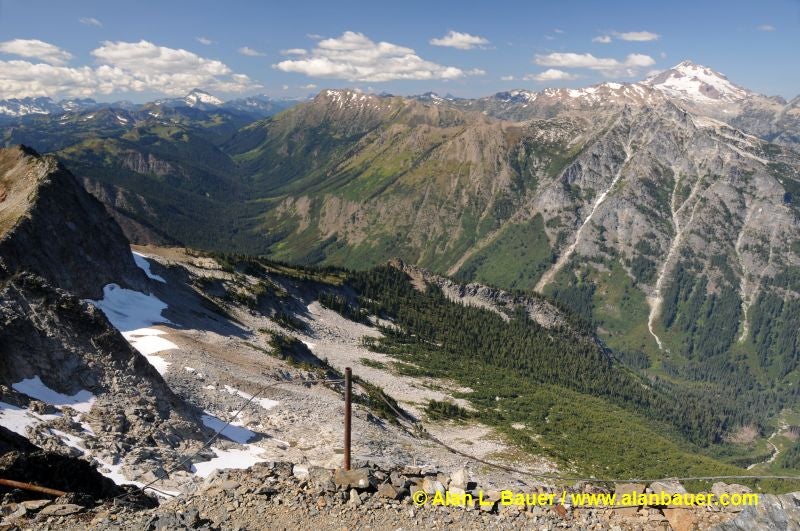
Mount David (7,420 ft.): Maneuver up the last few hundred yards to the summit (caution: this stretch is very exposed). Enjoy the views of some of the most remote places in Glacier Peak Wilderness. Follow the same route back to the trailhead.
Views from Mount David
Location: 47.9629953, -120.9894919
Summit views of Indian Creek Valley.